Click on this
link
if you cannot read this email.
 |
 |
| |
 |
|
ISPRS e-Bulletin
Issue No 2 - 2014
|
 |
| |
|
|
|
Editorial
 |
|
Council explores revision of ISPRS Commission structure
members and ISPRS community at large are asked for comments
by Christian Heipke
ISPRS Secretary General
|
A number of developments and assessments have led to this proposal for the restructuring of the ISPRS commissions (to be found
here). They include:
- The geospatial information market has become larger and more interesting to the Information and Communications Technology (ICT) community, and also to the general public. As a result, our area of interest faces stronger competition from other disciplines.
- The number of scientific ISPRS meetings has risen, as has the number of meetings outside ISPRS that are relevant to our community.
- Scientific and technical progress has given rise to overlap in the topics covered by the different ISPRS commissions, resulting in a fragmentation of activities and increasing duplication of effort.
- During recent General Assemblies there has been only a limited number of Ordinary Members interested in hosting a Technical Commission.
Council therefore feels that there is a need to explore the potential for a revision of the ISPRS commission structure with the aim of increasing the visibility and impact of our discipline and of our society. This can be best reached by focussing endeavours on the most important issues of the time, and by increasing the size and prominence of our scientific and technical meetings. This document presents the rationale for change, and makes a preliminary proposal for a revised ISPRS commission structure, together with an implementation plan and timetable. The overall goal is to better position our society as a relevant, vibrant and forward-looking organisation for the 21st Century.
In line with the ISPRS Strategic Plan, which calls for a concentration of Society efforts on the most important issues of our field, Council suggests examining and re-defining the ISPRS commission structure. The aims of this re-structuring effort are threefold:
- To increase the relevance of the society and its work in the global geospatial world in science, government, industry and end user communities;
- To concentrate the efforts of the society on the most relevant issues and thus reduce the existing lack of focus in some of our activities;
- To enhance the attractiveness of hosting a Technical Commission for Ordinary Members and individuals acting as Technical Commission Presidents.
It is suggested to re-structure ISPRS into fewer commissions, for example four focussing on the topics of:
- Earth Observation;
- Photogrammetry;
- Spatial Information Science;
- Policies, Education and Outreach.
In order to maximise multi-national participation in ISPRS, we further suggest the formal introduction of the position of a Vice-Technical Commission President (V-TCP), simultaneously encouraging the V-TCP to originate from an Ordinary Member different to that of the Technical Commission President (TCP).
An additional possibility to engender involvement of Ordinary Members not hosting a Technical Commission, and scientists in such countries, is the introduction of Regional Meetings, in particular in areas far away from symposia venues. In this way it is anticipated that global participation of all ISPRS members will be enhanced.
The proposed changes are to be discussed during 2014 and voted on by postal ballot in 2015. Assuming approval, this schedule provides Ordinary Members interested in hosting one of the (new) commissions for the period 2016-2020 sufficient time to formulate their ideas and develop their bids ahead of the XXIII ISPRS Congress and General Assembly in Prague in 2016.
We are most interested in your opinion about this important development and cordially invite you to take part in this discussion. You may do so by sharing your
comments on the blog, or by sending an
e-mail
to the Secretary General. The topic will also be discussed during the eight midterm symposia being held during 2014.
Christian Heipke
ISPRS Secretary General
|
|
| |
|
|
The ISPRS Foundation
|
 |
|
The ISPRS Foundation Travel Grants for 2014 Midterm Symposia
The ISPRS Foundation agreed to allocate the sum of approximately €3000 for travel grants to
deserving individuals to attend each of the eight ISPRS Symposia, and an
additional €6000 for a summer school. Two grants were allocated to grantees to attend the ISPRS
Technical Commission IV Symposium in Suzhou, China, and 5 grants for attendance at the ISPRS Technical Commission VI
Symposium in Wuhan China. The deadline for the submission of applications for travel grants to attend the
ISPRS Technical Commission V Symposium in Riva Italy has now passed with approximately 10 applications.
The following deadlines apply for the submission of applications for travel grants for the
remainder of the ISPRS Symposia in 2014.
7 July 2014
Commission III, September 5-7, 2014 in Zurich, Switzerland
Commission VII, September 29-October 2, 2014 in Istanbul, Turkey
Commission II, October 6-8, 2014 in Toronto, Canada
7 September 2014
Commission I, November 17-20, 2014 in Denver, USA
Commission VIII, December 9-12, 2014 in Hyderabad, India
Dieter Fritsch, John Trinder & Marguerite Madden
|
|
 |
|
Report on the 10th ISPRS WG VI/5 and Student Consortium Summer School
Geospatial Science for Monitoring of Environment for Sustainable Development
ADDIS ABABA
29 Oct 2 Nov 2013
» Report
|
|
|
| |
|
|
Society News
|
 |
|
New sustaining member
ISPRS is proud to announce Vision Map, http://www.visionmap.com/, as a new sustaining member of ISPRS. The Israeli company is a leader in digital mapping systems and has a long experience in the field of photogrammetry and digital aerial cameras.
|
|
 |
|
Individual membership category approved by Ordinary Members
With an overwhelming majority the ISPRS Ordinary Members have voted for the introduction of Individual Membership. Nevertheless, ISPRS will remain a society of societies; the new membership category is primarily being introduced to give individuals in areas without active Ordinary Members the possibility to link to the ISPRS network.
Individual membership in ISPRS is free of charge and is governed by Bylaw VI (7) and the new ISPRS Policy on Individual Membership. Anybody interested in ISPRS Individual Membership can submit an application here or contact his/her national ISPRS Ordinary Member.
|
|

|
|
Best Paper Award 2013 for the ISPRS Journal of Photogrammetry and
Remote Sensing announced.
The 2013 Best Paper Award for the ISPRS Journal of Photogrammetry and remote Sensing has been announced. The paper is entitled "Urban accessibility diagnosis from mobile laser scanning data", the authors are Andrés Serna and Beatriz Marcotegui from Écoles Nationale Supérieure des Mines - ParisTech, in Paris, France.
Along with the winners of the years 2012, 2014 and 2015, the paper will enter the competition for the ISPRS Helava Award, which is presented to the author of the most significant paper published in the ISPRS Journal between two Congresses, at the next ISPRS Congress in Prague.
|
|
 |
|
ISPRS Biennial Report 2012/13 published
ISPRS has introduced a new biennial report. The first edition covers the years 2012 and 2013 and can be found here. Printed copies are available upon request from the Secretary General.
|
|
 |
|
ISPRS Awards Brochure 2016 now available
The ISPRS Brochure for Awards to be presented at the 2016 Congress in Prague is now available - click here for details. All are cordially invited to nominate candidates for the various awards.
|
|
|
| |
|
 |
|
Society News
|
 |
|
Hearty congratulations to ISPRS 1st Vice president Prof. Orhan Altan for having been appointed Guest Professor of Wuhan University from November 2013 to November 2016.
|
|

|
|
|
 |
|
Quick Links
|

|
|
|
| |
|
|
General Announcements
 |
|
European Sentinel Satellite dedicated to the COPERNICUS programme launched on 3 April 2014, see
EU press release for details
|
 |
|
New Future Earth website launched
Future Earth, the new 10-year global change research programme launched by ICSU, the International Council of Science, has just launched a new website.
Besides offering latest research on global environmental change and up-to-date news from the Future Earth community, the site features a comprehensive overview of the initiative’s various research projects, and tells you how to get involved. The Future Earth blog, which continues to run, provides commentary and opinion articles on issues relating to the program’s research.
The website is located at
www.futureearth.info/
|
 |
|
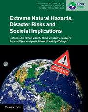
New book on
Extreme Natural Hazards, Disaster Risks and Societal Implications
Click
here for details
|
 |
|
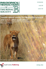
New book on
Satellite remote sensing for biodiversity research and conservation applications
Click
here for details
|
|
|
| |
|
|
Announcements of Scientific Meetings
(see also
ISPRS Calendar)
 |
|
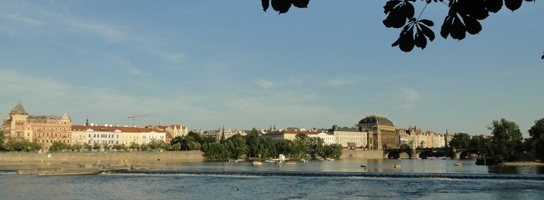
The Congress Director's Column
Duchy, Kingdom, Part of a Monarchy and Republic in the region of the Czech Republic.
The Czech Republic has passed through various political regimes since the 11th century A.D.
The first one was the Duchy of Přemyslid dynasty, which lasted from the 10th century until 1198. Since 1029, when Moravia became a part of it, the area of the Czech Duchy was similar to the present Czech Republic.
There were two individual Kings of Bohemia: Vratislav II (1085 – 1092) and his grandson Vladislav II (1152 – 1172). Přemysl Ottokar I, Duke of Bohemia, using diplomatic relations, managed to convince
Philip of Swabia,
elected
King of the Romans, to recognize him as a hereditary king. Philip confirmed the existence of the Kingdom of Bohemia (Regnum Bohemiae in Latin) and Přemysl’s royal status. The Kingdom lasted officially till 1918 when it was changed to a republic – the Czechoslovak Republic.
The Přemyslid Dynasty was replaced by the House of Luxembourg after the marriage of the last Přemyslid Dynasty daughter and John, Count of Luxembourg in 1306.
From 1526, the kingdom was continuously ruled by the
House of Habsburg and its successor, the house
Habsburg-Lorraine.
The Czechoslovak Republic = Czechoslovakia was founded 28 October 1918 as a result of European reorganisation of countries after the World War I. The first President and founder of the new republic, Tomáš Garrigues Masaryk, a university professor, was the representative of a democratic regime which was interrupted by World War II. Three years of democracy after WW II were ended by a communist putsch to establish a communist regime governed unofficially by the Soviet Union. The Velvet Revolution in November 1989 changed the communist regime republic to a democratic one. The first president of the new democratic era was Václav Havel. He was elected a president in December 1989.
|
 |
|
Call for papers
Asian Conference of Remote Sensing
Nay Pyi Taw, Myanmar , Oct. 27-31, 2014
deadline May 15, 2014
Dear International Colleagues,
I am sending you the second call for papers of the 35th Asia Conference on Remote Sensing(ACRS) to be organized from 27 to 31, October 2014 in Nay Pyi Taw, Myanmar. As you may know, ACRS is one of the largest remote sensing conference in Asia. Last year, more than 1300 participants attended ACRS2013 organized in Bali, Indonesia. We welcome your active participation to ACRS2014. The pamphlet of ACRS2014 is attached herewith.
Kohei Cho
General Secretary
Asian Association on Remote Sensing (AARS)
|
 |
|
Announcement of the 14th International Scientific and Technical Conference
From imagery to map: digital photogrammetric technologies
October 20-23, 2014, Hainan, China
by RACURS Co.
Visit the conference website
|
 |
|
Announcement of the Pacific Islands GIS-Remote Sensing Conference 2014
Empowering Pacific Communities through Improved Geospatial Data
Suva, Fiji Islands, Nov. 25-27, 2014
Click
here for details
|
 |
|
Invitation to Geonetworking Event on June 3rd 2014 in Brussels, Belgium
Dear Madam, dear Sir,
The next AM/FM-GIS Belux seminar will focus on Earth observation services for national, regional and local authorities: how can they boost economic and employment development in your area?
Save the date of June 3rd 2014 from 12 until 20:00 to join us at the premises of the Royal Military Academy in Brussels, Rue Hobbema 8.
To attend the event, please register on the AM/FM-GIS Belux Website.
Further details are available in the attached document.
Above all, feel free to spread the word!
Looking forward to meeting you soon! We are expecting many of you…
Kind regards,
Philippe LEDENT
Business Unit Manager
SPACEBEL
Click
here for details
|
|
ISPRS Midterm Symposia
2014 is the year of Midterm Symposia in ISPRS. In this issue of the eBulletin, we again present the complete list incl. all available dates for abstract and paper submission. While deadlines for some of the symposia have already passed, abstracts and full papers can still be submitted to others.
TC |
Date |
Location |
Theme
|
Deadline, Abstracts for Archives |
Deadline, Full papers for Annals |
Deadline, cam.-ready manuscripts |
I |
Nov.
17-20 |
Denver,
USA
|
Sustaining Land Imaging:
UAVs to Satellites |
Jun
6 |
June
6 |
Sep
12 |
II |
Oct
6-8 |
Toronto,
Canada |
Geospatial Theory, Processing,
Modelling and Applications |
closed |
May
1 |
May 1
(Archives)
Aug 1
(Annals) |
III |
Sep
5-7 |
Zurich,
Switzerland |
Photogrammetric Computer Vision - PCV 2014 |
Jun
19 |
closed |
Jul
27 |
IV |
May
14-16 |
Suzhou,
China |
Geospatial databases and location
based services |
closed |
closed |
closed |
V |
Jun
23-25 |
Riva del Garda,
Italy |
Close-range imaging, ranging and applications |
closed |
closed |
May
12 |
VI |
May
19-21 |
Wuhan,
China |
Data, information, and knowledge
sharing for geo-education |
closed |
closed |
closed |
VII |
Sep 29
-
Oct 2 |
Istanbul,
Turkey |
Thematic Processing, Modeling and
Analysis of Remotely Sensed Data |
Jun
1 |
May
20 |
Jul 15
(Archives)
Jul 30
(Annals) |
VIII |
Dec
9-12 |
Hyderabad,
India |
Operational Remote Sensing
Applications: Opportunities, Progress and Challenges |
Aug
15 |
Aug
15 |
Nov
15 |
Updated information of all Symposia can be found at
www.isprs.org/society/midterm.aspx.
|
|
|
| |
|
|
Event Reports
 |
|
Report on the 3rd Geospatial Conference in Tunis (GCT)
March 17-21, 2014
by Ian Dowman
» Report
|
|
|
| |
|
|
ISPRS Journal of Photogrammetry and Remote Sensing
 |
|
New publications in the ISPRS Journal of
Photogrammetry and Remote Sensing Volume 90 (April 2014)
Introducing mapping standards in the quality assessment of buildings extracted from very high resolution satellite imagery
S. Freire, T. Santos, A. Navarro, F. Soares, J.D. Silva, N. Afonso, A. Fonseca, J. Tenedório
Pages: 1-9
Classification of dual- and single polarized SAR images by incorporating visual features
Stefan Uhlmann, Serkan Kiranyaz
Pages: 10-22
3D change detection at street level using mobile laser scanning point clouds and terrestrial images
Rongjun Qin, Armin Gruen
Pages: 23-35
A multi-index learning approach for classification of high-resolution remotely sensed images over urban areas
Xin Huang, Qikai Lu, Liangpei Zhang
Pages: 36-48
Spectral monitoring of moorland plant phenology to identify a temporal window for hyperspectral remote sensing of peatland
Beth Cole, Julia McMorrow, Martin Evans
Pages: 49-58
Advanced image processing methods as a tool to map and quantify different types of biological soil crust
Emilio Rodríguez-Caballero, Paula Escribano, Yolanda Cantón
Pages: 59-67
Indoor scene reconstruction using feature sensitive primitive extraction and graph-cut
Sven Oesau, Florent Lafarge, Pierre Alliez
Pages: 68-82
A local descriptor based registration method for multispectral remote sensing images with non-linear intensity differences
Yuanxin Ye, Jie Shan
Pages: 83-95
New publications in the ISPRS Journal of
Photogrammetry and Remote Sensing Volume 91 (May 2014)
SIFT feature extraction and matching for large images in large-scale aerial photogrammetry
Yanbiao Sun, Liang Zhao, Shoudong Huang, Lei Yan, Gamini Dissanayake
Pages: 1-16
Empirical comparison of noise reduction techniques for NDVI time-series based on a new measure
Ryo Michishita, Zhenyu Jin, Jin Chen, Bing Xu
Pages: 17-28
On accurate dense stereo-matching using a local adaptive multi-cost approach
C. Stentoumis, L. Grammatikopoulos, I. Kalisperakis, G. Karras
Pages: 29-49
MELISSA, a new class of ground based InSAR system. An example of application in support to the Costa Concordia emergency
Joan Broussolle, Vladimir Kyovtorov, Marco Basso, Guido Ferraro Di Silvi E Castiglione, Jorge Figueiredo Morgado, Raimondo Giuliani, Franco Oliveri, Pier Francesco Sammartino, Dario Tarchi
Pages: 50-58
Soil moisture retrieval from airborne L-band passive microwave using high resolution multispectral data
Sayeh Hasan, Carsten Montzka, Christoph Rüdiger, Muhammad Ali, Heye R. Bogena, Harry Vereecken
Pages: 59-71
Different units of measurement of carotenoids estimation in cotton using hyperspectral indices and partial least square regression
Qiuxiang Yi, Guli Jiapaer, Jingming Chen, Anming Bao, Fumin Wang
Pages: 72-84
A simple two-band semi-analytical model for retrieval of specific absorption coefficients in coastal waters
Jun Chen, Tingwei Cui, Zhongfeng Qiu, Changsong Lin
Pages: 85-97
Mapping seasonal rice cropland extent and area in the high cropping intensity environment of Bangladesh using MODIS 500 m data for the year 2010
Murali Krishna Gumma, Prasad S. Thenkabail, Aileen Maunahan, Saidul Islam, Andrew Nelson
Pages: 98-113
Levee crest elevation profiles derived from airborne lidar-based high resolution digital elevation models in south Louisiana
Monica Palaseanu-Lovejoy, Cindy A. Thatcher, John A. Barras
Pages: 114-126
|
|
|
| |
|
|
ISPRS International Journal of Geo-Information — Open Access Journal
 |
|
New publications in the ISPRS International Journal of Geo-Information
Open Access Journal (March 2014 - June 2014)
Utilizing GIS to Examine the Relationship Between State Renewable Portfolio Standards and the Adoption of Renewable Energy Technologies
Schelly, Chelsea, Price, Jessica
Pages: 1-17
Quantification of Deltaic Coastal Zone Change Based on Multi-Temporal High Resolution Earth Observation Techniques
Vassilakis, Emmanuel, Papadopoulou-Vrynioti, Kyriaki
Pages: 18-28
Developing a GIS-Based Visual-Acoustic 3D Simulation for Wind Farm Assessment
Manyoky, Madeleine, Wissen Hayek, Ulrike, Heutschi, Kurt, Pieren, Reto, Grêt-Regamey, Adrienne
Pages: 29-48
Barrier Island Dynamics Using Mass Center Analysis: A New Way to Detect and Track Large-Scale Change
Paris, Paul, Mitasova, Helena
Pages: 49-65
Light Detection and Ranging (LiDAR) and Multispectral Scanner (MSS) Studies Examine Coastal Environments Influenced by Mining
Kerfoot, W. Charles, Hobmeier, Martin M., Yousef, Foad, Green, Sarah A., Regis, Robert, Brooks, Colin N., Shuchman, Robert, Anderson, Jamey, Reif, Molly
Pages: 66-95
Using a Spatio-Temporal GIS Database to Monitor the Spatial Evolution of Urban Flooding Phenomena. The Case of Athens Metropolitan Area in Greece
Diakakis, Michalis, Pallikarakis, Aggelos, Katsetsiadou, Katerina
Pages: 96-109
Assessing the Seasonal Dynamics of the Java’s Paddy Field Using MODIS Satellite Images
Setiawan, Yudi, Rustiadi, Ernan, Yoshino, Kunihiko, Liyantono, , Effendi, Hefni
Pages: 110-129
A Geographic Information Systems (GIS)-Based Approach to Derivative Map Production and Visualizing Bedrock Topography within the Town of Rutland, Vermont, USA
Van Hoesen, John G.
Pages: 130-142
Model for Determining Geographical Distribution of Heat Saving Potentials in Danish Building Stock
Petrovic, Stefan, Karlsson, Kenneth
Pages: 143-165
Geospatial Narratives and Their Spatio-Temporal Dynamics: Commonsense Reasoning for High-Level Analyses in Geographic Information Systems
Bhatt, Mehul, Wallgrün, Jan Oliver
Pages: 166-205
Introduction to the Special Issue: Geospatial Monitoring and Modeling of Environmental Change
Rocchini, Duccio
Pages: 206-208
Spatial Analysis of Biomass Resources within a Socio-Ecologically Heterogeneous Region: Identifying Opportunities for a Mixed Feedstock Stream
Calvert, Kirby, Mabee, Warren
Pages: 209-232
Acknowledgement to Reviewers of the ISPRS International Journal of Geo-Information in 2013
IJGI Editorial Office,
Pages: 233-235
Spatial and Semantic Validation of Secondary Food Source Data
Lyseen, Anders K., Hansen, Henning Sten
Pages: 236-253
Investigating Forest Disturbance Using Landsat Data in the Nagagamisis Central Plateau, Ontario, Canada
Forsythe, K. Wayne, McCartney, Grant
Pages: 254-273
Spatial Distribution of Greenhouse Commercial Horticulture in Kenya and the Role of Demographic, Infrastructure and Topo-Edaphic Factors
Justus, Faith, Yu, Danlin
Pages: 274-296
Habitat Mapping and Change Assessment of Coastal Environments: An Examination of WorldView-2, QuickBird, and IKONOS Satellite Imagery and Airborne LiDAR for Mapping Barrier Island Habitats
McCarthy, Matthew J., Halls, Joanne N.
Pages: 297-325
An Operational Web-Based Indicator System for Integrated Coastal Zone Management
Hansen, Henning Sten, Fuglsang, Morten
Pages: 326-344
Geo-Enrichment and Semantic Enhancement of Metadata Sets to Augment Discovery in Geoportals
Vockner, Bernhard, Mittlböck, Manfred
Pages: 345-367
Monitoring Geologic Hazards and Vegetation Recovery in the Wenchuan Earthquake Region Using Aerial Photography
Li, Zhenwang, Jiao, Quanjun, Liu, Liangyun, Tang, Huan, Liu, Tong
Pages: 368-390
A Dynamic GIS as an Efficient Tool for Integrated Coastal Zone Management
Gourmelon, Françoise, Le Guyader, Damien, Fontenelle, Guy
Pages: 391-407
The Application of WebGIS Tools for Visualizing Coastal Flooding Vulnerability and Planning for Resiliency: The New Jersey Experience
Lathrop, Richard, Auermuller, Lisa, Trimble, James, Bognar, John
Pages: 408-429
Mapping the Potential for Biofuel Production on Marginal Lands: Differences in Definitions, Data and Models across Scales
Lewis, Sarah M., Kelly, Maggi
Pages: 430-459
Small Reservoir Distribution, Rate of Construction, and Uses in the Upper and Middle Chattahoochee Basins of the Georgia Piedmont, USA, 1950–2010
Ignatius, Amber R., Jones, John W.
Pages: 460-480
Web GIS-Based Public Health Surveillance Systems: A Systematic Review
Luan, Hui, Law, Jane
Pages: 481-506
Effects of Pansharpening on Vegetation Indices
Johnson, Brian
Pages: 507-522
GIS Supported Landslide Susceptibility Modeling at Regional Scale: An Expert-Based Fuzzy Weighting Method
Chalkias, Christos, Ferentinou, Maria, Polykretis, Christos
Pages: 523-539
Land Cover Heterogeneity Effects on Sub-Pixel and Per-Pixel Classifications
Tran, Trung V., Julian, Jason P., de Beurs, Kirsten M.
Pages: 540-553
A Hierarchical Approach to Optimizing Bus Stop Distribution in Large and Fast Developing Cities
Huang, Zhengdong, Liu, Xuejun
Pages: 554-564
GIS-Based Analytical Tools for Transport Planning: Spatial Regression Models for Transportation Demand Forecast
Lopes, Simone Becker, Brondino, Nair Cristina Margarido, Rodrigues da Silva, Antônio Nélson
Pages: 565-583
A Conceptual Flash Flood Early Warning System for Africa, Based on Terrestrial Microwave Links and Flash Flood Guidance
Hoedjes, Joost C. B., Kooiman, André, Maathuis, Ben H. P., Said, Mohammed Y., Becht, Robert, Limo, Agnes, Mumo, Mark, Nduhiu-Mathenge, Joseph, Shaka, Ayub, Su, Bob
Pages: 584-598
Geo-Spatial Support for Assessment of Anthropic Impact on Biodiversity
Piragnolo, Marco, Pirotti, Francesco, Guarnieri, Alberto, Vettore, Antonio, Salogni, Gianluca
Pages: 599-618
Geo-Based Statistical Models for Vulnerability Prediction of Highway Network Segments
Pollak, Keren, Peled, Ammatzia, Hakkert, Shalom
Pages: 619-637
|
|
|
| |
|
|
New Events
03 June 2014
Earth Observation Breakthroughs
Earth Observation services for local and regional public authorities, what are the perspectives for economic growth and job creation?
www.amfmgis-belux.be/amfmgis-belux/WELCOME.html
Brussels, BELGIUM
27-28 Jun 2014
Landscape study with Historical Photographs through Monoplotting – Workshop
www.wsl.ch/fe/oekosystem/insubrisch/projekte/Evoluzione_paesaggio/Workshop_monoplotting_EN
Corzoneso, SWITZERLAND
11-12 Sep 2014
Summit on Earth Observation Business
organized as part of the World Satellite Business Week
www.satellite-business.com/program/sympo-eo/seob
Paris, FRANCE
13-16 Sep 2014
ISCGM 2014
International Symposium on Crop Growth Monitoring
iscgm2014.netcia.org.cn
Nanjing, CHINA
24-25 Sep 2014
International Workshop Remote Sensing and GIS for Monitoring of Habitat Quality
rsgis4hq.geo.tuwien.ac.at
Vienna, AUSTRIA
20-23 Oct 2014
14th International Scientific and Technical Conference
From Imagery to Map: Digital Photogrammetric Technologies
conf.racurs.ru/conf2014/eng/
Hainan, CHINA
27-31 Oct 2014
ACRS2014
The 35th Asian Conference on Remote Sensing Sensing for Reintegration of Societies
www.acrs2014.com
Nay Pyi Taw, MYANMAR
27-31 Oct 2014
AARSE2014
10th International Conference of the African Association of Remote Sensing of the Environment
Space Technologies for Societal Benefits in Africa
www.aarse2014.co.za/
Johannesburg, SOUTH AFRICA
9-11 Nov 2014
Digital Earth Summit 2014
Digital Earth for ESD
www.isde-j.com/summit2014/
Nagoya, JAPAN
9-11 Nov 2014
The 4th International FIG 3D Cadastre Workshop
in combination with the 3D GeoInfo Conference (11-13 November 2014)
www.gdmc.nl/3DCadastres/workshop2014/
Dubai, United Arab Emirates
15-17 Nov 2014
WG II/1, WG II/4, ICWG II/IV
GI Research 2014
giresearch.ut.ac.ir/
Tehran, IRAN
26-28 Jan 2015
GIS Ostrava 2015
Surface Models for Geosciences
http://gis.vsb.cz/gisostrava/index.php
Ostrava, CZECH REPUBLIC
7-12 Feb 2015
SPIE Photonics West 2015
with SPIE Photonics West Exhibition 2015 10–12 Feb 2015
spie.org/photonics-west.xml?WT.mc_id=RPWCAW
San Francisco, California, USA
26-27 Jun 2015
WG VIII/7
International Conference on Intelligent Earth Observing and Applications
www.glut.edu.cn
Guilin, Guangxi, CHINA
» See more
|
|
| |
|
|
Updated Events
17-20 Nov 2014
ISPRS Technical Commission I Symposium
in conjunction with the Pecora 19 ASPRS Fall Meeting and IAG Commission 4 Assembly
www.isprs.org/2014tc1symposium/
Denver, USA
9-12 Dec 2014
ISPRS Technical Commission VIII Symposium
Operational RS Applications: Opportunities, Progress and Challenges
www.nrsc.gov.in/technicalcommission8.html
Hyderabad, INDIA
» See more
|
|
| |
|
|
New Publications in the ISPRS Archives & Annals
2013, International Symposium on
Satellite Mapping Technology and Application (ISSMTA2013)
6-8 Nov, Nanjing, Jiangsu, China
ISSMTA2013 |
» See more (ISPRS Archives)
» See more (ISPRS Annals)
» See more (Non ISPRS Proceedings)
|
|
| |
|
|
Job Opportunities
|
14-Mar-2014 |
6 PhD positions in the field of Geo-Information Science and Earth Observation
The University of Twente, The Netherlands
Deadline: 12-May-2014 |
|
05-Jan-2014 |
Professorship in Remote Sensing in Earth Surface Dynamics
University of Lausanne, Switzerland
Deadline: 10-May-2014
|
|
29-Apr-2014 |
PhD funded by DGA, Classification of acoustic signatures for the retrieval of environmental characteristics
GIPSA-Lab, Dept. of Image and Signal, team SIGMAPHY, Grenoble, France
Deadline: 10-May-2014 |
» See more
|
|
| |
|
|
|
To unsubscribe from the email list, send this with 'Unsubscribe ISPRS' in subject line to
ISPRS webmaster.
© ISPRS, 2014.
|
