Click on this
link
if you cannot read this email.

 |
| |
| |
 |
|
ISPRS e-Bulletin
Issue No 4 - 2017
|
 |
| |
|
|
|
Quick Links
|
|
| |
|
|
Editorial
 |
|
Invitation to join ISPRS TC III Mid-Term Symposium
Developments, Technologies and Applications in Remote Sensing
May 7 -10, 2018
Beijing China
by Jiang Jie

You are warmly welcomed to take part in the ISPRS Technical Commission III mid-term Symposium to be held in Beijing, China in May 2018. The aim of the Symposium is to attract scientists, researches, practitioners, and students working in the field of Remote Sensing, from all over the World, to attend, share and present their latest developments in Remote Sensing. The symposium is focusing on three main themes: Developments, Technologies, and Applications. Scientific topics and research related to the TC Working groups will be considered for publication.
- Thematic Information Extraction (Organized by WG III/1 )
- Radar remote sensing for a changing world (Organized by WG III/2)
- SAR-based Surface Generation and Deformation Monitoring (Organized by WG III/3)
- New trends in Hyperspectral Image Processing (organized by WG III/4)
- Information Extraction from LiDAR Intensity Data (WG III/5)
- Remote Sensing Data Fusion (Organized by WG III/6)
- Change Detection of Landuse & Landcover for updating spatial databases (Organized by WG III/7)
- Remote Sensing and Synergic Analysis on Atmospheric Environment (Organized by WG III/8)
- Challenges and solutions in changing cryosphere and hydrosphere for sustainable developments (Organized by WG III/9)
- Climate Change and its Impact to Agriculture and Natural Ecosystem (Organized by WG III/10)
- Planetary remote sensing, planetary photogrammetry and robotic vision, planetary cartography and GIS (Organized by ICWG III/II)
- Disaster Assessment, Monitoring and Management (Organized by ICWG Ill/lVa)
- Quality issues in remote sensing in the big data era (Organized by ICWG II/IVb)
- Environment and Health (Organized by ICWG Ill/lVc)
- Pattern Analysis in Remote Sensing (ICWG ll/II)
- Global Mapping: Updating, Verification and Interoperability (Organized by ICWG IV/III)
read the full version ...
The symposium will act as a forum to participants for knowledge updates, technology transfer and to promote international collaboration. The scientific organizing committee are providing "Young Author Award" (resented to participant who is less than 35 years old and is the sole author of a high quality paper submitted to Annals) and “Student Best Poster Award” (presented to a participant student for his/her poster design and scientific contents). The two Awards value are $500 and $300, respectively with certificate of appreciation. Second place for both competitions will receive $200 each with certificate of appreciation. The symposium will serve as a contact venue for potential high quality students.
While the symposium will provide unique opportunity for the industry to show their latest technologies in the field of Remote Sensing through the technical exhibition, technical tours to visit Chinese companies working in software/hardware developments will be arranged. In addition, a visit to the Chinese National Geomatics Center will be organized to introduce the latest technologies and applications used by the center.
The papers accepted by the Symposium will be published in the ISPRS Annals of the Photogrammetry, Remote Sensing and Spatial Information Sciences (by double-blind full paper review) or The International Archives of the Photogrammetry, Remote Sensing and Spatial Information Sciences (by abstract review). Special Issue in the ISPRS Journal of Photogrammetry and Remote Sensing will be organized based on papers from the Annals and Archives.
The Symposium will be held in Beijing, the capital city of the China. With a history of more than 3,000 years, Beijing is not only the nation's political center, but also its cultural, scientific and educational heart as well as a key transportation hub, offering China's most wonderful array of attractions. The city hosted the 2008 Summer Olympics and will host the 2022 Winter Olympics, which will make it the first city to ever host both events. The Symposium venue will be Beijing International Convention Center (BICC), located close to the main venue of 2008 Olympic Games.
On behalf of the symposium organizing committee, we are looking forward to seeing you in Beijing in May 2018.
Symposium Website: http://www.isprs-tc3.tianditu.com/
↑ Up
|
|
|
| |
|
|
The ISPRS Foundation (TIF) News
|
 |
|
TIF Travel Grant Recipients Reports
Five recipients of TIF travel grants gratefully accepted the support to attend the GSW2017 in Wuhan in September. Read their reports below.

Recipients of the TIF travel grant at the closing ceremony in Wuhan: Jojene Santillan, Supanut Chaidee, Shristi Paudel, Xuke Hu, Florian Albrecht with ISPRS President, Christian Heipke
a.
The ISPRS Geospatial Week 2017 in Wuhan, China: impressions and experiences
by Jojene R. Santillan
Caraga State University
Butuan City, Philippines
b. The great experiences during attending the Geospatial Week 2017
by Supanut Chaidee
Department of Mathematics, Faculty of Science
Chiang Mai University, Thailand
c. What an undergraduate learnt from ISPRS Geospatial Week 2017?
by Shristi Paudel
Institute of Engineering
Tribhuvan University, Nepal
d. The ISPRS Foundation
by Xuke Hu
GIScience Research Group
Department of Geography
Heidelberg University, Germany
e. Impressions from the ISPRS Geospatial Week 2017
by Florian Albrecht
Department of Geoinformatics – Z_GIS
University of Salzburg, Austria
The ISPRS Foundation depends on individual donations and contributions from ISPRS and ISPRS-sponsored events. Donations to the non-profit TIF may be mailed directly to TIF Finance Officer, Marguerite Madden (Department of Geography, University of Georgia, Athens, Georgia, USA 30602, mmadden@uga.edu for details) or via the TIF PayPal donation link on the TIF website:
http://www.isprs.org/foundation/donations/make.aspx
|
|
|
| |
|
|
Society News
|

|
|
2018 ISPRS Call for Educational and Capacity Building Initiative
In accordance with the statutory mission and activities of ISPRS, the Society shall provide funds to support educational and capacity building initiatives, which will further improve its international status in the educational area in the field of the photogrammetry, remote sensing and spatial information sciences, and will therefore benefit all ISPRS members. Future calls for funding shall be made on a two yearly basis (in odd-years), and dependent on the budgetary restrictions at the time of the call for proposals. In view of ISPRS resources, Council is making up to CHF 40.000 available to support the capacity building initiative 2018.
The maximum funding assigned to any one scientific project shall be SFr. 10,000. Projects should commence on or after 1st February 2018 and can be of any duration up to a maximum of 12 months, to be completed on or before 31st January 2019. If possible, results should be presented at the ISPRS Com. V Symposium to be held in India in late 2018 (see www.isprs.org for details).
ISPRS Working Group Officers are invited to submit applications to their respective Technical Commission President by the deadline below. Further details, including information on the topics and the application process, are available in Appendix 9b of the Orange Book at:
http://www.isprs.org/documents/orangebook/app9b.aspx
Any queries should be addressed to the ISPRS Treasurer, Songnian Li, at
isprs-tr@isprs.org.
Timescale
Announcement of Scientific Initiatives: 31st October 2017.
Deadline for submission of proposals from WG Officers to TCPs: 15th December 2017.
Deadline for submission of recommendation from TCPs to ISPRS Treasurer: 15th January 2018.
Announcement of successful grants by Council: Monday 25th January 2018.
Funding available from 1st February 2018.
|
|
|
|
Dubai selected to host Geospatial Week 2019
ISPRS Council is pleased to announce that on September 20, during the Geospatial Week 2017, held in Wuhan, China, the ISPRS GSW Selection Committee elected Dubai Municipality to host the GSW2019, which will be held from 24-28 March, 2019.
We look forward to seeing you all in Dubai in 2019!

ISPRS President, Christian Heipke and Secretary General, Lena Halounova with Chairman of the Geospatial Week 2019, Hussein M. Abdulmuttalib and his assistant, Anna Zih from Dubai Municipality, UAE.
|
|
|
|
Nice Congress 2020 Contract signed
The ISPRS contract relative to the organisation of the XXIV ISPRS congress was signed, on the 22nd of September, in Wuhan, China, during the ISPRS Geospatial Week 2017, by the president of ISPRS, Christian Heipke, and the congress director, Nicolas Paparoditis, on behalf of the French Society for Photogrammetry and Remote Sensing (SFPT). This contract details the duties of the congress organiser. The XXIV ISPRS Congress will be held in Nice from the 28th of June to the 4th of July 2020.

2020 Congress Director, Nicolas Paparoditis and ISPRS President, Christian Heipke sign the Nice Congress contract in Wuhan.
|
|
|
|
New Sustaining Members
ISPRS is pleased to announce that three new Sustaining Members have joined us in the past three months. On behalf of the ISPRS Council, we extend a very warm welcome to them.
Read the company profiles here….
|
|

|
|
ICORSE instates new President - Professor Guo Huadong
by Charles Hutchinson
President of ICRSE
Executive Secretary of ICORSE
cfh@email.arizona.edu
I am pleased to announce that Professor Guo Huadong, of the Institute for Remote Sensing and Digital Earth (RADI) of the Chinese Academy of Science, has agreed to serve as chairman of the International Committee on Remote Sensing of Environment (ICORSE), effective September 20, 2017.
As with previous chairpersons of ICORSE, Professor Guo was nominated by the President of the
International Center for Remote Sensing of Environment (ICRSE), with concurrence of the Council of the International Society of Photogrammetry and Remote Sensing (ISPRS).
Those of you who attended the ICORSE meeting in Tshwane will recall the Mr. Lawrence Friedl, the
sitting chair of ICORSE, extended an open invitation to members who wished to succeed him as
chairperson. I am sure that you will all join me in appreciation of Mr. Friedl’s efforts as chairman to
improve upon the long-standing terms of reference for ICORSE with the hope that Professor Guo will continue these efforts.
Professor Guo has assured me that he will address the ICORSE membership soon. We hope you will welcome your colleague to the chairmanship of ICORSE.
|
|
 |
|
ISPRS Student Consortium (SC) News
- CALL FOR BOARD MEMBER APPLICATIONS. The ISPRS SC is looking for responsible and passionate individual to be part of the organization’s board members. The application is open from October 9 to October 31, 2017. If you are interested in becoming an active ISPRS SC board member, please complete the attached form and send it to Ayda Akkarta Aktas, akkartala@itu.edu.tr.
- BE A MEMBER NOW! Be part of our growing community! Be up-to-date with technological advancements and get exposed to available educational and career opportunities in the field. Always looking for a way to join conferences to present your research? Learn about available travel grants for the youth through our network and access opportunities that can enhance your career experience and journey. Register at our official website: http://sc.isprs.org and receive the latest updates from the ISPRS and ISPRS SC.
- SHARE YOUR TALENT AS A VOLUNTEER!We are constantly in search of resourceful, creative and passionate people to be part of the ISPRS SC. If you have a desire to serve and willing to lend your time and skills with an enthusiasm to learn more about team work, time management, coordination, and leadership, join our outstanding team of volunteers and help us achieve the goals of the ISPRS SC! The ISPRS SC welcomes creative thinkers, proficient writers, and Internet savvy millennials to help us disseminate information and organize activities with flair. Sign up here: https://goo.gl/forms/Kp4ie1ItepxFkFK22
- GET CONNECTED, BE A COORDINATOR! The ISPRS SC continuously aims to expand and strengthen the network of expertise in this profession. If you are always on the look-out for the latest development in the fields of remote sensing, photogrammetry, geospatial information sciences and their related applications across the globe, WE NEED YOU! Get connected with other coordinators around the world and learn more through your involvement with the community. Join our pool of coordinators and help us spread the word about the advancements in our profession in the global community. Apply here: https://goo.gl/QcsABN
Upcoming Student Consortium Events
- The 18th ISPRS SC and WG V/5 Summer School – “Land Cover Assessment and Monitoring Using Google Earth Engine”
Apart from climate, one of the most important components of global change is the change in land use and land cover (LULC). LULC change detection is a key task for better understanding landscape dynamics and sustainable management planning. Mapping and monitoring LULC has become one of the most important applications of remote sensing (RS). Today, we face an unprecedented amount of public RS data and new tools are already available to transform it into useful information. Google Earth Engine (GEE) is a cloud computing platform for processing RS data that provides access to a large collection of satellite imagery and the necessary computational power to analyze them. This summer school will focus on the use of machine learning algorithms to classify Landsat images using GEE to produce land cover maps and monitor change in time.
Dates: November 13 – 17, 2017
Location: Santiago City, Chile
Registration Deadlines: October 10, 2017 for international participants and October 20, 2017 for local participants
|
|
|
| |
|
|
General Announcements
 |
|
UN-GGIM Seeking Geospatial Expertise Universities and Research Network
The United Nations initiative on Global Geospatial Information Management [1] develops and uses geospatial information to address key global challenges. The priorities and work programs of UN-GGIM are driven by Member States and UN-GGIM is looking for university and research center partners from across the globe to help support its aims and objectives.
UN-GGIM has formed in the UN-GGIM Academic Network [2]. This is a strategic arm for UN-GGIM to achieve their vision [3]. The members of this Academic Network will be comprised of relevant universities, academic institutions or research centres where geospatial information research and/or education are accomplished and also want to voluntarily collaborate with UN-GGIM. Qualifications of universities and research institutions to become members are listed in the Terms of References [4].
Although there are no membership dues required, there is an expectation for each member to regularly contribute to one or more objectives of the UN-GGIM Academic Network.
If the aims and goals of your geospatial scholars, scientific and academic institution are in alignment with those of UN-GGIM, I as the Chair of this Academic Network encourage you to review the UN-GGIM Academic Network website and, submit and join this Network by sending an Expression of Interest [5]. Because the EOI must be submitted online in one sitting currently, I recommend that you download the pdf containing the EOI questions so you may have all responses ready to cut and paste into the form as well as the letter of support from your chief administrative officer.
We look forward to your submission. If you would like to discuss any issues or ask questions, please feel free to contact me.
Prof. Maria Antonia Brovelli
Professor of GIS and Remote Sensing
Politecnico di Milano
maria.brovelli@polimi.it
[1] http://ggim.un.org/
[2] http://unggim.academicnetwork.org
[3] The primary objective of the UN-GGIM Academic Network is to support the aims and objectives of the United Nations Committee of Experts on Global Geospatial Information Management (UN-GGIM), as UN-GGIM sets the agenda for the development of global geospatial information and promotes its use to address key global challenges.
The network will facilitate access globally to research and education capabilities for UN-GGIM and its affiliated members in order to identify and respond to challenges and opportunities for UN-GGIM and related UN offices. The UN-GGIM Academic Network will be a coalition of recognized universities and research and education centers involved in research, development and education on geospatial, land information and related matters, run on a volunteer basis.
[4] http://unggim.academicnetwork.org/wp-content/uploads/2017/03/UNGGIM_AcademicNetwork_TOR.pdf
[5] http://unggim.academicnetwork.org/eoi/
|
 |
|
Visit the walled city of 1850 Geneva
The Relief Model of 1850 Geneva is a 30m2 metallic model of the city when it was still enclosed by three rows of fortifications. The model was completed in 1896, after 18 years of study and labour, by a team of goldsmiths under the direction of the architect Auguste Magnin. It is the first historical reconstruction of an entire city in three dimensions.

In 2011, a consortium of engineers and historians working on a digital copy of the Relief Model discovered that the model’s geometric precision was exceptional for the time of its creation. Out of this discovery came the project of using the Relief Model to create a 3D digital model of 1850 Geneva, perfectly matched to the official cadastre and with textures, vegetation and landscapes of that era. Thanks to the long, meticulous labour of 50 specialists from nine professions, and to innovative digital technology, we can now visit 1850 Geneva on the Internet: www.geneva1850.ch (requires a desktop and Adobe Flash Player – the next version will be html 5 and responsive)
More information:
Association gE-story
c/o Christian HALLER SA
Rue du Lievre 4
CH-1224 Les Acacias-Geneva
SWITZERLAND
info@ge-story.ch
tel: +41 22 827 16 40
www.geneva1850.ch
|
 |
|
New book on 50 years (1965-2015) of Earth observation activities from space performed by Europe to be released in first half of 2018!!
Last year a publication has been released related to the history of Earth observation in Europe since the mid 60’s till now. This book was realised under the auspices of the “Institut Français de l’Histoire de l’Espace” (IFHE), a non-profit association, and is entitled « Observation spatiale de la Terre - Optique et Radar- La France et l’Europe pionnières ». It provides a comprehensive overview over a period of 50 years (1965-2015) of Earth observation activities and applications performed in Europe. The book is focused on high resolution optical and SAR imagery and covers both civilian and military space systems. Several chapters deal with EU and ESA Earth Observation cooperation programmes starting from the early days with Earthnet till today with the Copernicus Sentinels satellites. It also covers cooperative programmes between the EU and some Member States (e.g. Belgium, Sweden and France for the Vegetation instrument flown on Spot satellite missions). The book results of contributions of more than 80 space « pioneers », all being or having been key players from Space agencies (ESA, CNES, ASI, DLR, CSA…) and Space industries (Airbus Space and Defence, Thales Alenia Space, etc.), from European Commission DGs (DG Research and DG GROW) and the Joint Research Centre as well as from the scientific and application communities, in particular EARSeL and EARSC. ESA has provided a major financial support for the translation of the book into English and it is expected to release this English version by May 2018. This is a major step forward but, in order to complete and secure the total required funding, IFHE is looking for pre-purchase orders, at a preferential unit price of 40 € instead of 50 € when released to public, to cover the remaining cost of publication and to print some 2000-2500 copies of the book. About 800 pre-purchase orders are needed in order to cover this production cost and the EARSeL community support would be very much appreciated.
For more information please contact:
Guy Duchossois
Former ESA EO Mission Manager
EO Expert at the EC for Copernicus
Email: guy.duchossois@libertysurf.fr
Use the form to place a pre-purchase order for the English version of the book.
|
 |
|
Call for Participation in ISPRS-sponsored Competition: Atlas Challenge
The 2030 Agenda for Sustainable Development, adopted by the United Nations (UN) General Assembly in 2015, contains a set of 17 Sustainable Development Goals (SDGs). Geoinformatics can make a powerful contribution to the Agenda for Sustainable Development. It is therefore timely for the creation of an Atlas that describes contributions of remote sensing and the spatial information sciences towards helping achieve the 17 UN SDGs. With the support of a current ISPRS Scientific Initiatives Project, we are pleased to announce the “Atlas Challenge”. Participants should submit research, together with a short report, that uses global land cover, with other geospatial and socio-economic datasets as deemed appropriate, to measure, monitor and manage the progress of any aspect of sustainable development, as defined by one or more of the UN’s 17 SDGs. A First Place prize of 2000 Swiss Francs and a Second Place prize of 1000 Swiss Francs will be awarded, with the winning entries demonstrated at the 2018 Commission IV Symposium in the Netherlands.
» Full call for participation
Deadline for submissions: 30th April 2018
↑ Up
|
|
|
| |
|
|
Announcements of Scientific Meetings
(see also
ISPRS Calendar)
 |
|
5th Research@Locate conference
Multi-Source Data Fusion Based Classification and Information Extraction
Adelaide, Australia
April 4-8, 2018
Deadline for full paper submission: 30 November 2017
Locate18 is the fifth in the series of Australasian conferences aiming to unite all communities – research, industry and government – working in the field of spatial information. Research@Locate18 is the academic research stream of Locate18 taking place from 9-11 April 2018 in Adelaide Convention Centre in conjunction with Geosmart Asia 2018.
Research@Locate18 will bring together academic communities involved in spatial information from the Australasian region and beyond. Short papers are welcome from researchers in geodesy, mapping, computer science, artificial intelligence, geography, geographic information science and related disciplines contributing to spatial information science. Papers may cover the latest research advances, recent results, work in progress and new ideas within the field of spatial information. Submissions are encouraged from researchers at any stage of their career, from Postgraduate students to senior researchers
Submissions must be original, previously unpublished papers contributing to spatial information science. Authors are encouraged to address one or more of the following themes:
- positioning and sensing
- remote sensing and imaging for spatial information
- spatial information integration
- spatial information infrastructure
- location intelligence
- crowdsourcing, volunteered geographic information, and citizens as sensors
- spatial and spatiotemporal pattern recognition, data mining and knowledge discovery
- spatial human computer interaction
- spatial web and mobile services and mapping
- multidimensional spatial data acquisition and analytics
Research@Locate presentations will be interspersed throughout the Locate18 main conference sessions. We encourage authors to frame research advances in a way that is of interest to the wider Locate18 audience. Accepted papers will be published in an online proceedings available at the time of the conference.
Contact:
stefan.peters@unisa.edu.au
k.khoshelham@unimelb.edu.au
For more information see www.asiera.org.au/rl18.html
|
 |
|
GEO Business 2018
Business Design Centre, London UK
May 22-23, 2018
GEO Business is the largest geospatial event in the UK designed for everyone involved in the gathering, storing, processing and delivery of geospatial information. Launched in 2014, the annual geospatial show has grown year on year and is now firmly established as the must attend event in the industry attracting over 2500 people from more than 50 countries.
The two day show incorporates:
- Cutting Edge Conference presenting the latest developments from leading industry experts from across the globe keeping delegates one step ahead in this fast moving industry.
- International Exhibition showcasing 200 of the world’s leading suppliers of geospatial technology and service providers, all under one roof.
- Commercial Workshops demonstrating the latest products and services first hand, offering visitors the unique opportunity to see them in action.
- Associated Meetings addressing the industries ‘Hot Topics’ which are driving the industry forward.
- Networking Opportunities providing visitors with the opportunity to develop successful business relationships at the welcome drinks, ale trail and gala dinner.
Organised in collaboration with the Royal Institution of Chartered Surveyors (RICS), the Chartered Institution of Civil Engineering Surveyors (ICES), The Survey Association (TSA), the Association for Geographic Information (AGI) and the Institution of Civil Engineers (ICE).
For more information visit www.GeoBusinessShow.com , email info@GeoBusinessShow.com or call +44(0)1453 836363.
Follow us on twitter: @GEOBusinessShow #geobiz, LinkedIn: GEO Business, Facebook: GEOBusinessShow or Instagram: GEOBusinessShow
|
 |
|
GI4DM 2018 Announcement
Istanbul, Turkey
March 18-21, 2018
GEO Business is the largest geospatial event in the UK designed for everyone involved in the gathering, storing, processing and delivery of geospatial information. Launched in 2014, the annual geospatial show has grown year on year and is now firmly established as the must attend event in the industry attracting over 2500 people from more than 50 countries.
Geo-information for Disaster management (Gi4DM) Disaster Management heavily relies on remote sensing and the underlying radio science which supports the remote sensing and communications systems. Many of the challenges are interdisciplinary and require sophisticated solutions.
In this spirit, the session aims to highlight and explore the radio science and remote sensing challenges which must be overcome to support humanitarian relief.
These include a wide variety of sensor systems including ground penetrating radars to search for buried people and objects and the opportunistic detection of EM emissions from communications devices including cell phones, PDAs, which can help to locate lost persons. In both of these cases the radio scientist is involved in the antenna design, the propagation of wideband signals through dispersive ground media and also the signal processing. The remote sensing community then requires sophisticated search and recognition strategies to quickly identify targets.
» Conference Flyer
» Visit the Website
↑ Up
|
|
|
| |
|
|
Event Reports
 |
|
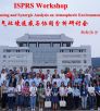
Report of 1st ISPRS Workshop on Remote Sensing and Synergic Analysis on Atmospheric Environment
Changsha, China
September 21-22, 2017
by Kai Qin
The 1st ISPRS Workshop on Remote Sensing and Synergic Analysis on Atmospheric Environment was held in Changsha, China during Sept. 21 and 22, 2017. It was organized by the ISPRS Working Group on Remote Sensing of Atmospheric Environment (WGIII/8) and Central South University. Professor Lixin Wu, chairman of the ISPRS WGIII/8, served as the chairman of the workshop. There were more than 90 attendees from 25 institutions, e.g., German Aerospace Center (DLR), Ludwig-Maximilians-Universität München (LMU), Chinese Academy of Sciences (CAS), Wuhan University, Fudan University. There were 35 oral presentations including 15 invited speakers from remote sensing, meteorology, environment, and public health areas.
Read more ...
|
|
|
|
Report of GSW 2017
Wuhan, China
September 18-22, 2017
by Bisheng Yang
The Geo-spatial Week 2017 (GSW 2017), approved by ISPRS Council and held by Wuhan University from Sept. 18-22, was successfully closed in Wuhan. With the great efforts of Local Organization Committee and Program Committee, and the guidance of International Scientific Committee and ISPRS Council, GSW 2017 won a great success.

Read more ...
|
 |
|
Report on ISPRS Workshop:
Collaborative and Dynamic Land Cover Information Services Supporting UN Sustainable Development Goals
Jinan, China
16th September, 2017
by Wu Hao
The ISPRS workshop, entitled “Collaborative and Dynamic Land Cover Information Services Supporting UN Sustainable Development Goals”, was held in Jinan, China on 16th September 2017. The meeting was jointly co-organized by ISPRS ICWG IV/III, the National Geomatics Center of China (NGCC), Shandong Normal University and NASG Research Center for Fundamental Geospatial Information. The workshop enjoyed the support of the ongoing ISPRS Scientific Initiatives project, entitled “An ISPRS contribution to Transforming Our World: Augmentation of GlobeLand30 with additional data for monitoring United Nations Sustainable Development Goals”. The theme of the meeting was on how global land cover data could quantify indicators of the sustainable development goals (SDGs) in order to support the United Nations (UN) “2030 Agenda for Sustainable Development”. More than 100 delegates from 20 research institutes attended the workshop, including four members of the ISPRS Council. Prof. Duan Peiyong, Vice-President of Shandong Normal University, gave a welcome speech in the opening session. Dr. Wu Hao, Co-Chair of ISPRS ICWG IV/III, chaired the workshop.
Read the full report
|
 |
|
Report on the Eighth International Scientific-Technical Conference on:
Environmental Monitoring, Photogrammetry, Geoinformatics - Modern Technologies and Development Perspectives.
Lviv Polytechnic National University and village Shidnytsya
September 14-16, 2017
The conference was attended by more than 100 participants from 9 countries (Ukraine, Poland, Germany, Moldova, Armenia, USA, Canada, Czech Republic, and Iraq). Among them are leading scientists, entrepreneurs and industry workers, representatives of local authorities and the public, students and Phd students.
Read the report here…
|
 |
|
UAV-g 2017
Bonn, Germany
September 4-7, 2017
by Cyrill Stachniss
The UAV-g 2017 conference was successfully held in Bonn from September 4-7, 2017. The event hosted around 180 researchers from various research fields and from over 25 countries. The conference featured two plenary tasks, one given by Prof. Davide Scaramuzza on Autonomous, Agile, Vision-controlled Drones: from Active to Event Vision and one by Prof. Charles Toth on UAS Technology: The Challenges of Mapping.
Read the full report
|
 |
|
1st IAA North East Asia Symposium on Small Satellites
– Serving the Needs for the Benefits of the Region
Ulaanbaatar, Mongolia
August 21-23, 2017
The 1st IAA North East Asia Symposium on Small Satellites - titled "Serving the Needs for the Benefits of the Region" - took place in Mongolia's capital Ulaanbaatar from August 21-23, 2017. Initiated by IAA academician Dr. M. Saandar on behalf of the Mongolian small satellite community the symposium was organized by the International Academy of Astronautics (IAA), hosted and supported by the Mongolian Society of Photogrammetry and Remote Sensing (MSPRS), the Mongolian Academy of Sciences (MAS) and MonMap Engineering Services as well as promoted by the Mongolian Ministry of Education, Culture, Sciences and Sports (MECSS), the National University of Mongolia (NUM), the Asian Association of Remote Sensing (AARS) and the International Society of Photogrammetry and Remote Sensing (ISPRS).
Read more....
|
 |
|
Report of the 2017 International Symposium on Planetary Remote Sensing and Mapping
Hong Kong, China
August 13-16, 2017
by Bo Wu
From 13 to 16 August 2017, the 2017 International Symposium on Planetary Remote Sensing and Mapping (PRSM2017) was successfully held at the Hong Kong Polytechnic University (PolyU). The Symposium was jointly organized by the International Society for Photogrammetry and Remote Sensing (ISPRS) Working Group III/II: "Planetary Remote Sensing and Mapping" and the Department of Land Surveying and Geo-Informatics (LSGI) of PolyU. The Symposium provided an interdisciplinary forum for leading scientists and researchers from different countries/regions to share the latest research and developments from the recent missions exploring the Moon, Mars, and other planets by NASA, ESA (European Space Agency), China, and other countries.
Read the full report here….
↑ Up
|
|
|
| |
|
|
Obituaries
|
|
|
In Memoriam: James Boyce Case
1928 - 2017
Jim Case, 88, of Cedar City, UT, passed away May 8, 2017, in St. George, UT. He was born October 26, 1928, in Lincoln Illinois, to Richard Warren and Blanche Irene Boyce Case. He married Claire Criger, together they had a son James C. Case.
He grew up in Hanford, California where he graduated from Hanford High School, then graduated from Stanford University, and earned a doctorate degree from Ohio State University. He spent his career as a photogrammetrist for the federal government. He has lived in Cedar City, UT, since 1989.
Read comments from ASPRS members and friends of Jim Case here…
Read comments from ASPRS members and friends of Jim Case
here ...
|
|
|
| |
|
|
ISPRS International Journal of Geo-Information — Open Access Journal
 |
|
New publications in the ISPRS International Journal of Geo-Information
Open Access Journal
Volume 6, Issue 7 (July)
Addressing Public Law Restrictions within a 3D Cadastral Context
Kitsakis, Dimitrios, Dimopoulou, Efi
No: 182
An Urban Heat Island Study of the Colombo Metropolitan Area, Sri Lanka, Based on Landsat Data (1997–2017)
Ranagalage, Manjula, Estoque, Ronald C., Murayama, Yuji
No: 189
Unveiling E-Bike Potential for Commuting Trips from GPS Traces
Lopez, Angel J., Astegiano, Paola, Gautama, Sidharta, Ochoa, Daniel, Tampère, Chris M. J., Beckx, Carolien
No: 190
Participatory Land Administration on Customary Lands: A Practical VGI Experiment in Nanton, Ghana
Asiama, Kwabena, Bennett, Rohan, Zevenbergen, Jaap
No: 186
Fusion of Multi-Temporal Interferometric Coherence and Optical Image Data for the 2016 Kumamoto Earthquake Damage Assessment
Tamkuan, Nopphawan, Nagai, Masahiko
No: 188
Conceptual Architecture and Service-Oriented Implementation of a Regional Geoportal for Rice Monitoring
Granell, Carlos, Miralles, Ignacio, Rodríguez-Pupo, Luis E., González-Pérez, Alberto, Casteleyn, Sven, Busetto, Lorenzo, Pepe, Monica, Boschetti, Mirco, Huerta, Joaquín
No: 191
A Two-Step Method for Missing Spatio-Temporal Data Reconstruction
Cheng, Shifen, Lu, Feng
No: 187
Prediction of Suspect Location Based on Spatiotemporal Semantics
Duan, Lian, Ye, Xinyue, Hu, Tao, Zhu, Xinyan
No: 185
Cloud-Based Architectures for Auto-Scalable Web Geoportals towards the Cloudification of the GeoVITe Swiss Academic Geoportal
Iosifescu-Enescu, Ionuț, Matthys, Claudia, Gkonos, Charalampos, Iosifescu-Enescu, Cristina M., Hurni, Lorenz
No: 192
Spatial Context from Open and Online Processing (SCOOP): Geographic, Temporal, and Thematic Analysis of Online Information Sources
Robertson, Colin, Horrocks, Kevin
No: 193
Toward the Development of a Marine Administration System Based on International Standards
Athanasiou, Katerina, Sutherland, Michael, Kastrisios, Christos, Tsoulos, Lysandros, Griffith-Charles, Charisse, Davis, Dexter, Dimopoulou, Efi
No: 194
An Improved Hybrid Method for Enhanced Road Feature Selection in Map Generalization
Zhang, Jianchen, Wang, Yanhui, Zhao, Wenji
No: 196
Using Latent Semantic Analysis to Identify Research Trends in OpenStreetMap
Sehra, Sukhjit Singh, Singh, Jaiteg, Rai, Hardeep Singh
No: 195
A Novel Semantic Matching Method for Indoor Trajectory Tracking
Guo, Sheng, Xiong, Hanjiang, Zheng, Xianwei
No: 197
Assessing Performance of Three BIM-Based Views of Buildings for Communication and Management of Vertically Stratified Legal Interests
Atazadeh, Behnam, Rajabifard, Abbas, Kalantari, Mohsen
No: 198
Modified Neutral Models as Benchmarks to Evaluate the Dynamics of Land System (DLS) Model Performance
Xiu, Yingchang, Liu, Wenbao, Yang, Wenjing
No: 199
A New Look at Public Services Inequality: The Consistency of Neighborhood Context and Citizens’ Perception across Multiple Scales
Wei, Chunzhu, Cabrera Barona, Pablo, Blaschke, Thomas
No: 200
Highlighting Current Trends in Volunteered Geographic Information
Jonietz, David, Antonio, Vyron, See, Linda, Zipf, Alexander
No: 202
Nationwide Flood Monitoring for Disaster Risk Reduction Using Multiple Satellite Data
Kwak, Young-joo
No: 203
Disaster Hashtags in Social Media
Murzintcev, Nikita, Cheng, Changxiu
No: 204
Integrating Global Open Geo-Information for Major Disaster Assessment: A Case Study of the Myanmar Flood
Li, Suju, Cui, Yan, Liu, Ming, He, Haixia, Ravan, Shirish
No: 201
A Visual Analysis Approach for Inferring Personal Job and Housing Locations Based on Public Bicycle Data
Shi, Xiaoying, Yu, Zhenhai, Fang, Qiming, Zhou, Quan
No: 205
Erratum: Zhai, J., et al. Quality Assessment Method for Linear Feature Simplification Based on Multi-Scale Spatial Uncertainty. ISPRS International Journal of Geo-Information 2017, 6, 184
Office, IJGI Editorial
No: 207
Automatic Room Segmentation of 3D Laser Data Using Morphological Processing
Jung, Jaehoon, Stachniss, Cyrill, Kim, Changjae
No: 206
A Spatial Analysis Approach for Evaluating the Service Capability of Urban Greenways—A Case Study in Wuhan
Bai, Junwen, Zhang, Penglin, Du, Juan, Li, Zheng
No: 208
Applications of Location-Based Services and Mobile Technologies in K-12 Classrooms
Kolvoord, Robert, Keranen, Kathryn, Rittenhouse, Paul
No: 209
Trajectory Data Mining via Cluster Analyses for Tropical Cyclones That Affect the South China Sea
Yang, Feng, Wu, Guofeng, Du, Yunyan, Zhao, Xiangwei
No: 210
A Method for Estimating Surveillance Video Georeferences
Milosavljević, Aleksandar, Rančić, Dejan, Dimitrijević, Aleksandar, Predić, Bratislav, Mihajlović, Vladan
No: 211
Integrating Decentralized Indoor Evacuation with Information Depositories in the Field
Zhao, Haifeng, Winter, Stephan, Tomko, Martin
No: 213
Three-Dimensional Modeling and Indoor Positioning for Urban Emergency Response
Zhang, Xin, Chen, Yongxin, Yu, Linjun, Wang, Weisheng, Wu, Qianyu
No: 214
Analysis of the Patrimonial Conservation of a Quito Suburb without Altering Its Commercial Structure by Means of a Centrality Measure for Urban Networks
Agryzkov, Taras, Oliver, José L., Tortosa, Leandro, Vicent, José F.
No: 215
A Novel Popular Tourist Attraction Discovering Approach Based on Geo-Tagged Social Media Big Data
Peng, Xia, Huang, Zhou
No: 216
A Matrix-Based Structure for Vario-Scale Vector Representation over a Wide Range of Map Scales: The Case of River Network Data
Huang, Lina, Ai, Tinghua, Oosterom, Peter Van, Yan, Xiongfeng, Yang, Min
No: 218
SCMDOT: Spatial Clustering with Multiple Density-Ordered Trees
Wu, Xiaozhu, Jiang, Hong, Chen, Chongcheng
No: 217
Semantic-Geographic Trajectory Pattern Mining Based on a New Similarity Measurement
Wan, You, Zhou, Chenghu, Pei, Tao
No: 212
Robust and Parameter-Free Algorithm for Constructing Pit-Free Canopy Height Models
Chen, Chuanfa, Wang, Yifu, Li, Yanyan, Yue, Tianxiang, Wang, Xin
No: 219
An Array Database Approach for Earth Observation Data Management and Processing
Tan, Zhenyu, Yue, Peng, Gong, Jianya
No: 220
Robust Indoor Mobile Localization with a Semantic Augmented Route Network Graph
Zhou, Yan, Zheng, Xianwei, Xiong, Hanjiang, Chen, Ruizhi
No: 221
Overview of the Croatian Land Administration System and the Possibilities for Its Upgrade to 3D by Existing Data
Vučić, Nikola, Roić, Miodrag, Mađer, Mario, Vranić, Saša, van Oosterom, Peter
No: 223
Accuracy Improvement of DGPS for Low-Cost Single-Frequency Receiver Using Modified Flächen Korrektur Parameter Correction
Kim, Jungbeom, Song, Junesol, No, Heekwon, Han, Deokhwa, Kim, Donguk, Park, Byungwoon, Kee, Changdon
No: 222
Towards Enhancing Integrated Pest Management Based on Volunteered Geographic Information
Yan, Yingwei, Feng, Chen-Chieh, Chang, Klarissa Ting-Ting
No: 224
FOSS Tools and Applications for Education in Geospatial Sciences
Ciolli, Marco, Federici, Bianca, Ferrando, Ilaria, Marzocchi, Roberto, Sguerso, Domenico, Tattoni, Clara, Vitti, Alfonso, Zatelli, Paolo
No: 225
Collaborative Geodesign and Spatial Optimization for Fragmentation-Free Land Allocation
Xie, Yiqun, Runck, Bryan C., Shekhar, Shashi, Kne, Len, Mulla, David, Jordan, Nicolas, Wiringa, Peter
No: 226
Evaluating the Evacuation and Rescue Capabilities of Urban Open Space from a Land Use Perspective: A Case Study in Wuhan, China
Gong, Jie, Liu, Yaolin, Liu, Yanfang, Huang, Pujiang, Li, Jiwei
No: 227
Comparative Assessment of Three Nonlinear Approaches for Landslide Susceptibility Mapping in a Coal Mine Area
Su, Qiaomei, Zhang, Jin, Zhao, Shangmin, Wang, Li, Liu, Jin, Guo, Jianli
No: 228
Volume 6, Issue 8 (August 2017)
What do New Yorkers Think about Impacts and Adaptation to Heat Waves? An Evaluation Tool to Incorporate Perception of Low-Income Groups into Heat Wave Adaptation Scenarios in New York City
Matmir, Sadra, Reckien, Diana, Flacke, Johannes
No: 229
Analysis and Applications of GlobeLand30: A Review
Chen, Jun, Cao, Xin, Peng, Shu, Ren, Huiru
No: 230
Comparative Research of Visual Interpretation of Aerial Images and Topographic Maps for Unskilled Users: Searching for Objects Important for Decision-Making in Crisis Situations
Svatonova, Hana, Kolejka, Jaromir
No: 231
Extrusion Approach Based on Non-Overlapping Footprints (EABNOF) for the Construction of Geometric Models and Topologies in 3D Cadasters
Ding, Yuan, Jiang, Nan, Yu, Zhaoyuan, Ma, Binqing, Shi, Ge, Wu, Changbin
No: 232
On Wi-Fi Model Optimizations for Smartphone-Based Indoor Localization
Ebner, Frank, Fetzer, Toni, Deinzer, Frank, Grzegorzek, Marcin
No: 233
Determination of 3D Displacements of Drainage Networks Extracted from Digital Elevation Models (DEMs) Using Linear-Based Methods
Mozas-Calvache, Antonio Tomás, Ureña-Cámara, Manuel Antonio, Ariza-López, Francisco Javier
No: 234
Spatial Characteristics of Twitter Users—Toward the Understanding of Geosocial Media Production
Rzeszewski, Michal, Beluch, Lukasz
No: 236
Disaster Risk Reduction in Agriculture through Geospatial (Big) Data Processing
Řezník, Tomáš, Lukas, Vojtěch, Charvát, Karel, Charvát, Karel, Křivánek, Zbyněk, Kepka, Michal, Herman, Lukáš, Řezníková, Helena
No: 238
Farm Level Assessment of Irrigation Performance for Dairy Pastures in the Goulburn-Murray District of Australia by Combining Satellite-Based Measures with Weather and Water Delivery Information
Abuzar, Mohammad, Whitfield, Des, McAllister, Andy
No: 239
A Hierarchical Approach for Measuring the Consistency of Water Areas between Multiple Representations of Tile Maps with Different Scales
Shen, Yilang, Ai, Tinghua
No: 240
A Triangular Prism Spatial Interpolation Method for Mapping Geological Property Fields
Cui, Yang, Li, Qingquan, Li, Qingyuan, Zhu, Jiasong, Wang, Chisheng, Ding, Kai, Wang, Dan, Yang, Bisheng
No: 241
Centrality as a Method for the Evaluation of Semantic Resources for Disaster Risk Reduction
Čerba, Otakar, Jedlička, Karel, Čada, Václav, Charvát, Karel
No: 237
Continuous Scale Transformations of Linear Features Using Simulated Annealing-Based Morphing
Li, Jingzhong, Ai, Tinghua, Liu, Pengcheng, Yang, Min
No: 242
The IMU/UWB Fusion Positioning Algorithm Based on a Particle Filter
Wang, Yan, Li, Xin
No: 235
Wicked Water Points: The Quest for an Error Free National Water Point Database
Verplanke, Jeroen, Georgiadou, Yola
No: 244
Nationwide Point Cloud—The Future Topographic Core Data
Virtanen, Juho-Pekka, Kukko, Antero, Kaartinen, Harri, Jaakkola, Anttoni, Turppa, Tuomas, Hyyppä, Hannu, Hyyppä, Juha
No: 243
High-Resolution Remote Sensing Data Classification over Urban Areas Using Random Forest Ensemble and Fully Connected Conditional Random Field
Sun, Xiaofeng, Lin, Xiangguo, Shen, Shuhan, Hu, Zhanyi
No: 245
Spatial Variation Relationship between Floating Population and Residential Burglary: A Case Study from ZG, China
Chen, Jianguo, Liu, Lin, Zhou, Suhong, Xiao, Luzi, Jiang, Chao
No: 246
A Generalized Additive Model Combining Principal Component Analysis for PM2.5 Concentration Estimation
Li, Shuang, Zhai, Liang, Zou, Bin, Sang, Huiyong, Fang, Xin
No: 248
GIS-Based Visibility Network and Defensibility Model to Reconstruct Defensive System of the Han Dynasty in Central Xinjiang, China
Zhu, Jianfeng, Nie, Yueping, Gao, Huaguang, Liu, Fang, Yu, Lijun
No: 247
Evaluating the Impact of Meteorological Factors on Water Demand in the Las Vegas Valley Using Time-Series Analysis: 1990–2014
Huntra, Patcha, Keener, Tim C.
No: 249
A Novel Approach for Publishing Linked Open Geodata from National Registries with the Use of Semantically Annotated Context Dependent Web Pages
Iwaniak, Adam, Leszczuk, Marta, Strzelecki, Marek, Harvey, Francis, Kaczmarek, Iwona
No: 252
Template Matching and Simplification Method for Building Features Based on Shape Cognition
Yan, Xiongfeng, Ai, Tinghua, Zhang, Xiang
No: 250
Event-Driven Distributed Information Resource-Focusing Service for Emergency Response in Smart City with Cyber-Physical Infrastructures
Xiao, Changjiang, Chen, Nengcheng, Gong, Jianya, Wang, Wei, Hu, Chuanbo, Chen, Zeqiang
No: 251
Evolving Spatial Data Infrastructures and the Role of Adaptive Governance
Sjoukema, Jaap-Willem, Bregt, Arnold, Crompvoets, Joep
No: 254
Estimation of Travel Time Distributions in Urban Road Networks Using Low-Frequency Floating Car Data
Shi, Chaoyang, Chen, Bi Yu, Li, Qingquan
No: 253
Enabling the Use of Sentinel-2 and LiDAR Data for Common Agriculture Policy Funds Assignment
Estrada, Jesús, Sánchez, Héctor, Hernanz, Lorena, Checa, María José, Roman, Dumitru
No: 255
Spatiotemporal Assessment of Littoral Waterbirds for Establishing Ecological Indicators of Mediterranean Coastal Lagoons
Farinós-Celdrán, Pablo, Robledano-Aymerich, Francisco, Carreño, María Francisca, Martínez-López, Javier
No: 256
An Internet-Based GIS Platform Providing Data for Visualization and Spatial Analysis of Urbanization in Major Asian and African Cities
Gong, Hao, Simwanda, Matamyo, Murayama, Yuji
No: 257
Spatial-Spectral Graph Regularized Kernel Sparse Representation for Hyperspectral Image Classification
Liu, Jianjun, Xiao, Zhiyong, Chen, Yufeng, Yang, Jinlong
No: 258
Volume 6, Issue 9 (September 2017)
Geospatial Google Street View with Virtual Reality: A Motivational Approach for Spatial Training Education
Carbonell-Carrera, Carlos, Saorín, Jose Luis
No: 261
Texture-Cognition-Based 3D Building Model Generalization
Liu, Po, Li, Chengming, Li, Fei
No: 260
Identifying and Analyzing the Prevalent Regions of a Co-Location Pattern Using Polygons Clustering Approach
Yu, Wenhao
No: 259
The Ecological Security Pattern and Its Constraint on Urban Expansion of a Black Soil Farming Area in Northeast China
Liu, Shuhan, Wang, Dongyan, Li, Hong, Li, Wenbo, Wu, Wenjun, Zhu, Yuanli
No: 263
Examining the Driving Factors Causing Rapid Urban Expansion in China: An Analysis Based on GlobeLand30 Data
Liao, Cong, Dai, Teqi, Cai, Hongyu, Zhang, Wenxin
No: 264
Improving Identification of Areas for Ecological Restoration for Conservation by Integrating USLE and MCDA in a GIS-Environment: A Pilot Study in a Priority Region Northern Mexico
Aguirre-Salado, Carlos Arturo, Miranda-Aragón, Liliana, Pompa-García, Marín, Reyes-Hernández, Humberto, Soubervielle-Montalvo, Carlos, Flores-Cano, Jorge Alberto, Méndez-Cortés, Heriberto
No: 262
Use of Tencent Street View Imagery for Visual Perception of Streets
Cheng, Liang, Chu, Sensen, Zong, Wenwen, Li, Shuyi, Wu, Jie, Li, Manchun
No: 265
Tensions in Rural Water Governance: The Elusive Functioning of Rural Water Points in Tanzania
Katomero, Jesper, Georgiadou, Yola, Lungo, Juma, Hoppe, Robert
No: 266
Public Transit Route Mapping for Large-Scale Multimodal Networks
Poletti, Flavio, Bösch, Patrick M., Ciari, Francesco, Axhausen, Kay W.
No: 268
Simulation-Based Evaluation of Ease of Wayfinding Using Digital Human and As-Is Environment Models
Maruyama, Tsubasa, Kanai, Satoshi, Date, Hiroaki, Tada, Mitsunori
No: 267
Consistent Roof Geometry Encoding for 3D Building Model Retrieval Using Airborne LiDAR Point Clouds
Chen, Yi-Chen, Lin, Bo-Yi, Lin, Chao-Hung
No: 269
Contextual Building Selection Based on a Genetic Algorithm in Map Generalization
Wang, Lin, Guo, Qingsheng, Liu, Yuangang, Sun, Yageng, Wei, Zhiwei
No: 271
An Adaptive Sweep-Circle Spatial Clustering Algorithm Based on Gestalt
Zhan, Qingming, Deng, Shuguang, Zheng, Zhihua
No: 272
An Assessment of Spatial Pattern Characterization of Air Pollution: A Case Study of CO and PM2.5 in Tehran, Iran
Habibi, Roya, Alesheikh, Ali Asghar, Mohammadinia, Ali, Sharif, Mohammad
No: 270
A Parcel-Level Model for Ranking and Allocating Urban Land-Uses
Maleki, Jamshid, Hakimpour, Farshad, Masoumi, Zohreh
No: 273
Limits of Colour Perception in the Context of Minimum Dimensions in Digital Cartography
Lupa, Michał, Szombara, Stanisław, Chuchro, Monika, Chrobak, Tadeusz
No: 276
Closing Data Gaps with Citizen Science? Findings from the Danube Region
Lisjak, Josip, Schade, Sven, Kotsev, Alexander
No: 277
Using Eye Tracking to Explore the Guidance and Constancy of Visual Variables in 3D Visualization
Liu, Bing, Dong, Weihua, Meng, Liqiu
No: 274
Spatial Orientation Skill Improvement with Geospatial Applications: Report of a Multi-Year Study
Carbonell-Carrera, Carlos, Hess Medler, Stephany
No: 278
Mapping Forest Species in the Central Middle Atlas of Morocco (Azrou Forest) through Remote Sensing Techniques
Mohajane, Meriame, Essahlaoui, Ali, Oudija, Fatiha, El Hafyani, Mohammed, Cláudia Teodoro, Ana
No: 275
Making Spatial Decisions Using ArcGIS Pro: A Workbook. By Kathryn Keranen and Robert Kolvoord, Esri Press, 2017; 376 Pages. Price $69.99, ISBN 9781589484849
IJGI Editorial Office,
No: 279
Towards an Affordance-Based Ad-Hoc Suitability Network for Indoor Manufacturing Transportation Processes
Scholz, Johannes, Schabus, Stefan
No: 280
Mapping Parallels between Outdoor Urban Environments and Indoor Manufacturing Environments
Schabus, Stefan, Scholz, Johannes, Lampoltshammer, Thomas J.
No: 281
The Governance Landscape of Geospatial E-Services—The Belgian Case
Chantillon, Maxim, Crompvoets, Joep, Peristeras, Vassilios
No: 282
Employing Search Engine Optimization (SEO) Techniques for Improving the Discovery of Geospatial Resources on the Web
Katumba, Samy, Coetzee, Serena
No: 284
Spatial Modelling and Prediction Assessment of Soil Iron Using Kriging Interpolation with pH as Auxiliary Information
Tziachris, Panagiotis, Metaxa, Eirini, Papadopoulos, Frantzis, Papadopoulou, Maria
No: 283
A New Endmember Preprocessing Method for the Hyperspectral Unmixing of Imagery Containing Marine Oil Spills
Cui, Can, Li, Ying, Liu, Bingxin, Li, Guannan
No: 286
Topographic Correction to Landsat Imagery through Slope Classification by Applying the SCS + C Method in Mountainous Forest Areas
Vázquez-Jiménez, René, Romero-Calcerrada, Raúl, Ramos-Bernal, Rocío N., Arrogante-Funes, Patricia, Novillo, Carlos J.
No: 287
GeoSpark SQL: An Effective Framework Enabling Spatial Queries on Spark
Huang, Zhou, Chen, Yiran, Wan, Lin, Peng, Xia
No: 285
Monitoring and Modeling of Spatiotemporal Urban Expansion and Land-Use/Land-Cover Change Using Integrated Markov Chain Cellular Automata Model
Rimal, Bhagawat, Zhang, Lifu, Keshtkar, Hamidreza, Wang, Nan, Lin, Yi
No: 288
Selecting the Best Band Ratio to Estimate Chlorophyll-a Concentration in a Tropical Freshwater Lake Using Sentinel 2A Images from a Case Study of Lake Ba Be (Northern Vietnam)
Ha, Nguyen Thi Thu, Thao, Nguyen Thien Phuong, Koike, Katsuaki, Nhuan, Mai Trong
No: 290
Improving Destination Choice Modeling Using Location-Based Big Data
Molloy, Joseph, Moeckel, Rolf
No: 291
Volume 6, Issue 10 (October 2017)
Geo-Hazard Detection and Monitoring Using SAR and Optical Images in a Snow-Covered Area: The Menyuan (China) Test Site
Huang, Qihuan, Wang, Yian, Xu, Jia, Nishyirimbere, Angelique, Li, Zhimin
No: 293
Using a Hidden Markov Model for Improving the Spatial-Temporal Consistency of Time Series Land Cover Classification
Gong, Wenbing, Fang, Shenghui, Yang, Guang, Ge, Mengyu
No: 292
Mapping the Far Right: Geomedia in an Educational Response to Right-Wing Extremism
Jekel, Thomas, Lehner, Michael, Vogler, Robert
No: 294
A New Approach for Interpreting the Morisita Index of Aggregation through Quadrat Size
Hayes, James J., Castillo, Oscar
No: 296
Comparative Analysis on Topological Structures of Urban Street Networks
Lin, Jingyi, Ban, Yifang
No: 295
Analysis of Groundwater Nitrate Contamination in the Central Valley: Comparison of the Geodetector Method, Principal Component Analysis and Geographically Weighted Regression
Shrestha, Anil, Luo, Wei
No: 297
Mapping Changes in Carbon Storage and Productivity Services Provided by Riparian Ecosystems of Semi-Arid Environments in Northwestern Mexico
Mendez-Estrella, Romeo, Romo-Leon, Jose Raul, Castellanos, Alejandro E.
No: 298
Entropy-Based Fusion of Water Indices and DSM Derivatives for Automatic Water Surfaces Extraction and Flood Monitoring
Horkaew, Paramate, Puttinaovarat, Supattra
No: 301
On Metrics for Location-Aware Games
Rodríguez-Pupo, Luis E., Casteleyn, Sven, Granell, Carlos
No: 299
A Hybrid Process/Thread Parallel Algorithm for Generating DEM from LiDAR Points
Ren, Yibin, Chen, Zhenjie, Chen, Ge, Han, Yong, Wang, Yanjie
No: 300
Analyzing Refugee Migration Patterns Using Geo-tagged Tweets
Hübl, Franziska, Cvetojevic, Sreten, Hochmair, Hartwig, Paulus, Gernot
No: 302
Determination of Areas Susceptible to Landsliding Using Spatial Patterns of Rainfall from Tropical Rainfall Measuring Mission Data, Rio de Janeiro, Brazil
Guimarães, Renato Fontes, Machado, Wátila Portela, de Carvalho, Osmar Abílio, Montgomery, David R., Gomes, Roberto Arnaldo Trancoso, Greenberg, Harvey M., Cataldi, Márcio, Mendonça, Pedro Coutinho
No: 289
A Sightseeing Spot Recommendation System That Takes into Account the Change in Circumstances of Users
Mizutani, Yuri, Yamamoto, Kayoko
No: 303
Assessing Spatial Accessibility of Public and Private Residential Aged Care Facilities: A Case Study in Wuhan, Central China
Cai, Enxiang, Liu, Yaolin, Jing, Ying, Zhang, Lei, Li, Jiwei, Yin, Chaohui
No: 304
Towards Detecting the Crowd Involved in Social Events
Huang, Wei, Fan, Hongchao, Zipf, Alexander
No: 305
Overview of the OGC CDB Standard for 3D Synthetic Environment Modeling and Simulation
Saeedi, Sara, Liang, Steve, Graham, David, Lokuta, Michael F., Mostafavi, Mir Abolfazl
No: 306
The Local Colocation Patterns of Crime and Land-Use Features in Wuhan, China
Yue, Han, Zhu, Xinyan, Ye, Xinyue, Guo, Wei
No: 307
A Content-Based Remote Sensing Image Change Information Retrieval Model
Ma, Caihong, Xia, Wei, Chen, Fu, Liu, Jianbo, Dai, Qin, Jiang, Liyuan, Duan, Jianbo, Liu, Wei
No: 310
Road Intersection Detection through Finding Common Sub-Tracks between Pairwise GNSS Traces
Xie, Xingzhe, Philips, Wilfried
No: 311
Machine Learning Classification of Buildings for Map Generalization
Lee, Jaeeun, Jang, Hanme, Yang, Jonghyeon, Yu, Kiyun
No: 309
Exploring the Role of the Spatial Characteristics of Visible and Near-Infrared Reflectance in Predicting Soil Organic Carbon Density
Guo, Long, Chen, Yiyun, Shi, Tiezhu, Zhao, Chang, Liu, Yaolin, Wang, Shanqin, Zhang, Haitao
No: 308
Towards 3D Cadastre in Serbia: Development of Serbian Cadastral Domain Model
Radulović, Aleksandra, Sladić, Dubravka, Govedarica, Miro
No: 312
An Interactive Planning Support Tool for Addressing Social Acceptance of Renewable Energy Projects in The Netherlands
Flacke, Johannes, de Boer, Cheryl
No: 313
Rural Road Extraction from High-Resolution Remote Sensing Images Based on Geometric Feature Inference
Liu, Jian, Qin, Qiming, Li, Jun, Li, Yunpeng
No: 314
A Framework for Evaluating Stay Detection Approaches
Schneider, Cornelia, Gröchenig, Simon, Venek, Verena, Leitner, Michael, Reich, Siegfried
No: 315
INTERLIS Language for Modelling Legal 3D Spaces and Physical 3D Objects by Including Formalized Implementable Constraints and Meaningful Code Lists
Kalogianni, Eftychia, Dimopoulou, Efi, Quak, Wilko, Germann, Michael, Jenni, Lorenz, van Oosterom, Peter
No: 319
Monitoring Rural Water Points in Tanzania with Mobile Phones: The Evolution of the SEMA App
Lemmens, Rob, Lungo, Juma, Georgiadou, Yola, Verplanke, Jeroen
No: 316
Review of Web Mapping: Eras, Trends and Directions
Veenendaal, Bert, Brovelli, Maria Antonia, Li, Songnian
No: 317
Flow Orientation Analysis for Major Activity Regions Based on Smart Card Transit Data
Singh, Parul, Oh, Kyuhyup, Jung, Jae-Yoon
No: 318
↑ Up
|
|
|
| |
|
|
ISPRS Journal of Photogrammetry and Remote Sensing
 |
|
New publications in the ISPRS Journal of
Photogrammetry and Remote Sensing Volume 130 (August 2017)
Bundle adjustment with raw inertial observations in UAV applications
Davide Antonio Cucci, Martin Rehak, Jan Skaloud
Pages: 1-12
Random forest wetland classification using ALOS-2 L-band, RADARSAT-2 C-band, and TerraSAR-X imagery
Masoud Mahdianpari, Bahram Salehi, Fariba Mohammadimanesh, Mahdi Motagh
Pages: 13-31
Image jitter detection and compensation using a high-frequency angular displacement method for Yaogan-26 remote sensing satellite
Mi Wang, Chengcheng Fan, Jun Pan, Shuying Jin, Xueli Chang
Pages: 32-43
Verification of road databases using multiple road models
Marcel Ziems, Franz Rottensteiner, Christian Heipke
Pages: 44-62
A higher order conditional random field model for simultaneous classification of land cover and land use
Lena Albert, Franz Rottensteiner, Christian Heipke
Pages: 63-80
Spring green-up date derived from GIMMS3g and SPOT-VGT NDVI of winter wheat cropland in the North China Plain
Zhengjia Liu, Chaoyang Wu, Yansui Liu, Xiaoyue Wang, Bin Fang, Wenping Yuan, Quansheng Ge
Pages: 81-91
A graph-based approach to detect spatiotemporal dynamics in satellite image time series
Fabio Guttler, Dino Ienco, Jordi Nin, Maguelonne Teisseire, Pascal Poncelet
Pages: 92-107
High-resolution digital elevation models from single-pass TanDEM-X interferometry over mountainous regions: A case study of Inylchek Glacier, Central Asia
Julia Neelmeijer, Mahdi Motagh, Bodo Bookhagen
Pages: 108-121
Validation of Suomi-NPP VIIRS sea ice concentration with very high-resolution satellite and airborne camera imagery
Daniel Baldwin, Mark Tschudi, Fabio Pacifici, Yinghui Liu
Pages: 122-138
Simultaneous extraction of roads and buildings in remote sensing imagery with convolutional neural networks
Rasha Alshehhi, Prashanth Reddy Marpu, Wei Lee Woon, Mauro Dalla Mura
Pages: 139-149
Reducing classification error of grassland overgrowth by combing low-density lidar acquisitions and optical remote sensing data
T.P. Pitkänen, N. Käyhk
Pages: 150-161
Automatic co-registration of 3D multi-sensor point clouds
Ravi Ancil Persad, Costas Armenakis
Pages: 162-186
Evaluation of seasonal variations of remotely sensed leaf area index over five evergreen coniferous forests
Rong Wang, Jing M. Chen, Zhili Liu, Altaf Arain
Pages: 187-201
Technical design and system implementation of region-line primitive association framework
Min Wang, Jinjin Xing, Jie Wang, Guonian Lv
Pages: 202-216
The impacts of environmental variables on water reflectance measured using a lightweight unmanned aerial vehicle (UAV)-based spectrometer system
Chuiqing Zeng, Murray Richardson, Douglas J. King
Pages: 217-230
Joint classification and contour extraction of large 3D point clouds
Timo Hackel, Jan D. Wegner, Konrad Schindler
Pages: 231-245
Predicting grain yield in rice using multi-temporal vegetation indices from UAV-based multispectral and digital imagery
X. Zhou, H.B. Zheng, X.Q. Xu, J.Y. He, X.K. Ge, X. Yao, T. Cheng, Y. Zhu, W.X. Cao, Y.C. Tian
Pages: 246-255
Local and global evaluation for remote sensing image segmentation
Tengfei Su, Shengwei Zhang
Pages: 256-276
A review of supervised object-based land-cover image classification
Lei Ma, Manchun Li, Xiaoxue Ma, Liang Cheng, Peijun Du, Yongxue Liu
Pages: 277-293
Automatic building extraction from LiDAR data fusion of point and grid-based features
Shouji Du, Yunsheng Zhang, Zhengrong Zou, Shenghua Xu, Xue He, Siyang Chen
Pages: 294-307
Retrieving the gap fraction, element clumping index, and leaf area index of individual trees using single-scan data from a terrestrial laser scanner
Yumei Li, Qinghua Guo, Yanjun Su, Shengli Tao, Kaiguang Zhao, Guangcai Xu
Pages: 308-316
The P2L method of mismatch detection for push broom high-resolution satellite images
Yi Wan, Yongjun Zhang
Pages: 317-328
3D local feature BKD to extract road information from mobile laser scanning point clouds
Bisheng Yang, Yuan Liu, Zhen Dong, Fuxun Liang, Bijun Li, Xiangyang Peng
Pages: 329-343
Automatic markerless registration of point clouds with semantic-keypoint-based 4-points congruent sets
Xuming Ge
Pages: 344-357
The complex karst dynamics of the Lisan Peninsula revealed by 25 years of DInSAR observations. Dead Sea, Jordan
Simone Fiaschi, Damien Closson, Najib Abou Karaki, Paolo Pasquali, Paolo Riccardi, Mario Floris
Pages: 358-369
Change detection using landsat time series: A review of frequencies, preprocessing, algorithms, and applications
Zhe Zhu
Pages: 370-384
Vertical stratification of forest canopy for segmentation of understory trees within small-footprint airborne LiDAR point clouds
Hamid Hamraz, Marco A. Contreras, Jun Zhang
Pages: 385-392
Radiometric inter-sensor cross-calibration uncertainty using a traceable high accuracy reference hyperspectral imager
Javier Gorroño, Andrew C. Banks, Nigel P. Fox, Craig Underwood
Pages: 393-417
Fusion of photogrammetric and photoclinometric information for high-resolution DEMs from Mars in-orbit imagery
Cheng Jiang, Sylvain Douté, Bin Luo, Liangpei Zhan
Pages: 418-430
A novel binary shape context for 3D local surface description
Zhen Dong, Bisheng Yang, Yuan Liu, Fuxun Liang, Bijun Li, Yufu Zang
Pages: 431-452
Using Landsat time series for characterizing forest disturbance dynamics in the coupled human and natural systems of Central Europe
Cornelius Senf, Dirk Pflugmacher, Patrick Hostert, Rupert Seidl
Pages: 453-463
New publications in the ISPRS Journal of
Photogrammetry and Remote Sensing Volume 131 (September 2017)
Assessing very high resolution UAV imagery for monitoring forest health during a simulated disease outbreak
Jonathan P. Dash, Michael S. Watt, Grant D. Pearse, Marie Heaphy, Heidi S. Dungey
Pages: 1-14
On support relations and semantic scene graphs
Michael Ying Yang, Wentong Liao, Hanno Ackermann, Bodo Rosenhahn
Pages: 15-25
Mapping leaf nitrogen and carbon concentrations of intact and fragmented indigenous forest ecosystems using empirical modeling techniques and WorldView-2 data
Galal Omer, Onisimo Mutanga, Elfatih M. Abdel-Rahman, Kabir Peerbhay, Elhadi Adam
Pages: 26-39
A practical approach for deriving all-weather soil moisture content using combined satellite and meteorological data
Pei Leng, Zhao-Liang Li, Si-Bo Duan, Mao-Fang Gao, Hong-Yuan Huo
Pages: 40-51
Spectral analysis of amazon canopy phenology during the dry season using a tower hyperspectral camera and modis observations
Yhasmin Mendes de Moura, Lênio Soares Galvão, Thomas Hilker, Jin Wu, Scott Saleska, Cibele Hummel do Amaral, Bruce Walker Nelson, Aline Pontes Lopes, Kenia K. Wiedeman, Neill Prohaska, Raimundo Cosme de Oliveira, Carolyne Bueno Machado, Luiz E.O.C. Aragão
Pages: 52-64
Unsupervised domain adaptation for early detection of drought stress in hyperspectral images
P. Schmitter, J. Steinrücken, C. Römer, A. Ballvora, J. Léon, U. Rascher, L. Plümer
Pages: 65-76
Improving the prediction of African savanna vegetation variables using time series of MODIS products
Miriam Tsalyuk, Maggi Kelly, Wayne M. Getz
Pages: 77-91
Reconstruction of time-varying tidal flat topography using optical remote sensing imageries
Kuo-Hsin Tseng, Chung-Yen Kuo, Tang-Huang Lin, Zhi-Cheng Huang, Yu-Ching Lin, Wen-Hung Liao, Chi-Farn Chen
Pages: 92-103
A mangrove forest map of China in 2015: Analysis of time series Landsat 7/8 and Sentinel-1A imagery in Google Earth Engine cloud computing platform
Bangqian Chen, Xiangming Xiao, Xiangping Li, Lianghao Pan, Russell Doughty, Jun Ma, Jinwei Dong, Yuanwei Qin, Bin Zhao, Zhixiang Wu, Rui Sun, Guoyu Lan, Guishui Xie, Nicholas Clinton, Chandra Giri
Pages: 104-120
Multi-temporal mesoscale hyperspectral data of mixed agricultural and grassland regions for anomaly detection
Cooper McCann, Kevin S. Repasky, Rick Lawrence, Scott Powell
Pages: 121-133
Toward combining thematic information with hierarchical multiscale segmentations using tree Markov random field model
Xueliang Zhang, Pengfeng Xiao, Xuezhi Feng
Pages: 134-146
Pure endmember extraction using robust kernel archetypoid analysis for hyperspectral imagery
Weiwei Sun, Gang Yang, Ke Wu, Weiyue Li, Dianfa Zhang
Pages: 147-159
A novel scene-based non-uniformity correction method for SWIR push-broom hyperspectral sensors
Bin-Lin Hu, Shi-Jing Hao, De-Xin Sun, Yin-Nian Liu
Pages: 160-169
New publications in the ISPRS Journal of
Photogrammetry and Remote Sensing Volume 132 (October 2017)
An auto-adapting global-to-local color balancing method for optical imagery mosaic
Lei Yu, Yongjun Zhang, Mingwei Sun, Xiuguang Zhou, Chi Liu
Pages: 1-19
A service relation model for web-based land cover change detection
Huaqiao Xing, Jun Chen, Hao Wu, Jun Zhang, Songnian Li, Boyu Liu
Pages: 20-32
Camera pose refinement by matching uncertain 3D building models with thermal infrared image sequences for high quality texture extraction
Dorota Iwaszczuk, Uwe Stilla
Pages: 33-47
Contextually guided very-high-resolution imagery classification with semantic segments
Wenzhi Zhao, Shihong Du, Qiao Wang, William J. Emery
Pages: 48-60
Robust feature matching via support-line voting and affine-invariant ratios
Jiayuan Li, Qingwu Hu, Mingyao Ai, Ruofei Zhong
Pages: 61-76
Significant effect of topographic normalization of airborne LiDAR data on the retrieval of plant area index profile in mountainous forests
Jing Liu, Andrew K. Skidmore, Marco Heurich, Tiejun Wang
Pages: 77-87
Hyperspectral dimensionality reduction for biophysical variable statistical retrieval
Juan Pablo Rivera-Caicedo, Jochem Verrelst, Jordi Muñoz-Marí, Gustau Camps-Valls, José Moreno
Pages: 88-101
A structured regularization framework for spatially smoothing semantic labelings of 3D point clouds
Loïc Landrieu, Hugo Raguet, Bruno Vallet, Clément Mallet, Martin Weinmann
Pages: 102-118
Generation and performance assessment of the global TanDEM-X digital elevation model
Paola Rizzoli, Michele Martone, Carolina Gonzalez, Christopher Wecklich, Daniela Borla Tridon, Benjamin Bräutigam, Markus Bachmann, Daniel Schulze, Thomas Fritz, Martin Huber, Birgit Wessel, Gerhard Krieger, Manfred Zink, Alberto Moreira
Pages: 119-139
Efficient structure from motion for oblique UAV images based on maximal spanning tree expansion
San Jiang, Wanshou Jiang
Pages: 140-161
Stand-volume estimation from multi-source data for coppiced and high forest Eucalyptus spp. silvicultural systems in KwaZulu-Natal, South Africa
Timothy Dube, Mbulisi Sibanda, Cletah Shoko, Onisimo Mutanga
Pages: 162-169
Hierarchical semantic cognition for urban functional zones with VHR satellite images and POI data
Xiuyuan Zhang, Shihong Du, Qiao Wang
Pages: 170-184
Scaling effects on spring phenology detections from MODIS data at multiple spatial resolutions over the contiguous United States
Dailiang Peng, Xiaoyang Zhang, Bing Zhang, Liangyun Liu, Xinjie Liu, Alfredo R. Huete, Wenjiang Huang, Siyuan Wang, Shezhou Luo, Xiao Zhang, Helin Zhang
Pages: 185-198
Graph SLAM correction for single scanner MLS forest data under boreal forest canopy
Antero Kukko, Risto Kaijaluoto, Harri Kaartinen, Ville V. Lehtola, Anttoni Jaakkola, Juha Hyyppä
Pages: 199-209
↑ Up
|
|
|
| |
|
|
New Events
20 Nov 2017
Workshop on Passive and Active Electro-Optical Sensors for Aerial & Space Imaging
http://www2.informatik.hu-berlin.de/cv/psivt2017/
Wuhan, China
27-30 Nov 2017
FIG Commission 3 Annual Meeting and Workshop
Volunteered Geographic Information: Emerging Applications in Public Science and Citizen Participation
http://com3fig.wixsite.com/fig-commission3-2017
Lisbon, Portugal
09-11 Apr 2018
Research@Locate
held jointly with GeoSmart Asia 2018
http://www.asiera.org.au/rl18.html
Adelaide, Australia
22-26 Apr 2018
SPIE Photonics Europe 2018
Exhibition: 24 April – 25 April 2018
http://spie.org/SPIE_Photonics_Europe_Conference
Strasbourg, France
22-23 May 2018
GEO Business 2018
http://www.geobusinessshow.com/
London, UK
03-06 Jul 2018
GI_Forum 2018
Symposium and Exhibit
http://www.gi-forum.org/
Salzburg, Austria
04 Jul 2018
AGIT 2018
Symposium and EXPO
http://www.agit.at
Salzburg, Austria
26-28 Sep 2018
2nd TeanGeo 2018
Second International Conference & Exhibitionon Advanced Geospatial Science & Technology
http://www.teangeo.org
Tunis , Tunisia
06-08 May 2019
11th International Symposium On Mobile Mapping Technology and Summer School on mobile Mapping
http://www.MMT2019.com
Shenzhen, China
» See more
|
|
| |
|
|
Updated Events
18-21 Mar 2018
Gi4DM
Geo-information for Disaster Management
http://www.gi4dm2018.org
Istanbul, Turkey
01 Oct 2018
ISPRS TC IV Mid-term Symposium
3D Spatial Information Science - The Engine of Change
http://www.isprs.org/tc4-symposium2018/
Delft, The Netherlands
09-12 Oct 2018
ISPRS TC I Mid-term Symposium
Innovative Sensing - From Sensors to Methods and Applications
http://tc1-symposium2018.ipf.kit.edu/
Karlsruhe, Germany
» See more
|
|
| |
|
|
Job Opportunities
|
14-Sep-2017 |
Research Assistant or Postdoc: 3D/4D modeling of South Pacific Islands (Moorea IDEA Avatar)
ETH Zurich, Institute of Theoretical Physics, Platform for Advanced Scientific Computing, with occasional fieldwork in Moorea and Tetiorea
|
|
14-Sep-2017 |
Research Assistant or Postdoc: 3D/4D modeling of South Pacific Islands (Moorea IDEA Avatar)
ETH Zurich, Institute of Theoretical Physics, Platform for Advanced Scientific Computing
|
|
15-Sep-2017 |
Hong Kong PhD Fellowship
Department of Land Surveying & Geo-Informatics, The Hong Kong Polytechnic University
Deadline: 1-Dec-2017
|
|
13-Oct-2017 |
PhD Student in Crop Precision Farming
Institute of Agricultural Sciences at ETH Zurich, Switzerland
Deadline: 1-Nov-2017
|
|
31-Oct-2017 |
Research Assistant/Associate (Photogrammetric Computer Vision)
School of Engineering, Newcastle University, UK
Deadline: 27-Nov-2017
|
» See more
|
|
|
| |
|
|
|
You got this email as you subscribed to the ISPRS mailing list.
Officers, members and contact persons of members get it by default.
To unsubscribe from the ISPRS mailing list,
click here.
© ISPRS, 2017.
Imprint
|


