Click on this
link
if you cannot read this email.

 |
| |
| |
 |
|
ISPRS e-Bulletin
Issue No 2 - 2018
|
 |
| |
|
 |
|
Quick Links
|
 |
| |
 |
|
Editorial
 |
|
ISPRS Technical Commission I Symposium
Innovative Sensing - From Sensors to Methods and Applications

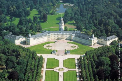
The ISPRS Technical Commission I Symposium will take place October 10-12, 2018 in Karlsruhe (Germany). The Technical Commission I Sensor Systems intend to organize the Symposium's technical sessions in single-track fashion to support maximum information, interaction and communication. For allowing the presentation and publication of “cutting edge” technical papers as well as early concepts or latest, highly application-relevant results, we plan two submission possibilities: full papers to be assessed by peer-review for ISPRS Annals and review based on abstracts for ISPRS Archives.
Several one- or half-day workshops and tutorials (9 October 2018) with special focus on young scientists and practitioners from industry and (non-)governmental agencies will be organized. This will include, for instance, tutorials and workshops for UAS- and spaceborne data acquisition strategies, modern calibration methods, sensor-oriented SAR and hyperspectral data processing, multi-sensor fusion concepts etc. The main topics of the Symposium are:
- Innovative and integrated UAS-oriented sensor and (small) platform concepts
- Systems and methods for terrestrial and mobile mapping in complex indoor and outdoor environments
- Small and low-cost active sensing (micro-LIDAR and -RADAR sensors)
- Design and realization of sensors and constellations for digital aerial and spaceborne missions for Earth observation
- Geometric and radiometric properties, quality standards, and factors affecting data quality
- Benchmark definition, calibration and evaluation of imaging and non-optical imaging sensors
- Integrated platform guidance, navigation, direct georeferencing (positioning and orientation) and integrated sensor orientation
- On-board (pre-)processing and concepts for embedded systems
You are encouraged to submit a paper or abstract for oral or poster presentation. All accepted papers will be published in either the International Annals (double-blind full paper review) or the International Archives (abstract review) of the Photogrammetry and Remote Sensing and Spatial Information Sciences. Reconnect with old friends or make new ones at the ISPRS Technical Commission I Symposium.
See you in Karlsruhe!
Stefan Hinz
President
The ISPRS Technical Commission I
More Information:
http://www2.isprs.org/commissions/comm1.html
http://tc1-symposium2018.ipf.kit.edu
|
|

|
|
ISPRS Symposium on Education and Outreach 2018


With great pleasure, we invite you to the International Society for Photogrammetry and Remote Sensing (ISPRS) Technical Commission V (TCV) Symposium on Education & Outreach – “Geospatial technology: Pixel to People” at Indian Institute of Remote Sensing, Dehradun, India during Nov 20-23, 2018. With increasing demand of geospatial information for sustainable development goals of nations, innovative approaches for capacity building to cope up with advanced technologies and software solutions are in high demand. The ISPRS TCV is actively involved under eight working groups with pioneers to deal multi-tier training for all levels; cross border education; e-learning and online web-based resource sharing; citizen science and its societal benefit applications; innovative technologies for training civil engineers and architects; open source tools and geo web services. Please visit: http://www2.isprs.org/commissions/comm5.html for details. The WG leaders will present the outcome of activities, share their ideas and experience with the participants from last two years.
Four pre-symposium tutorials on the emerging topics are planned: Big Data Analytics, Ground Based 3D Modeling, Citizen Science and its applications and Space Education for Educators as part of APRSAF. There will be also special lectures from ISPRS and Indian Society of Remote Sensing (ISRS).
We cordially invite you to participate and submit your research contributions on the above topics by submitting abstracts and papers. These will be published in ISPRS Archives and Annals. June 1, 2018 is the last date for submitting abstracts and papers. Please visit: http://tc5-symposium2018.isrs-india.org/ for further details.
A. Senthil Kumar
President
The ISPRS Technical Commission V
↑ Up
|
|
 |
| |
 |
|
The ISPRS Foundation (TIF) News
|
 |
|
Resounding Success of Brilliant Remote Sensing Labs FZ LLE Awards in 2018

On the occasion of becoming a new Sustaining Member of ISPRS, Brilliant Remote Sensing Labs FZ LLE offered The ISPRS Foundation (TIF), study grants from the Remote Sensing Portal to worthy participants, for all or a selection of the ERDAS IMAGINE software training courses.
A total number of 115 trainees from 40 countries enrolled in the courses through the ISPRS Foundation website. There were 56 academic trainees, and 59 non academic trainees. Professions of the trainees were: Agriculturalists, Computer Engineers, Environmentalists, Geographers, Geologists, GIS Specialist, Petrologists, Remote Sensing Specialist, Soil Specialists, Surveyors, Urban Planning, others.
15 trainees selected no. 1 entitled ‘Space Science and Satellites Overview for General Managers & Supervisors’; 51 trainees selected course no. 2 entitled ‘Remote Sensing Fundamentals’; and 49 trainees selected course no.5 entitled: ‘Satellite Images Visual Interpretation’. Duration of the offer was two months.
The total value to The ISPRS Foundation of the 115 courses, according to Brilliant Remote Sensing pricing page was $27,900 which was happily offered to the Geospatial community by Brilliant Remote Sensing. The ISPRS Foundation wishes to thank Brilliant Remote Sensing Labs for this generous offer, which was clearly well received by the trainees.

ISPRS Technical Commission III Symposium

Travel grants were received by the following 8 applicants for attendance at the ISPRS Technical Commission III Symposium, held in Beijing, China from 7-10 May 2018.
| First name |
Last name |
Country of citizenship |
| Peng |
Jia |
China |
| Elbegjargal |
Nasanbat |
Mongolia |
| Vijendra Singh |
Bramhe |
India |
| Rashmi |
Saini |
India |
| Alvin |
Baloloy |
Philippines |
| Varsha |
Pandey |
India |
| Zsofia |
Kugler |
Hungary |
| Md. Surabuddin |
Mondal |
India |
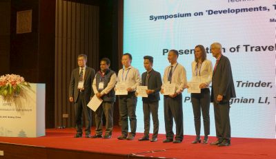
Travel grant recipients receiving their certificates during the opening ceremony.
TIF Travel Grants for ISPRS Symposia 2018

Travel Grant applications can be forwarded to TIF for the Symposia for Technical Commissions I - Sensor Systems, IV - Spatial Information Science and V - Education and Outreach. See deadlines below:
| TC |
Term |
Place |
Application Deadline |
|
I |
October 9-12 |
Karlsruhe, Germany |
July 31 2018 |
|
II |
June 4-7 |
Riva del Garda, Italy |
March 19 2018 |
|
III |
May 7-10 |
Beijing, China |
March 19 2018 |
|
IV |
October 1-5 |
Delft, The Netherlands |
July 31 2018 |
|
V |
November 20-23 |
Dehradun, India |
Sept 30 2018 |
Interested persons should complete the
online application form
The ISPRS Foundation
May 2018
↑ Up
|
|
 |
| |
 |
|
Society News
|

|
|
GSW 2019 in Enschede, the Netherlands – June 10-14, 2019

Council would like to inform the ISPRS community that the Director of the Geospatial Week 2019, Hussein Abdulmuttalib from Dubai Municipality, has asked ISPRS to postpone the meeting in Dubai to 2021, putting it under the patronage of the Mohammed Bin Rashid Space Centre, UAE. In the wake of this development, ISPRS invited the University of Twente which narrowly lost the bid against Dubai Municipality last September, to host GSW 2019 in Enschede with George Vosselman as Director. The University of Twente has accepted this offer and will organise the Geospatial Week from June 10-14, 2019. More details will be available soon.
At the same time, ISPRS has agreed to tentatively consider Dubai as the location of GSW 2021.
|
|

|
|
New Canadian Ordinary Member - Canadian Remote Sensing Society / Société Canadienne de Télédétection

Council is pleased to announce that a postal ballot of Ordinary Members has approved the application for transfer from Associate to Ordinary membership from the Canadian Remote Sensing Society (CRSS - SCT) following the unfortunate withdrawal of our longstanding member, Canadian Institute of Geomatics (CIG). We thank CRSS for the dedication and look forward to fruitful collaboration in the future. For an overview of CRSS see here…
or visit https://crss-sct.ca/about/mission-vision/
At the same time, we would also like to express our gratitude to CIG, who supported ISPRS for many decades. In 1972, they organised an ISPRS Congress and successfully nominated Dr. Samuel Gamble as ISPRS President during the term 1972-1976. They hosted several Technical Commissions, including TC I (2008-2012), TC II (1992-1996), TC IV (1976-1980, 2000-2004), and TC V (1980-1984) and presently host one Council Member and two Technical Commission Vice-Presidents during the current term 2016-2020. CIG also sponsored the Samuel Gamble Award from 1988-2017. It is sad to lose a member like CIG.
|
|


|
|
Two New Sustaining Members
Beijing University of Civil Engineering & Architecture, School of Geomatics and Urban Spatial Informatics (BUCEA) and
University of Novi Sad, Faculty of Technical Science, Geoinformatics Laboratory

ISPRS Council also warmly welcomes our new Sustaining Members, BUCEA, from China and the Faculty of Technical Science of the University of Novi Sad from Serbia.
A brief statement on BUCEA can be found here…
Further information can be found at http://chxy.bucea.edu.cn/
Read a brief statement about the Faculty of Technical Science here…
or visit: http://www.uns.ac.rs
http://geoinformatika.uns.ac.rs |
|

|
|
The U. V. Helava Award – Best Paper Volumes 123-134 (2017) announced

The winner of the 2017 Best Paper Award is:
“Bundle adjustment with raw inertial observations in UAV applications”
by Davide Antonio Cucci, Martin Rehak and Jan Skaloud
(École Polytechnique Fédérale de Lausanne, Switzerland)
published in volume 130, August 2017, pp. 1-12,
https://www.sciencedirect.com/science/article/pii/S0924271617301387
Read the complete announcement here…
|
|

|
|
ISPRS Brochure Now Available in Multiple Languages

In a further attempt to reach out to scientists, particularly in Latin America and China, ISPRS now have the ISPRS brochure translated and available in Spanish, Portuguese and Chinese on the ISPRS web site.
Printed brochures, also in English, can be requested from the office of the Secretary General at isprs-sg@isprs.org |
|

|
|
ISPRS Biennial Report 2016-17

The ISPRS 2016-17 Biennial Report with reports from Council, Technical Commission Presidents, ISPRS Committees and other Society activities, publications and events in that period can be found here…. |
|

|
|
Memorandums of Understanding now on Web

ISPRS's role in promoting international cooperation for the advancement of photogrammetry, remote sensing and spatial information sciences has expanded significantly over recent years. To benefit from the exchange of information, the collaboration for events and working groups and to pursue collaborative activities that benefit their collective missions, the International Society of Photogrammetry and Remote Sensing has signed various MoUs with international organizations. These MoUs can now be found on the ISPRS web site at the following link: http://www.isprs.org/society/interorganization.aspx#MOU
|
|
|
|
New Regional Representative for Asia

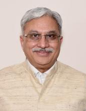
Shailesh Nayak, Director of the National Institute of Advanced Studies at the Indian Institute of Science Campus in Bengaluru, was unanimously approved as the new ISPRS Regional Representative of Asia. ISPRS Council is very pleased to have won Mr. Nayak for this office and thank him for accepting. We look forward to a fruitful collaboration.
Thanks also go to the past Asian Regional Representative, Lal Samarakoon, from Thailand.
|
|
|
|
New Director at Sociedad Chilena de Fotogrametria y Sensores Remotos

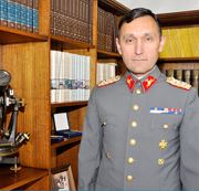
In December 2017, Lieutenant Colonel Eduardo Cayul Aristondo was appointed director of the Instituto Geographico Militar, ISPRS Ordinary member for Chile, taking over from Colonel José Riquelme Munoz. The Director of IGM is the official representative of the Chilean State before ISPRS and is consequently the head of Sociedad Chilena de Fotogrametria y Sensores Remotos which is located at IGM.
While congratulating Eduardo Cayul Aristondo on his new position, ISPRS also thanks Colonel Munoz for his past support of the Society.
We look forward to further successful collaboration with our Chilean Ordinary Member under the direction of Eduardo Cayul Aristondo.
|

|
|
ISPRS Sustaining Member RACURS receives Feodosy Nikolaevich Krasovsky Award

By decision of the Central Board of the “Russian Society of Geodesy, Cartography and Land Management” dated March 5, 2018, the Feodosy Nikolaevich Krasovsky Award for the best scientific and technical developments in geodesy and cartography was appropriated to the founders of the RACURS company – Victor Adrov, Alexander Chekurin, Andrey Sechin, and Alexander Smirnov - for the creation of “Digital photogrammetric system PHOTOMOD”.
In 1993, the authors and developers of PHOTOMOD offered the market a digital photogrammetric system for personal computers. From this moment, almost 25 years have passed, and as a result, today PHOTOMOD is the most popular photogrammetric system in Russia and is also successfully used in 80 countries throughout the world. See more at:
http://www.racurs.ru/index.php?page=258&news_id=843
↑ Up
|
|
 |
| |
 |
|
General Announcements
 |
|
Copernicus Masters 2018

The Copernicus Masters is an international competition that awards prizes to innovative solutions, developments and ideas for business and society based on Earth observation data. Big data produced by Earth observation holds huge potential for the creation of innovative products and services. A wide variety of industries and areas of public interest stand to profit from the advances of the Copernicus programme. The Copernicus Masters has developed into the moving force promoting cutting-edge solutions. Annually, different prize categories tackle global challenges with revolutionary competition entries in the fields of deep learning, IoT, big data analytics, smart mobility and industry 4.0 – just to name a few.
As partner of the Copernicus Masters, the German Aerospace Center, DLR is looking for innovative ideas that use Earth observation data to drive the sustainable management of our limited natural resources and foster human well-being. In addition to using Copernicus data and other Earth observation satellite data, participants are encouraged to supplement their ideas with other sources of data, such as information generated by crowd-sourcing or in-situ measurements. Ideas should support professionals working in these areas, inform the public, or empower public authorities to take action and solve issues on a local, national, or global scale.
Areas of particular interest to DLR are:
- Environmental Management: Identifying environmental issues and managing natural resources
- Sustainable Energy Management: Monitoring and improving the generation, distribution, or consumption of energy
- Health Promotion: Identifying, monitoring and / or providing solutions for negative environmental factors affecting human health
Details on the Copernicus Masters and the DLR Challenge can be found here:
https://www.copernicus-masters.com/
https://www.copernicus-masters.com/prize/dlr-challenge/
|

 |
|
Launch of the International Science Council — SAVE THE DATE
5 JULY 2018, 9:00-17:00
Paris, France

On 5 July, the International Science Council will be launched, a new global non-governmental organization representing more than 180 scientific academies, unions and associations from around the globe. The new organization will be the only global body representing both the natural and social sciences and results from the historic merger of the International Social Science Council (ISSC) with the International Council for Science (ICSU). Read more here…
To register or for more information, please contact:
Denise Young + 33 (0) 6 51 15 19 52 denise.young@icsu.org
Johannes Mengel +33 (0) 1 45 25 03 29 johannes@icsu.org
Lizzie Sayer +33 (0) 1 45 68 44 46 Lizzie@worldsocialscience.org
↑ Up
|
|
 |
| |
 |
|
Announcements of Scientific Meetings
(see also
ISPRS Calendar)
 |
|
ISPRS TC II Symposium Towards Photogrammetry 2020
June 4-7, 2018
Riva del Garda, Italy

The Symposium will feature 4 days with plenary and parallel sessions, oral and poster presentations as well as keynote speakers from research and commercial domains and an exhibition of the most important business players in the photogrammetric and geospatial domain.
More info and details are available in the event website:
http://www.isprs.org/tc2-symposium2018/ |
 |
|
“50 years of Earth Observation - What’s next?”
ISPRS Side event at UNISPACE+50
United Nations Office at Vienna
Vienna International Centre,
Wagramerstrasse 5,
A-1220 Vienna
AUSTRIA
Room M2 in the first floor
Tuesday, 19 June 2018, 13:30 - 15:00

ISPRS and IPAC, the International Policy Advisory Committee of ISPRS, invite you to attend this event, held at the United Nations Office in Vienna. To begin with, the following speakers will make statements and/or presentations on behalf of their organizations. The program will then continue with a Q&A session, dealing with questions such as:
- What are the next big challenges in EO?
- Do we need more international projects and missions or do we need more national satellites?
The session will be moderated by Gunter Schreier, IPAC Chair, and Lena Halounová, ISPRS Secretary General. All participants are invited to a cocktail after the event. Invited speakers:
- Josef Aschbacher, ESA Director Earth Observation
- Christian Heipke, President ISPRS
- Jim Green, NASA Chief Scientist
- Barbara Ryan, GEO
- Robbie Schingler, CSO, Planet
- Mr. Kazuo Tachi, Associate Director General, JAXA
- Jean-Jacques Tortora, Director Space Policy Inst, ESPI, Vienna
- Wolfgang Wagner, TU Vienna
To register, please visit:
http://www.unoosa.org/oosa/en/ourwork/ unispaceplus50/symposium.html.
|
 |
|
ISPRS TC I Midterm Symposium Innovative Sensing - From Sensors to Methods and Applications
October 10-12, 2018
Karlsruhe, Germany

- Early bird registration 380€ (until 15. July 2018)
- Travel grant and publication in IJGI Special Issue possible
For further details visit: http://www.isprs.org/tc1-symposium2018/
|
 |
|
AARSE 2018 - Earth Observations and Geospatial Science in Service of Sustainable Development Goals
25-29 October 2018
Abu kir, Alexandria, Egypt

Read more here…
|
 |
|
XXVIII International Symposium on Modern Technologies, Education and Professional Practice in Geodesy and related Fields
Sofia, Bulgaria
November 08-09, 2018

With a special session for young scientists and students and Exhibition, organized by the Union of Surveyors and Land Managers in Bulgaria. See the brochure here ….
For more information visit: website
|
 |
|
ISPRS TC V Midterm Symposium - Geospatial Technology - Pixel to People
November 20-23, 2018
Dehradun, India

Important dates for Papers for Archives - based on abstract review
- Deadline for submission of abstracts - June 1, 2018
- Notification to authors of acceptance of abstracts - August 15, 2018
- Deadline for submission of camera ready manuscript of full papers - September 30, 2018
Important dates for Papers for Annals - based on double-blinded peer-review
- Deadline for submission of full papers - June 1, 2018
- Notification to authors of acceptance of paper - August 31, 2018
- Deadline for submission of camera ready manuscript of full papers - September 30, 2018
For further information visit http://tc5-symposium2018.isrs-india.org/index.php
|
 |
|
GISTAM 2019
5th International Conference on Geographical Information Systems Theory, Applications and Management
May 3–5, 2019
Heraklion, Crete - Greece

http://www.gistam.org/
↑ Up
|
|
 |
| |
 |
|
Event Reports
 |
|
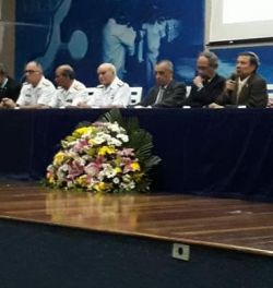
XXVII Brazilian Congress of Cartography
November 6-9, 2017
Rio de Janeiro, Brazil
by Flávia Renata Ferreira

SBC organised the XXVII BRAZILIAN CONGRESS OF CARTOGRAPHY and the XXVI EXPOSICARTA with the theme "Cartography and National Sovereignty: Consolidation of Borders and Boundaries", at the Marine Military School in the city of Rio de Janeiro.
Read more
here…
|
 |
|
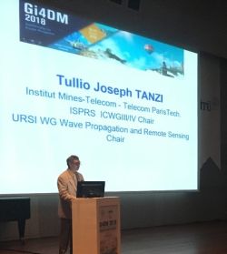
Gi4DM Conference 2018 Report
Istanbul, Turkey
18-21 March
by Tullio Tanzi, Madhu Chandra, Orhan Altan and Filiz Sunar

Gi4DM Conference 2018, organised by the ISPRS ICWGIII/IVa, was completed successfully. The conference addressed diverse topics related to methodologies and technologies within a unique platform keeping participants up to date with the latest advances in geoinformation applicable to disaster management.
Read the complete report
here… .
|
 |
|
Information Extraction from Laser Scanning Data Workshop
during RSCy2018 - Paphos, Cyprus
March 26-29, 2018

Read report
here… .
|
 |
|
Brief Summary of ISPRS Technical Commission III Mid-term Symposium - "Developments, Technologies and Applications in Remote Sensing"
By Jie Jiang, Hongping Zhang
Beijing, China
May 7-10, 2018

A total of 763 participants from 52 countries and regions took part in the symposium, among them 34 invited guests, 10 student volunteers, 54 exhibitors, and 16 visitors. 48 ISPRS officers attended this symposium, including 4 Honorary Members, 5 Council Members, and 39 WG chair/co-chair/secretaries from TC III, TC II and TC IV. .
Read
more…
↑ Up
|
|
 |
| |
 |
|
Obituaries
 |
|
Prof. Dr. Gerd Hildebrandt
1923-2017

Prof. Dr. Gerd Hildebrandt, former head of the Department of Aerial Imaging and Remote Sensing at the Albert-Ludwigs University Freiburg, passed away on December 11, 2017, at the age of 95.
Read the full obituary here…
|
 |
|
Prof. Ivan Antipov
1927-2018

The former Second Vice President of the International Society for Photogrammetry and Remote Sensing, Professor Ivan Antipov, 91, passed away on Friday, March 23, 2018 at his home in Novosibirsk, Russia.
Read the full obituary here…
|
|
 |
| |
 |
|
ISPRS International Journal of Geo-Information — Open Access Journal
 |
|
New publications in the ISPRS International Journal of Geo-Information
Open Access Journal
Volume 7, Issue 3 (March 2018)
Increasing the Accuracy of Crowdsourced Information on Land Cover via a Voting Procedure Weighted by Information Inferred from the Contributed Data
Foody, Giles, See, Linda, Fritz, Steffen, Moorthy, Inian, Perger, Christoph, Schill, Christian, Boyd, Doreen
No: 80
A Generalized Model for Indoor Location Estimation Using Environmental Sound from Human Activity Recognition
Galván-Tejada, Carlos E., López-Monteagudo, F. E., Alonso-González, O., Galván-Tejada, Jorge I., Celaya-Padilla, José M., Gamboa-Rosales, Hamurabi, Magallanes-Quintanar, Rafael, Zanella-Calzada, Laura A.
No: 81
A Novel Approach to Site Selection: Collaborative Multi-Criteria Decision Making through Geo-Social Network (Case Study: Public Parking)
Neisani Samani, Zeinab, Karimi, Mohammad, Alesheikh, Ali Asghar
No: 82
A Spatial Analysis of the Relationship between Vegetation and Poverty
Dawson, Teddy, Sandoval, J.S. Onésimo, Sagan, Vasit, Crawford, Thomas
No: 83
Generative Street Addresses from Satellite Imagery
Demir, İlke, Hughes, Forest, Raj, Aman, Dhruv, Kaunil, Muddala, Suryanarayana Murthy, Garg, Sanyam, Doo, Barrett, Raskar, Ramesh
No: 84
Assessment of Multiple GNSS Real-Time SSR Products from Different Analysis Centers
Wang, Zhiyu, Li, Zishen, Wang, Liang, Wang, Xiaoming, Yuan, Hong
No: 85
Short-Term and Long-Term Forecasting for the 3D Point Position Changing by Using Artificial Neural Networks
Alevizakou, Eleni-Georgia, Siolas, George, Pantazis, George
No: 86
Land Consolidation Suitability Ranking of Cadastral Municipalities: Information-Based Decision-Making Using Multi-Criteria Analyses of Official Registers’ Data
Tomić, Hrvoje, Mastelić Ivić, Siniša, Roić, Miodrag
No: 87
Measuring the Spatial Relationship Information of Multi-Layered Vector Data
Chen, Pengfei, Shi, Wenzhong
No: 88
Geographic Information Retrieval Method for Geography Mark-Up Language Data
Fang, Caili, Zhang, Shuliang
No: 89
Similarity Measurement of Metadata of Geospatial Data: An Artificial Neural Network Approach
Chen, Zugang, Song, Jia, Yang, Yaping
No: 90
Evaluating the Societal Impact of Using Drones to Support Urban Upgrading Projects
Gevaert, Caroline M., Sliuzas, Richard, Persello, Claudio, Vosselman, George
No: 91
Augmented Virtuality for Coastal Management: A Holistic Use of In Situ and Remote Sensing for Large Scale Definition of Coastal Dynamics
Bartolini, Sandro, Mecocci, Alessandro, Pozzebon, Alessandro, Zoppetti, Claudia, Bertoni, Duccio, Sarti, Giovanni, Caiti, Andrea, Costanzi, Riccardo, Catani, Filippo, Ciampalini, Andrea, Moretti, Sandro
No: 92
Evaluation of Close-Range Photogrammetry Image Collection Methods for Estimating Tree Diameters
Mokroš, Martin, Liang, Xinlian, Surový, Peter, Valent, Peter, Čerňava, Juraj, Chudý, František, Tunák, Daniel, Saloň, Šimon, Merganič, Ján
No: 93
A Distance-Adaptive Refueling Recommendation Algorithm for Self-Driving Travel
Xu, Quanli, Yang, Kun, Peng, Shuangyun, Hong, Liang
No: 94
Improving the Separability of Deep Features with Discriminative Convolution Filters for RSI Classification
Liu, Na, Lu, Xiankai, Wan, Lihong, Huo, Hong, Fang, Tao
No: 95
Once upon a Spacetime: Visual Storytelling in Cognitive and Geotemporal Information Spaces
Mayr, Eva, Windhager, Florian
No: 96
Representing Time-Dynamic Geospatial Objects on Virtual Globes Using CZML—Part I: Overview and Key Issues
Zhu, Liangfeng, Wang, Zhongliang, Li, Zhiwen
No: 97
An Approach to Measuring Semantic Relatedness of Geographic Terminologies Using a Thesaurus and Lexical Database Sources
Chen, Zugang, Song, Jia, Yang, Yaping
No: 98
Extraction of Tourist Destinations and Comparative Analysis of Preferences Between Foreign Tourists and Domestic Tourists on the Basis of Geotagged Social Media Data
Maeda, Takashi Nicholas, Yoshida, Mitsuo, Toriumi, Fujio, Ohashi, Hirotada
No: 99
Do Charitable Foundations Spend Money Where People Need It Most? A Spatial Analysis of China
Song, Yongze, Fu, Linyun
No: 100
Investigating the Influences of Tree Coverage and Road Density on Property Crime
Ye, Chengming, Chen, Yifei, Li, Jonathan
No: 101
Representing Time-Dynamic Geospatial Objects on Virtual Globes Using CZML—Part II: Impact, Comparison, and Future Developments
Zhu, Liangfeng, Li, Zhiwen, Wang, Zhongliang
No: 102
ENSO- and Rainfall-Sensitive Vegetation Regions in Indonesia as Identified from Multi-Sensor Remote Sensing Data
Arjasakusuma, Sanjiwana, Yamaguchi, Yasushi, Hirano, Yasuhiro, Zhou, Xiang
No: 103
Impacts of Street-Visible Greenery on Housing Prices: Evidence from a Hedonic Price Model and a Massive Street View Image Dataset in Beijing
Zhang, Yonglin, Dong, Rencai
No: 104
Multitemporal SAR Data and 2D Hydrodynamic Model Flood Scenario Dynamics Assessment
Scarpino, Santina, Albano, Raffaele, Cantisani, Andrea, Mancusi, Leonardo, Sole, Aurelia, Milillo, Giovanni
No: 105
On the Use of Geographic Information in Humanities Research Infrastructure: A Case Study on Cultural Heritage
Mościcka, Albina, Zwirowicz-Rutkowska, Agnieszka
No: 106
Fine Resolution Probabilistic Land Cover Classification of Landscapes in the Southeastern United States
St. Peter, Joseph, Hogland, John, Anderson, Nathaniel, Drake, Jason, Medley, Paul
No: 107
Spatio-Temporal Database of Places Located in the Border Area
Mościcka, Albina, Kuźma, Marta
No: 108
Development of a QGIS Plugin to Obtain Parameters and Elements of Plantation Trees and Vineyards with Aerial Photographs
Duarte, Lia, Silva, Pedro, Teodoro, Ana Cláudia
No: 109
Pixel-Wise Classification Method for High Resolution Remote Sensing Imagery Using Deep Neural Networks
Guo, Rui, Liu, Jianbo, Li, Na, Liu, Shibin, Chen, Fu, Cheng, Bo, Duan, Jianbo, Li, Xinpeng, Ma, Caihong
No: 110
WebGIS for Geography Education: Towards a GeoCapabilities Approach
Fargher, Mary
No: 111
An Indoor Scene Recognition-Based 3D Registration Mechanism for Real-Time AR-GIS Visualization in Mobile Applications
Ma, Wei, Xiong, Hanjiang, Dai, Xuefeng, Zheng, Xianwei, Zhou, Yan
No: 112
OSM Data Import as an Outreach Tool to Trigger Community Growth? A Case Study in Miami
Juhász, Levente, Hochmair, Hartwig H.
No: 113
Accuracy Assessment of Different Digital Surface Models
Alganci, Ugur, Besol, Baris, Sertel, Elif
No: 114
Spatial Transformation of Equality – Generalized Travelling Salesman Problem to Travelling Salesman Problem
Zia, Mohammed, Cakir, Ziyadin, Seker, Dursun Zafer
No: 115
Progressive Amalgamation of Building Clusters for Map Generalization Based on Scaling Subgroups
He, Xianjin, Zhang, Xinchang, Yang, Jie
No: 116
Graph-Based Matching of Points-of-Interest from Collaborative Geo-Datasets
Novack, Tessio, Peters, Robin, Zipf, Alexander
No: 117
Validation of Pleiades Tri-Stereo DSM in Urban Areas
Panagiotakis, Emmanouil, Chrysoulakis, Nektarios, Charalampopoulou, Vasiliki, Poursanidis, Dimitris
No: 118
A Multiresolution Grid Structure Applied to Seafloor Shape Modeling
Maleika, Wojciech, Koziarski, Michał, Forczmański, Paweł
No: 119
A Co-Citation and Cluster Analysis of Scientometrics of Geographic Information Ontology
Liu, Yu, Li, Lin, Shen, Hang, Yang, Hui, Luo, Feng
No: 120
Efficient Method for POI/ROI Discovery Using Flickr Geotagged Photos
Kuo, Chiao-Ling, Chan, Ta-Chien, Fan, I-Chun, Zipf, Alexander
No: 121
Single-Frequency Kinematic Performance Comparison between Galileo, GPS, and GLONASS Satellite Positioning Systems Using an MMS-Generated Trajectory as a Reference: Preliminary Results
Tarantino, Eufemia, Novelli, Antonio, Cefalo, Raffaela, Sluga, Tatiana, Tommasi, Agostino
No: 122
Storytelling in Interactive 3D Geographic Visualization Systems
Thöny, Matthias, Schnürer, Raimund, Sieber, René, Hurni, Lorenz, Pajarola, Renato
No: 123
Factors Affecting the Number of Visitors in National Parks in the Czech Republic, Germany and Austria
Stemberk, Josef, Dolejs, Josef, Maresova, Petra, Kuca, Kamil
No: 124
Digital Story Mapping to Advance Educational Atlas Design and Enable Student Engagement
Berendsen, Margo E., Hamerlinck, Jeffrey D., Webster, Gerald R.
No: 125
Mining Individual Similarity by Assessing Interactions with Personally Significant Places from GPS Trajectories
Yang, Mengke, Cheng, Chengqi, Chen, Bo
No: 126
Procedural Generation of Large-Scale Forests Using a Graph-Based Neutral Landscape Model
Li, Jiaqi, Gu, Xiaoyan, Li, Xinchi, Tan, Junzhong, She, Jiangfeng
No: 127
↑ Up

New publications in the ISPRS International Journal of Geo-Information
Open Access Journal
Volume 7, Issue 4 (April 2018)
Revealing Recurrent Urban Congestion Evolution Patterns with Taxi Trajectories
An, Shi, Yang, Haiqiang, Wang, Jian
No: 128
Multi-Temporal Land Cover Classification with Sequential Recurrent Encoders
Rußwurm, Marc, Körner, Marco
No: 129
Using Spatial Semantics and Interactions to Identify Urban Functional Regions
Wang, Yandong, Gu, Yanyan, Dou, Mingxuan, Qiao, Mengling
No: 130
The Role of Social Factors in the Accessibility of Urban Areas for People with Motor Disabilities
Gharebaghi, Amin, Mostafavi, Mir-Abolfazl, Chavoshi, Seyed Hossein, Edwards, Geoffrey, Fougeyrollas, Patrick
No: 131
Enhancing Location-Related Hydrogeological Knowledge
Kmoch, Alexander, Uuemaa, Evelyn, Klug, Hermann, Cameron, Stewart G.
No: 132
An Efficient Shortest Path Routing Algorithm for Directed Indoor Environments
Alamri, Sultan
No: 133
Mapping Heritage: Geospatial Online Databases of Historic Roads. The Case of the N-340 Roadway Corridor on the Spanish Mediterranean
Loren-Méndez, Mar, Pinzón-Ayala, Daniel, Ruiz, Rita, Alonso-Jiménez, Roberto
No: 134
A Novel Approach for Identifying Urban Built-Up Area Boundaries Using High-Resolution Remote-Sensing Data Based on the Scale Effect
Zhou, Yi, Tu, Mingguang, Wang, Shixin, Liu, Wenliang
No: 135
Saddle Position-Based Method for Extraction of Depressions in Fengcong Areas by Using Digital Elevation Models
Yang, Xianwu, Tang, Guoan, Meng, Xin, Xiong, Liyang
No: 136
Long-Term Changes of the Wildland–Urban Interface in the Polish Carpathians
Kaim, Dominik, Radeloff, Volker C., Szwagrzyk, Marcin, Dobosz, Monika, Ostafin, Krzysztof
No: 137
An Efficient Visualization Method for Polygonal Data with Dynamic Simplification
Wu, Mingguang, Chen, Taisheng, Zhang, Kun, Jing, Zhimin, Han, Yangli, Chen, Menglin, Wang, Hong, Lv, Guonian
No: 138
Collecting Typhoon Disaster Information from Twitter Based on Query Expansion
Chen, Zi, Lim, Samsung
No: 139
Mapping Forest Characteristics at Fine Resolution across Large Landscapes of the Southeastern United States Using NAIP Imagery and FIA Field Plot Data
Hogland, John, Anderson, Nathaniel, St. Peter, Joseph, Drake, Jason, Medley, Paul
No: 140
A Wireless Sensor Network Framework for Real-Time Monitoring of Height and Volume Variations on Sandy Beaches and Dunes
Pozzebon, Alessandro, Andreadis, Alessandro, Bertoni, Duccio, Bove, Carmine
No: 141
Assessment of Accuracy in the Identification of Rock Formations from Aerial and Terrestrial Laser-Scanning Data
Paleček, Václav, Kubíček, Petr
No: 142
Environmental Influences on Leisure-Time Physical Inactivity in the U.S.: An Exploration of Spatial Non-Stationarity
Wang, Jue, Lee, Kangjae, Kwan, Mei-Po
No: 143
Evaluating the Open Source Data Containers for Handling Big Geospatial Raster Data
Hu, Fei, Xu, Mengchao, Yang, Jingchao, Liang, Yanshou, Cui, Kejin, Little, Michael M., Lynnes, Christopher S., Duffy, Daniel Q., Yang, Chaowei
No: 144
Improving ASTER GDEM Accuracy Using Land Use-Based Linear Regression Methods: A Case Study of Lianyungang, East China
Yang, Xiaoyan, Li, Long, Chen, Longgao, Chen, Longqian, Shen, Zhengping
No: 145
A Method of Mining Association Rules for Geographical Points of Interest
Lian, Shiwei, Gao, Jinning, Li, Hongwei
No: 146
Verification of a GNSS Time Series Discontinuity Detection Approach in Support of the Estimation of Vertical Crustal Movements
Kowalczyk, Kamil, Rapinski, Jacek
No: 149
Map Archive Mining: Visual-Analytical Approaches to Explore Large Historical Map Collections
Uhl, Johannes H., Leyk, Stefan, Chiang, Yao-Yi, Duan, Weiwei, Knoblock, Craig A.
No: 148
Foreword to the Special Issue on Machine Learning for Geospatial Data Analysis
Wegner, Jan Dirk, Roscher, Ribana, Volpi, Michele, Veronesi, Fabio
No: 147
Spatial-Temporal Event Detection from Geo-Tagged Tweets
Huang, Yuqian, Li, Yue, Shan, Jie
No: 150
Fusing Georeferenced and Stereoscopic Image Data for 3D Building Façade Reconstruction
Bacharidis, Konstantinos, Sarri, Froso, Paravolidakis, Vasilis, Ragia, Lemonia, Zervakis, Michalis
No: 151
Validity of VR Technology on the Smartphone for the Study of Wind Park Soundscapes
YU, Tianhong, Behm, Holger, Bill, Ralf, Kang, Jian
No: 152
The Implementation of Spatial Planning Objects in a 3D Cadastral Model
Bydłosz, Jarosław, Bieda, Agnieszka, Parzych, Piotr
No: 153
Land Use/Land Cover Dynamics and Modeling of Urban Land Expansion by the Integration of Cellular Automata and Markov Chain
Rimal, Bhagawat, Zhang, Lifu, Keshtkar, Hamidreza, Haack, Barry N., Rijal, Sushila, Zhang, Peng
No: 154
An Autonomous Ultra-Wide Band-Based Attitude and Position Determination Technique for Indoor Mobile Laser Scanning
Lau, Lawrence, Quan, Yiming, Wan, Jingjing, Zhou, Ning, Wen, Conghua, Qian, Nie, Jing, Faming
No: 155
New Geospatial Approaches for Efficiently Mapping Forest Biomass Logistics at High Resolution over Large Areas
Hogland, John, Anderson, Nathaniel, Chung, Woodam
No: 156
Land Cover Mapping from Remotely Sensed and Auxiliary Data for Harmonized Official Statistics
Costa, Hugo, Almeida, Diana, Vala, Francisco, Marcelino, Filipe, Caetano, Mário
No: 157
Using the TensorFlow Deep Neural Network to Classify Mainland China Visitor Behaviours in Hong Kong from Check-in Data
Han, Shanshan, Ren, Fu, Wu, Chao, Chen, Ying, Du, Qingyun, Ye, Xinyue
No: 158
DASSCAN: A Density and Adjacency Expansion-Based Spatial Structural Community Detection Algorithm for Networks
Wan, You, Liu, Yaolin
No: 159
Use of DEMs Derived from TLS and HRSI Data for Landslide Feature Recognition
Barbarella, Maurizio, Di Benedetto, Alessandro, Fiani, Margherita, Guida, Domenico, Lugli, Andrea
No: 160

New publications in the ISPRS International Journal of Geo-Information
Open Access Journal
Volume 7, Issue 5 (May 2018)
LiDAR—A Technology to Assist with Smart Cities and Climate Change Resilience: A Case Study in an Urban Metropolis
Garnett, Ryan, Adams, Matthew D.
No: 161
Development of a Conceptual Mapping Standard to Link Building and Geospatial Information
Kang, Taewook
No: 162
Extraction of Terrain Feature Lines from Elevation Contours Using a Directed Adjacent Relation Tree
Li, Chengming, Guo, Peipei, Wu, Pengda, Liu, Xiaoli
No: 163
A Trajectory Regression Clustering Technique Combining a Novel Fuzzy C-Means Clustering Algorithm with the Least Squares Method
Zhou, Xiangbing, Miao, Fang, Ma, Hongjiang, Zhang, Hua, Gong, Huaming
No: 164
Analysis of Land Use Change and Expansion of Surface Urban Heat Island in Bogor City by Remote Sensing
Nurwanda, Atik, Honjo, Tsuyoshi
No: 165
Assessing the Influence of Spatio-Temporal Context for Next Place Prediction using Different Machine Learning Approaches
Urner, Jorim, Bucher, Dominik, Yang, Jing, Jonietz, David
No: 166
Spatial Heterogeneity, Scale, Data Character and Sustainable Transport in the Big Data Era
Jiang, Bin
No: 167
Estimating the Performance of Random Forest versus Multiple Regression for Predicting Prices of the Apartments
Čeh, Marjan, Kilibarda, Milan, Lisec, Anka, Bajat, Branislav
No: 168
Obstacles and Opportunities of Using a Mobile App for Marine Mammal Research
Hann, Courtney H., Stelle, Lei Lani, Szabo, Andrew, Torres, Leigh G.
No: 169
A Multivariate Approach to Study Drivers of Land-Cover Changes through Remote Sensing in the Dry Chaco of Argentina
Hoyos, Laura E., Cabido, Marcelo R., Cingolani, Ana M.
No: 170
Coupling Traditional Monitoring and Citizen Science to Disentangle the Invasion of Halyomorpha halys
Malek, Robert, Tattoni, Clara, Ciolli, Marco, Corradini, Stefano, Andreis, Daniele, Ibrahim, Aya, Mazzoni, Valerio, Eriksson, Anna, Anfora, Gianfranco
No: 171
Optimal Route Searching with Multiple Dynamical Constraints—A Geometric Algebra Approach
Li, Dongshuang, Yu, Zhaoyuan, Luo, Wen, Hu, Yong, Che, Xiaoyu, Yuan, Linwang
No: 172
Stakeholder Specific Multi-Scale Spatial Representation of Urban Building-Stocks
Österbring, Magnus, Thuvander, Liane, Mata, Érika, Wallbaum, Holger
No: 173
Population Synthesis Handling Three Geographical Resolutions
Moreno, Ana Tsui, Moeckel, Rolf
No: 174
Study on Multi-Scale Window Determination for GLCM Texture Description in High-Resolution Remote Sensing Image Geo-Analysis Supported by GIS and Domain Knowledge
Lan, Zeying, Liu, Yang
No: 175
Modeling Urban Collaborative Growth Dynamics Using a Multiscale Simulation Model for the Wuhan Urban Agglomeration Area, China
Yu, Yan, He, Jianhua, Tang, Wenwu, Li, Chun
No: 176
Agent-Based Modeling of Taxi Behavior Simulation with Probe Vehicle Data
Ranjit, Saurav, Witayangkurn, Apichon, Nagai, Masahiko, Shibasaki, Ryosuke
No: 177
POI Information Enhancement Using Crowdsourcing Vehicle Trace Data and Social Media Data: A Case Study of Gas Station
Yang, Wei, Ai, Tinghua
No: 178
2DPR-Tree: Two-Dimensional Priority R-Tree Algorithm for Spatial Partitioning in SpatialHadoop
Elashry, Ahmed, Shehab, Abdulaziz, Riad, Alaa M., Aboul-Fotouh, Ahmed
No: 179
A Low-Cost Collaborative Location Scheme with GNSS and RFID for the Internet of Things
Jing, Changfeng, Wang, Shouqing, Wang, Mingshu, Du, Mingyi, Zhou, Lei, Sun, Tiancheng, Wang, Jian
No: 180
Multilevel Cloud Detection for High-Resolution Remote Sensing Imagery Using Multiple Convolutional Neural Networks
Chen, Yang, Fan, Rongshuang, Bilal, Muhammad, Yang, Xiucheng, Wang, Jingxue, Li, Wei
No: 181
Semi-Supervised Ground-to-Aerial Adaptation with Heterogeneous Features Learning for Scene Classification
Deng, Zhipeng, Sun, Hao, Zhou, Shilin
No: 182
Geographic Prevalence and Mix of Regional Cuisines in Chinese Cities
Zhu, Jingwei, Xu, Yang, Fang, Zhixiang, Shaw, Shih-Lung, Liu, Xingjian
No: 183
Integrating Risk Assessment into Spatial Planning: RiskOTe Decision Support System
Mileu, Nelson, Queirós, Margarida
No: 184
Allocation of Tutors and Study Centers in Distance Learning Using Geospatial Technologies
Khan, Shahid Nawaz, Mir, Kamran, Tahir, Ali, Awan, Arshad, Nisa, Zaib un, Gillani, Syeda Areeba
No: 185
Performance Evaluation of QZSS Augmenting GPS and BDS Single-Frequency Single-Epoch Positioning with Actual Data in Asia-Pacific Region
Zhang, Qiuzhao, Yang, Wei, Zhang, Shubi, Yao, Lihui
No: 186
hackAIR: Towards Raising Awareness about Air Quality in Europe by Developing a Collective Online Platform
Kosmidis, Evangelos, Syropoulou, Panagiota, Tekes, Stavros, Schneider, Philipp, Spyromitros-Xioufis, Eleftherios, Riga, Marina, Charitidis, Polychronis, Moumtzidou, Anastasia, Papadopoulos, Symeon, Vrochidis, Stefanos, Kompatsiaris, Ioannis, Stavrakas, Ilias, Hloupis, George, Loukidis, Andronikos, Kourtidis, Konstantinos, Georgoulias, Aristeidis K., Alexandri, Georgia
No: 187
Comprehensive Analysis of System Calibration between Optical Camera and Range Finder
Choi, Kang Hyeok, Kim, Changjae, Kim, Yongil
No: 188
The Influence of Geographic Factors on Information Dissemination in Mobile Social Networks in China: Evidence from WeChat
Liu, Liang, Chen, Bin, Ai, Chuan, He, Lingnan, Wang, Yiping, Qiu, Xiaogang, Lu, Xin
No: 189
A Smartphone-Based System for Outdoor Data Gathering Using a Wireless Beacon Network and GPS Data: From Cyber Spaces to Senseable Spaces
Osaba, Eneko, Pierdicca, Roberto, Malinverni, Eva Savina, Khromova, Anna, Álvarez, Fernando J., Bahillo, Alfonso
No: 190
Supporting Facility Management Processes through End-Users’ Integration and Coordinated BIM-GIS Technologies
Mirarchi, Claudio, Pavan, Alberto, De Marco, Francesco, Wang, Xiangyu, Song, Yongze
No: 191
Evaluation of the Cartographical Quality of Urban Plans by Eye-Tracking
Burian, Jaroslav, Popelka, Stanislav, Beitlova, Marketa
No: 192
Implementation of a Parallel GPU-Based Space-Time Kriging Framework
Zhang, Yueheng, Zheng, Xinqi, Wang, Zhenhua, Ai, Gang, Huang, Qing
No: 193
A Formalized 3D Geovisualization Illustrated to Selectivity Purpose of Virtual 3D City Model
Neuville, Romain, Pouliot, Jacynthe, Poux, Florent, de Rudder, Laurent, Billen, Roland
No: 194
An Endmember Initialization Scheme for Nonnegative Matrix Factorization and Its Application in Hyperspectral Unmixing
Cao, Jingjing, Zhuo, Li, Tao, Haiyan
No: 195
Using Location-Based Social Media Data to Observe Check-In Behavior and Gender Difference: Bringing Weibo Data into Play
Rizwan, Muhammad, Wan, Wanggen, Cervantes, Ofelia, Gwiazdzinski, Luc
No: 196
2D Cartography Training: Has the Time Come for a Paradigm Shift?
Carbonell-Carrera, Carlos, Jaeger, Allison J., Shipley, Thomas F.
No: 197
Suitability Evaluation of Urban Construction Land Based on an Approach of Vertical-Horizontal Processes
Yan, Yuetian, Zhou, Rui, Ye, Xinyue, Zhang, Hao, Wang, Xinjun
No: 198
↑ Up
|
|
 |
| |
 |
|
ISPRS Journal of Photogrammetry and Remote Sensing
 |
|
New publications in the ISPRS Journal of
Photogrammetry and Remote Sensing Volume 138 (April 2018)
Thanks to outgoing Associate Editors
Derek D. Lichti, Qihao Wen
Pages: A1
Mapping spatial variability of foliar nitrogen in coffee (Coffea arabica L.) plantations with multispectral Sentinel-2 MSI data
Abel Chemura, Onisimo Mutanga, John Odindi, Dumisani Kutywayo
Pages: 1-11
Use of LiDAR for calculating solar irradiance on roofs and façades of buildings at city scale: Methodology, validation, and analysis
Liang Cheng, Hao Xu, Shuyi Li, Yanming Chen, Fangli Zhang, Manchun Li
Pages: 12-29
A novel orthoimage mosaic method using a weighted A∗ algorithm – Implementation and evaluation
Maoteng Zheng, Xiaodong Xiong, Junfeng Zhu
Pages: 30-46
Open and scalable analytics of large Earth observation datasets: From scenes to multidimensional arrays using SciDB and GDAL
Marius Appel, Florian Lahn, Wouter Buytaert, Edzer Pebesma
Pages: 47-56
The edge-preservation multi-classifier relearning framework for the classification of high-resolution remotely sensed imagery
Xiaopeng Han, Xin Huang, Jiayi Li, Yansheng Li, Michael Ying Yang, Jianya Gong
Pages: 57-73
Binary patterns encoded convolutional neural networks for texture recognition and remote sensing scene classification
Rao Muhammad Anwer, Fahad Shahbaz Khan, Joost van de Weijer, Matthieu Molinier, Jorma Laaksonen
Pages: 74-85
Large-scale urban point cloud labeling and reconstruction
Liqiang Zhang, Zhuqiang Li, Anjian Li, Fangyu Liu
Pages: 86-100
Roof planes detection via a second-order variational model
Battista Benciolini, Valeria Ruggiero, Alfonso Vitti, Massimo Zanetti
Pages: 101-120
Close-range hyperspectral image analysis for the early detection of stress responses in individual plants in a high-throughput phenotyping platform
Mohd Shahrimie Mohd Asaari, Puneet Mishra, Stien Mertens, Stijn Dhondt, Dirk Inzé, Nathalie Wuyts, Paul Scheunders
Pages: 121-138
An unsupervised technique for optimal feature selection in attribute profiles for spectral-spatial classification of hyperspectral images
Kaushal Bhardwaj, Swarnajyoti Patra
Pages: 139-150
Integrating fuzzy object based image analysis and ant colony optimization for road extraction from remotely sensed images
Mehdi Maboudi, Jalal Amini, Shirin Malihi, Michael Hahn
Pages: 151-163
Towards breaking the spatial resolution barriers: An optical flow and super-resolution approach for sea ice motion estimation
Zisis I. Petrou, Yang Xian, YingLi Tian
Pages: 164-175
Refined shape model fitting methods for detecting various types of phenological information on major U.S. crops
Toshihiro Sakamoto
Pages: 176-192
A cloud shadow detection method combined with cloud height iteration and spectral analysis for Landsat 8 OLI data
Lin Sun, Xinyan Liu, Yikun Yang, TingTing Chen, Quan Wang, Xueying Zhou
Pages: 193-207
Evaluating accuracy of DSSAT model for soybean yield estimation using satellite weather data
Gustavo Ovando, Silvina Sayago, Mónica Bocco
Pages: 208-217
Towards automatic SAR-optical stereogrammetry over urban areas using very high resolution imagery
Chunping Qiu, Michael Schmitt, Xiao Xiang Zhu
Pages: 218-231
A spatio-temporal index for aerial full waveform laser scanning data
Debra F. Laefer, Anh-Vu Vo, Michela Bertolotto
Pages: 232-251
Dynamic displacement monitoring of long-span bridges with a microwave radar interferometer
Bochen Zhang, Xiaoli Ding, Charles Werner, Kai Tan, Bin Zhang, Mi Jiang, Jingwen Zhao, Youlin Xu
Pages: 252-264
Spectral-spatial classification of hyperspectral data with mutual information based segmented stacked autoencoder approach
Subir Paul, D. Nagesh Kumar
Pages: 265-280
Multi-class geospatial object detection based on a position-sensitive balancing framework for high spatial resolution remote sensing imagery
Yanfei Zhong, Xiaobing Han, Liangpei Zhang
Pages: 281-294

New publications in the ISPRS Journal of
Photogrammetry and Remote Sensing Volume 139 (May 2018)
Improved Small Baseline processing by means of CAESAR eigen-interferograms decomposition
Simona Verde, Diego Reale, Antonio Pauciullo, Gianfranco Fornaro
Pages: 1-13
Extraction and height estimation of artificial vertical structures based on the wrapped interferometric phase difference within their layovers
Jyunpei Uemoto, Akitsugu Nadai, Shoichiro Kojima, Tatsuharu Kobayashi, Toshihiko Umehara, Takeshi Matsuoka, Seiho Uratsuka, Makoto Satake
Pages: 14-29
Local curvature entropy-based 3D terrain representation using a comprehensive Quadtree
Qiyu Chen, Gang Liu, Xiaogang Ma, Gregoire Mariethoz, Zhenwen He, Yiping Tian, Zhengping Weng
Pages: 30-45
An automatic optimum number of well-distributed ground control lines selection procedure based on genetic algorithm
Somayeh Yavari, Mohammad Javad Valadan Zoej, Bahram Salehi
Pages: 46-56
Derivation of global vegetation biophysical parameters from EUMETSAT Polar System
Francisco Javier García-Haro, Manuel Campos-Taberner, Jordi Muñoz-Marí, Valero Laparra, Fernando Camacho, Jorge Sánchez-Zapero, Gustau Camps-Valls
Pages: 57-74
Dynamic monitoring of the Poyang Lake wetland by integrating Landsat and MODIS observations
Bin Chen, Lifan Chen, Bo Huang, Ryo Michishita, Bing Xu
Pages: 75-87
Mapping fractional woody cover in semi-arid savannahs using multi-seasonal composites from Landsat data
Thomas P. Higginbottom, Elias Symeonakis, Hanna Meyer, Sebastian van der Linden
Pages: 88-102
A new scheme for urban impervious surface classification from SAR images
Hongsheng Zhang, Hui Lin, Yunpeng Wang
Pages: 103-118
Integration of aerial oblique imagery and terrestrial imagery for optimized 3D modeling in urban areas
Bo Wu, Linfu Xie, Han Hu, Qing Zhu, Eric Yau
Pages: 119-132
Planarity constrained multi-view depth map reconstruction for urban scenes
Yaolin Hou, Jianwei Peng, Zhihua Hu, Pengjie Tao, Jie Shan
Pages: 133-145
Accurate facade feature extraction method for buildings from three-dimensional point cloud data considering structural information
Yongzhi Wang, Yuqing Ma, A-xing Zhu, Hui Zhao, Lixia Liao
Pages: 146-153
Deep convolutional neural network training enrichment using multi-view object-based analysis of Unmanned Aerial systems imagery for wetlands classification
Tao Liu, Amr Abd-Elrahman
Pages: 154-170
Accuracy assessment of the global TanDEM-X Digital Elevation Model with GPS data
Birgit Wessel, Martin Huber, Christian Wohlfart, Ursula Marschalk, Detlev Kosmann, Achim Roth
Pages: 171-182
Connecting infrared spectra with plant traits to identify species
Maria F. Buitrago, Andrew K. Skidmore, Thomas A. Groen, Christoph A. Hecker
Pages: 183-200
3D reconstruction from multi-view VHR-satellite images in MicMac
Ewelina Rupnik, Marc Pierrot-Deseilligny, Arthur Delorme
Pages: 201-211
Does quality control matter? Surface urban heat island intensity variations estimated by satellite-derived land surface temperature products
Jiameng Lai, Wenfeng Zhan, Fan Huang, Jinling Quan, Leiqiu Hu, Lun Gao, Weimin Ju
Pages: 212-227
Automated method for measuring the extent of selective logging damage with airborne LiDAR data
L. Melendy, S.C. Hagen, F.B. Sullivan, T.R.H. Pearson, S.M. Walker, P. Ellis, Kustiyo, Ari Katmoko Sambodo, O. Roswintiarti, M.A. Hanson, A.W. Klassen, M.W. Palace, B.H. Braswell, G.M. Delgado
Pages: 228-240
An enhanced multi-view vertical line locus matching algorithm of object space ground primitives based on positioning consistency for aerial and space images
Ka Zhang, Yehua Sheng, Meizhen Wang, Suxia Fu
Pages: 241-254
A remote sensing-based model of tidal marsh aboveground carbon stocks for the conterminous United States
Kristin B. Byrd, Laurel Ballanti, Nathan Thomas, Dung Nguyen, James R. Holmquist, Marc Simard, Lisamarie Windham-Myers
Pages: 255-271
Empirical ocean color algorithms and bio-optical properties of the western coastal waters of Svalbard, Arctic
Young-Sun Son, Hyun-cheol Kim
Pages: 272-283

New publications in the ISPRS Journal of
Photogrammetry and Remote Sensing Volume 140 (June 2018)
Geospatial Computer Vision
Foreword to the theme issue on geospatial computer vision
Jan Dirk Wegner, Devis Tuia, Michael Yang, Clement Malle
Pages: 1-2
Construction of pixel-level resolution DEMs from monocular images by shape and albedo from shading constrained with low-resolution DEM
Bo Wu, Wai Chung Liu, Arne Grumpe, Christian Wöhler
Pages: 3-19
Beyond RGB: Very high resolution urban remote sensing with multimodal deep networks
Nicolas Audebert, Bertrand Le Saux, Sébastien Lefèvre
Pages: 20-32
Learning a constrained conditional random field for enhanced segmentation of fallen trees in ALS point clouds
Przemyslaw Polewski, Wei Yao, Marco Heurich, Peter Krzystek, Uwe Stilla
Pages: 33-44
Disaster damage detection through synergistic use of deep learning and 3D point cloud features derived from very high resolution oblique aerial images, and multiple-kernel-learning
Anand Vetrivel, Markus Gerke, Norman Kerle, Francesco Nex, George Vosselman
Pages: 45-59
Object Scene Flow
Moritz Menze, Christian Heipke, Andreas Geiger
Pages: 60-76
Visual object tracking by correlation filters and online learning
Xin Zhang, Gui-Song Xia, Qikai Lu, Weiming Shen, Liangpei Zhang
Pages: 77-89
Landmark based localization in urban environment
Xiaozhi Qu, Bahman Soheilian, Nicolas Paparoditis
Pages: 90-103
Near real-time shadow detection and removal in aerial motion imagery application
Guilherme F. Silva, Grace B. Carneiro, Ricardo Doth, Leonardo A. Amaral, Dario F.G. de Azevedo
Pages: 104-121
Skipping the real world: Classification of PolSAR images without explicit feature extraction
Ronny Hänsch, Olaf Hellwich
Pages: 122-132
A hybrid MLP-CNN classifier for very fine resolution remotely sensed image classification
Ce Zhang, Xin Pan, Huapeng Li, Andy Gardiner, Isabel Sargent, Jonathon Hare, Peter M. Atkinson
Pages: 133-144

↑ Up
|
|
 |
| |
 |
|
New Events
11-12 Jun 2018
Workshop on Earth Observation with Chinese Satellite Systems
http://china-sat-workshop.univie.ac.at
Vienna, Austria
16-19 Aug 2018
The 3rd International BIRDS workshop and the 8th International Workshop for application of satellite data for Mongolian environment
http://sas.num.edu.mn/birds2018/
Ulaanbaatar, Mongolia
03-05 Sep 2018
International Conference on Geomatic and Geospatial Technology 2018
http://www.geoinfo.utm.my/ggt2018
Kuala Lumpur, Malaysia
05-07 Sep 2018
1 st EARSeL Workshop UAS
UAS for Mapping and Monitoring
http://uas.earsel.org/workshop/1st-uas-ws/
Warsaw, Poland
10-14 Sep 2018
ICRSS
15th International Circumpolar Remote Sensing Symposium
https://alaska.usgs.gov/science/geography/CRSS2018/index.php
Potsdam, Germany
18-20 Sep 2018
International Symposium on the Use of Space Technologies to Support Natural and Cultural Heritage Sites
website not yet available
City of Campeche, Mexico
24-27 Sep 2018
18th International Scientific and Technical Conference
FROM IMAGERY TO DIGITAL REALITY: ERS & Photogrammetry
http://conf.racurs.ru/conf2018/eng/
Hersonissos, Crete, Greece
02-05 Oct 2018
ForestSAT: Entering a New Era in Forest Observation and Analysis
http://forestsat2018.forestsat.com/
College Park, MD, USA
06-08 Feb 2019
11th EARSeL Imaging Spectroscopy Workshop
http://is.earsel.org/workshop/11-IS-Brno2019/
Brno, Czech Republic
06-08 Feb 2019
8th International Workshop - 3D ARCH
3D Virtual Reconstruction and Visualization of Complex Architectures
http://www.3d-arch.org/
Bergamo, Italy
02 May 2019
Underwater 3D Recording and Modeling
A Tool for Modern Applications and CH Recording
http://3d-underwater.cut.ac.cy/
Limassol, Cyprus
03-05 May 2019
GISTAM 2019
5th International Conference on Geographical Information Systems Theory, Applications and Management
http://www.gistam.org/
Heraklion, Crete, Greece
22-24 May 2019
JURSE 2019
Joint Urban Remote Sensing Event
http://www.jurse2019.org
Vannes, France
10-14 Jun 2019
Geospatial Week 2019
website not yet available
Enschede, The Netherlands
16-22 Jun 2019
Innsbruck Summer School of Alpine Research 2019
Close Range Sensing Techniques in Alpine Terrain
https://www.uibk.ac.at/geographie/summerschool/2019/
Obergurgl, Austria
01-06 Sep 2019
27th CIPA International Symposium
Documenting the past for a better future
http://www.cipa2019.org
Avila, Spain
03-06 Sep 2019
Summer School and Workshop on Evaluation and Benchmark of Sensors and Systems in Photogrammetry and Remote Sensing
http://ptfit.sgp.geodezja.org.pl/workshop2019/
Warsaw, Poland
09-13 Sep 2019
57th Photogrammetric Week
PhoWo 2019
website not yet available
Stuttgart, Germany
14-20 Jun 2020
XXIVth ISPRS Congress
Imaging today, Foreseeing tomorrow
http://www.isprs2020-nice.com/index
Nice, France
» See more
|
 |
| |
 |
|
Job Opportunities
|
3-Apr-2018 |
Post-Doctoral Fellowship and PhD Studentship in Computer Vision, Machine Learning and Photogrammetry
Department of Earth and Space Science and Engineering at York University, Canada
|
|
9-May-2018 |
Junior Professorship in Environmental Remote Sensing (W1 with tenure track option on W2)
Faculty of Environmental Sciences, TU Dresden, Germany / Center for Advanced Water Research (CAWR, TU Dresden / UFZ Leipzig)
Deadline: 14-Jun-2018
|
|
30-May-2018 |
Funded PhD: Fusion of Earth Observation data and 3D city models
The University of New South Wales, Sydney, Australia.
Deadline: 20-Jul-2018
|
|
02-Jun-2018 |
Head of section Image Data and Elevation Models
The Federal Office of Topography swisstopo, Berne, Switzerland
Deadline: 07-Jul-2018
|
» See more
|
 |
| |
|
|
 |
You got this email as you subscribed to the ISPRS mailing list.
Officers, members and contact persons of members get it by default.
To unsubscribe from the ISPRS mailing list,
click here.
© ISPRS, 2018.
Imprint
|


