ISPRS e-Bulletin
Issue No 1 - 2025

Editorial


JIANG Jie JIANG Jie

Increasing AI Elements: ISPRS Mid-term Symposium Overview

by JIANG Jie


AI technology has been deeply integrated into ISPRS-related fields, significantly transforming the way we capture, process, interpret and analyze geospatial infor-mation. This was evident in the ISPRS Mid-term Symposia, organized by 5 ISPRS Technical Commissions in 2024, all of which featured a substantial increase in AI el-ements, demonstrating the profound impact AI is having on advancing photogramme-try, remote sensing and geospatial science.

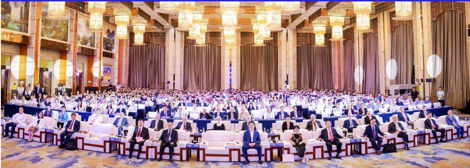
Technical Commission I, dedicated to Sensor Systems, hosted the Symposium ‘Intel-ligent Sensing and Remote Sensing Application’ during 13-17 May 2024, in Chang-sha, China. More than 1500 representatives from 29 countries and regions attended the event. A total of 174 full papers were published. Three tutorials were organized (one of them with the topic ‘Point Cloud Processing with AI’). It is particularly worthy to mention that a contest on ‘Intelligent Interpretation for Multi-modal Remote Sensing Application’ was held, with more than 300 teams consisting of 800 participants.

Fig-11

Technical Commission II, specializing in Photogrammetry, organized the Symposium ‘The Role of Photogrammetry for a Sustainable World’ during 11-14 June 2024 in Las Vegas, USA. About 150 people from 24 countries attended and about 100 papers published. Tutorials on ‘AI-based 3D Scene Capture and Modelling’ and ‘Benchmarking Underwater Photogrammetry‘ were organized as the side-events of the Symposium.

Fig-12

Technical Commission III, focusing on Remote Sensing, organized the symposium ‘Beyond the Canopy: Technologies and Applications of Remote Sensing’ during 4-8 November 2024 in Belem, Brazil. The themes of the symposium covered a very wide range, from satellite image acquisition and pro-cessing techniques (space missions, sensors, algorithms, etc.) to applications in many fields, all closely related to AI. A workshop on ‘Geospatial Intelligence: Bridging AI, Environmental Manage-ment, and Disaster Resilience’ was arranged as a side event of the symposium.

Fig-13

Technical Commission IV, concerned with Spatial Information Science, organized the symposium titled ‘Spatial Information to Empower the Metaverse’ during 22-25 October 2024 in Perth, Australia. A total of 491 participants from 29 Countries attended, with 292 accepted submissions. Sessions like ‘AI and uncertainty modeling in spatial analysis’ and ‘Intelligent systems in sensor Web and IoT’ were arranged among 38 others. Also, a panel discussion on ‘The role of international organizations in the world of AI and Digital Twins’ was organized.

Fig-14

Technical Commission V, focusing on Education and Outreach, organized the Symposium ‘Insight to Foresight via Geospatial Technologies’ during 6-8 August 2024 in Manila, Philippines. A total of 176 people attended and 60 papers were published. An ISPRS Summer School entitled ‘AI for Geospatial Applications’ was held as a side event of the Symposium with the classes covering cutting-edge Ge-oAI technologies


Lena Halounova Lena Halounova

President’s Message

Dear colleagues and friends,

You are no doubt busy with your many duties: studying, writing project proposals, doing field work, taking measurements, processing data, writing papers in the academia sphere and research departments, applying data from photogrammetry, remote sensing and spatial sciences to achieve new results important for organisations connected with decision makers in your country and around the world, amongst others.

I am inviting you to do more. With the beginning of the new ISPRS term in 2026, you could continue or commence cooperation with ISPRS in one way or another. You can become an ISPRS officer in working groups and technical commissions at various levels. You can also work as a reviewer of submissions for ISPRS events, you can propose tutorials, or parts of event programs, just to name a few. All of these activities are welcomed not only by ISPRS Council, but also by ISPRS members.

We encourage you to bring new ideas to attract new participants to our events and to our Society.

Two important events are approaching. The Geospatial Week 2025 is ready for us, commencing at the beginning of April. The organisers are expecting around 600 participants. We look forward to meeting you there, seeing your presentations, meeting other participants, enjoying the event and the location, and are grateful to the organisers for the preparation. The preparation for the 2026 Congress in Toronto is also well under way. We hope that you will also add this major ISPRS event to your calendar.

We are looking forward to your participation at the Congress, and hope for your decision to work for the Society as an ISPRS officer for the following four years.

It will be a pleasure to meet you in Dubai next month, and in Toronto next year.

Lena Halounová

The ISPRS Foundation (TIF) News


The ISPRS Foundation The ISPRS Foundation

THE ISPRS FOUNDATION

The ISPRS Foundation (TIF) is a non-profit entity established in 2003 and managed by a Board of Trustees. It responds to ISPRS grant needs that are identified by the ISPRS Council. Grant recipients are active participants in the ISPRS and ISPRS-sponsored events, presenting posters and oral presentations, publishing in the ISPRS Archives and Annals, and joining both technical discussions and cultural exchanges. While their experiences may sometimes lead to academic and professional opportunities, they always lead to new friendships and exposure to the latest research and advancements in geospatial sciences.
The ISPRS Foundation depends on individual donations and contributions from ISPRS. Donations may be mailed directly to the TIF Finance Officer, Jeff Yates (e-mail: jyates@datem.com).


TIF @ GSW, Dubai, U.A.E

The ISPRS Foundation (TIF) has announced the awardees of its travel grants to deserved students and young professionals to attend the ISPRS Geospatial Week GSW 2025 to be held in Dubai, UAE during April 06-11, 2025. The Grant Evaluation Committee reviewed all the applications submitted and found 23 applicants suitable to receive the travel grants. To reduce financial burden on the awardees especially from developing countries, GSW Organisers have generously granted registration fee waiver for them. The travel grant awardees’ list was published in the ISPRS Foundation Homepage here.


TIF Receives Outstanding Donation from Prof. Li Deren

The ISPRS Foundation (TIF) is pleased to announce that our good friend and colleague, Prof. Li Deren made a significant donation to the ISPRS Foundation. Such a donation is unique since it does not come from an institution but it is a personal gesture of Prof. Li Deren to assist young students in pursuing their careers in the areas of Photogrammetry and Remote Sensing.

ISPRS and TIF are very grateful for this outstanding generous contribution.


Student Consortium News


ISPRS SC ISPRS SC

ISPRS SC Student Chapters: Strengthening Global Networks in the field of Photogrammetry, Remote Sensing and Spatial Information Science

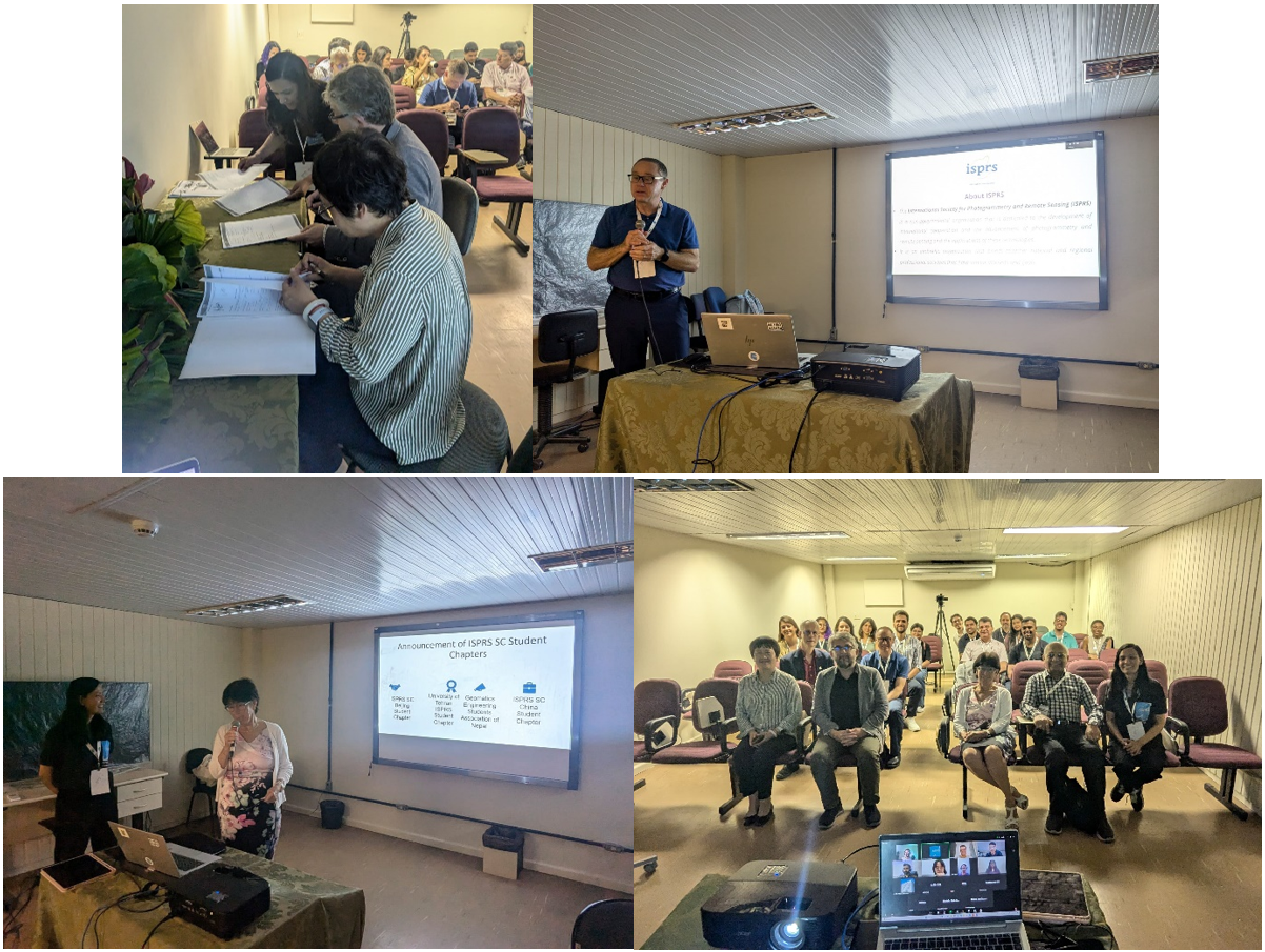
ISPRS SC Student Chapters are the groups of registered ISPRS SC members, envisioned to strengthen local professional networks and connect these networks to the Consortium and ISPRS, to promote the activities of the ISPRS SC by organizing and leading events for the youth. We are excited to share updates on the status of the ISPRS SC Student Chapters so far. The official announcement of the first cohort of these Chapters was made by the ISPRS President, Prof. Lena Halounová in the presence of the Council members, during the ISPRS SC Networking Hour on November 7, 2024 in Belém, Brazil, at the ISPRS TC III Mid-Term Symposium. This milestone marked the formal establishment of student-led chapters aimed at fostering collaboration and knowledge exchange among young professionals and researchers in the field of interests of ISPRS SC. The first group of ISPRS SC Student Chapters includes: 

  • ISPRS SC China – Beijing University of Civil Engineering and Architecture (BUCEA) Student Chapter  
  • ISPRS SC Iran – University of Tehran Student Chapter  
  • ISPRS SC Nepal – Geomatics Engineering Students Association of Nepal (GESAN) 
  • ISPRS SC China – Wuhan Student Chapter  

Fig 21
Figure 1: Top left: ISPRS SC Advisory Committee consisting of ISPRS Vice President, Nicolas Paparoditis and Secretary General, Jiang Jie - signing the student chapter’s application forms; top right: Derek Lichti, Congress Director - delivering his speech; bottom left: Lena Halounová, President of ISPRS – announcing the name of the approved student chapters and bottom right: online and in-person attendees of the Networking Session.

During the event, representatives from each chapter introduced their teams and shared their planned activities for the next 2 years. Likewise, Derek Lichti, ISPRS Congress Director gave a short talk about the upcoming ISPRS Congress 2026 to be held in Toronto, Canada from 6-11 July 2026 and potential activities being planned for young professionals and students. Additionally, Yogender Yadav, former ISPRS SC Website Administrator gave a presentation about ISPRS SC and its ongoing activities, whereas, Laxmi Thapa, President of the ISPRS SC, gave a presentation on the future activities of the ISPRS SC, highlighting the support available to such student chapters.

Expansion of ISPRS SC Student Chapters 
Since the initial announcement, ISPRS SC has continued to receive applications from student networks at universities worldwide. Three additional student chapters have been approved, further expanding the ISPRS SC community: 

  • ISPRS SC Bangladesh – Dhaka University Student Chapter  
  • ISPRS SC Brazil – UDESC Student Chapter  
  • ISPRS SC India – ITM Gwalior Student Chapter  

With these recent additions, the total number of established student chapters has reached seven, with two more applications currently under review. 

Virtual Breakout Session for the ISPRS SC Student Chapter: Fostering Global Networking and Collaboration 
To strengthen connections between student chapters, ISPRS SC has been organizing bi-monthly virtual breakout sessions since January 2025. These sessions provide a platform for the founding members of all the student chapters to network, exchange information about the activities of each other’s chapters, and interact with scholars belonging to the ISPRS Community. 


First Virtual Breakout Session (January 14, 2025) 
The first session was held on January 14, 2025, with Prof. Lena Halounová delivering an inspiring address. She expressed ISPRS's support for the activities of ISPRS SC and encouraged the active engagement of the chapters in its future initiatives. Following her remarks, Laxmi Thapa, President of ISPRS SC, presented an overview of ISPRS SC, outlining the consortium's objectives, upcoming activities, and the benefits the student chapter can get through various events that the consortium is going to organise in the coming days. She emphasized the opportunities for global networking, skill development, and research exposure by getting involved in various activities of the ISPRS SC and ISPRS. After the presentations, participants engaged in two breakout sessions of 10 minutes each, where founding members from different student chapters interacted and discussed about their research interests.  Nicolas Pucino, Vice President of ISPRS SC, moderated the session, which was also attended by rest of the ISPRS SC Board of Directors and volunteers. 

Fig 22
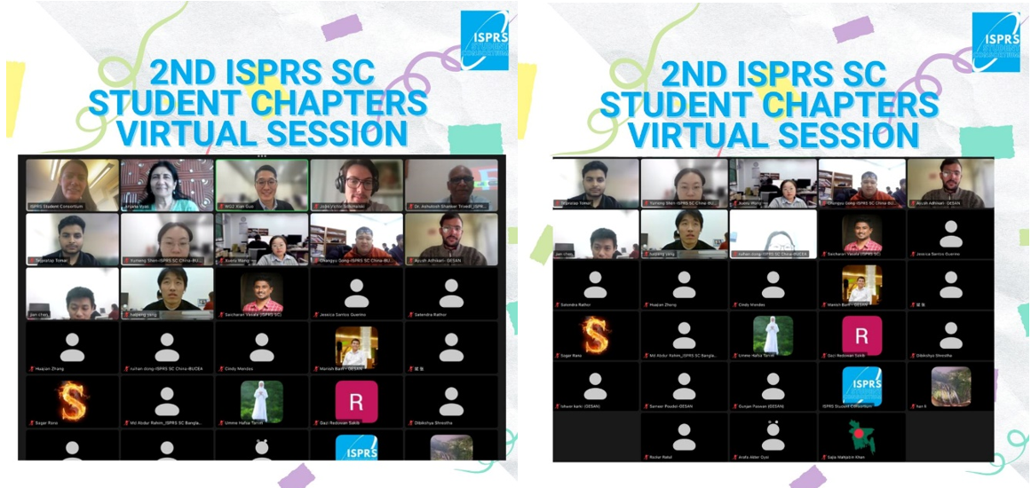
Figure 2: Attendees of the 1st ISPRS SC Student Chapters Virtual Session.


Second Virtual Breakout Session (March 4, 2025) 
The second breakout session, held on March 4, 2025, focused on the theme "Women in Geoscience", in celebration of the International Women’s Day. This event featured Prof. Dr. Anjana Vyas, Chair of ICWG V/IV, who shared insights from her more than four decades of experiences in academia and ISPRS. In her talk, Prof. Vyas reflected on her journey from an economics background to becoming a renowned academician in the field of geospatial sector, urban planning and data science. She emphasized the importance of persistence and risk-taking, leaving participants with a powerful message: "Be in it, take the risk, and see if that works for you."  

Fig 22
Figure 3: Attendees of the 2nd ISPRS SC Student Chapters Virtual Session.

Following her talk, Dr Xian Guo, Professor from BUCEA gave a brief presentation on the upcoming ISPRS SC Summer School, scheduled to take place in Beijing, China, in July 2025. Additionally, Laxmi introduced the Earth Sensing Summer School, to be hosted by the University of Padova. The session was successfully moderated by Laxmi, with Saicharan Vasala, Website Administrator of ISPRS SC, attending on behalf of the ISPRS SC Board of Directors. 
Future Initiatives 

ISPRS SC remains committed to organizing bi-monthly virtual breakout sessions, inviting scholars from the ISPRS community to share their expertise on various topics such as:  best practices for research publications, presentation and communication skills and proposal writing and funding opportunities. These sessions aim to enhance the professional development of student chapter members while providing them the platform for networking and collaboration with the founding members of similar chapters from different parts of the globe.
 Establishing an ISPRS SC Student Chapter  ?
For students and researchers interested in forming an ISPRS SC Student Chapter at their university or research institution, this initiative provides an opportunity to connect locally and globally with fellow geospatial professionals.  ISPRS SC Student Chapters serve as a platform to: 
- Strengthen local professional networks  
- Facilitate knowledge-sharing and collaboration  
- Organize events to promote geospatial research and innovation  
For more details on the establishment process, please refer to SC Student Chapters available at the website of the ISPRS SC Student Chapters page.


ISPRS SC ISPRS SC

ISPRS SC Supported Webinars and Upcoming Events:

The ISPRS Student Consortium (ISPRS SC) has been actively supporting various ISPRS working groups by hosting their webinar series through its Zoom platform.

ISPRS WG III/9 (Geospatial Environment and Health Analytics) Webinar
The first webinar it supported this year was organised by the ISPRS WG III/9. The session opened with remarks from Dr. Laurent Polidori, President of ISPRS TC III, followed by moderation from Dr. Murali Krishna Iyyanki, Chair of ISPRS WG III/9. The webinar saw 108 participants, engaging in an interactive session with the speakers.
Date: January 24, 2025
Topics and Speakers:
Spatio-Temporal Analysis of NO₂ and LST in Nairobi City – Dr. Patricia Mwangi
Urban Heat Island Mapping for Sustainable Cities – Dr. Y. Nithiyanandam
Laxmi Thapa, President of ISPRS SC, provided technical support in hosting the webinar on behalf of the ISPRS SC Board of Directors.


ISPRS WG III/3 (Active Microwave Remote Sensing) Webinar Series
The ISPRS WG III/3 (Active Microwave Remote Sensing) webinar series is an ongoing initiative, technically supported by ISPRS SC. These webinars typically last for one hour, with a 40–45-minute lecture followed by 15–20 minutes of discussion. They are held on the second Wednesday of every month and have received strong participation and engagement from attendees.
February Webinar
Date: February 12, 2025
Title: Interferometric SAR and the European Ground Motion Service
Speaker: Michele Crosetto, Centre Tecnològic de Telecomunicacions de Catalunya (CTTC)
Moderator: Prof. Junichi Susaki

This session started with the opening remarks from Dr. Laurent Polidori, President of ISPRS TC III and speaker’s introduction by Professor Junichi Susaki; this webinar attracted 133 participants, who actively engaged in discussions and asked numerous questions.
March Webinar
Date: March 12, 2025
Title: What SAR Can Learn from Optical Data
Speaker: Ronny Hänsch, DLR Germany
Moderator: Prof. Junichi Susaki

This session was attended by 165 participants, sparking engaging discussions with many insightful questions. Laxmi Thapa, President of ISPRS SC, has been providing technical support for these webinars on behalf of the ISPRS SC Board of Directors.


ISPRS TC V/WG 4 (Geospatial Technology for Effective Disaster Risk Management) Webinar Series
ISPRS Technical Commission V / Working Group 4 has launched a webinar series focusing on geospatial technology for disaster risk management, with technical support from the ISPRS SC. The ongoing series is being held in February and March 2025, has also been attracting wide participation in the first three webinars organised on the 21st February, 28th February and 11th March, 2025. Laxmi Thapa, President of ISPRS SC provided technical support for the first two webinars and Nicolas Pucino, Vice President of the ISPRS SC was handling the third webinar technically. We will share more details about the entire webinar series upon its completion.
All these webinars are recorded and shared on the YouTube channel of the ISPRS SC:(https://www.youtube.com/@ISPRSSC ).
ISPRS SC has been actively promoting these webinars through social media, managed by Miguel Lagahit, Social Media Coordinator, and website updates, handled by Saicharan Vasala, Website Administrator. We are also thankful to Markus Markus Englich, Webmaster of the ISPRS for his spontaneous support to promote these events and guide us in handling our website.
More details about the upcoming webinars are available on Webinar Series.


Upcoming Events
Students & Young Professionals Event at Geospatial Week 2025
Date: April 9, 2025
Location: Dubai World Trade Centre & Sharjah Academy of Astronomy, Space Sciences & Technology (SAASST)
Event Highlights:
Space Pioneers Speak – Gain insights from UAE’s leading space experts, ISPRS leaders, and even a UAE Astronaut!
From Ideas to Impact – Witness groundbreaking geospatial projects from UAE’s top universities.
Space & Astronomy Exploration – Tour SAASST, experience the Planetarium Show, and engage in CubeSat innovation workshops.
Building AI Foundations – Learn from Deep Learning experts in an interactive dataset preparation session.
Gala Dinner & Stargazing – End the day with networking, dinner, and a mesmerizing night under the stars!

Registration Link: Students & Young Professionals (SYP) Event - ESGRS


2025 Summer Schools
Summer School on Smart Cities
Date: July 3–12, 2025
Location: Beijing, China
Organizers: ISPRS SC, ISPRS TC V, Beijing University of Civil Engineering and Architecture (BUCEA), Belt and Road Architectural University International Consortium (BRAUIC)
For more details, visit: BUCEA Summer School
If the website is inaccessible, the application form is available here.                    
For inquiries, contact: guoxian@bucea.edu.cn

Earth Sensing Summer School 2025
Date: September 7–13, 2025
Location: San Vito di Cadore, Italy – Dolomite Mountains
Sponsors: University of Padova, ISPRS WG III/8, 3DForEcoTech COST ACTION CA20118, Società Italiana di Fotogrammetria e Topografia (SIFET), DecisionES MSCA Project
ISPRS SC is one of the supporting partners of this summer school.
For more details, visit: Earth Sensing Summer School 2025


Society News


ISPRS International Journal of Geo-Information — Open Access Journal ISPRS International Journal of Geo-Information — Open Access Journal

News from IJGI

Jack Dangermond Award Best Paper 2024

The best paper 2024 for the Jack Dangermond Award has been selected by the award committee.
Zhang, Z.; Li, D.; Zhang, Z.; Duffield, N. Mining Spatiotemporal Mobility Patterns Using Improved Deep Time Series Clustering. ISPRS Int. J. Geo-Inf. 2024, 13, 374. https://doi.org/10.3390/ijgi13110374

IJGI Quarterly Newsletter

Top IJGI Papers from 2024

ISPRS International Journal of Geo-Information - Highly Cited Papers in 2023–2024

ISPRS International Journal of Geo-Information (IJGI) - Annual Review in 2024

Announcements of Scientific Meetings                (see also ISPRS Calendar)


ISPRS ISPRS

Geospatial Technology for Effective Disaster Risk Management Webinar Series by ISPRS TC V - WG 4

Find more information here


EuroSDR EuroSDR

The 23rd series of EuroSDR e-learning courses

From Traditional to AI-based 3D Scene Capture and Modeling - Dates: March 17-28, 2025
Point Cloud Processing with Laser Scanning - Dates: April 7-18, 2025
Machine Learning for Earth Observation - Dates: May 5-16, 2025
Spatial Data Quality - Dates: June 2-13, 2025
For more information and updates, visit https://www.eurosdr.net/education/current


ISPRS ISPRS

ICWG II/Ib Webinar Series

March 27, 2025 | 03:00 PM (CET)

  • Computer Vision and Multi-Modal Data Analytics for Human-AI Collaboration in Civil Systems: Pingbo Tan (Carnegie Mellon University, USA)
  • Empowering Seamless and Universal BIM Interoperability with Invariant Signatures of AEC Objects: Jiansong Zhang (Purdue University, USA)

Apr 29, 2025 11:00 AM (CET)

  • Progress monitoring of construction sites using lidar and computer vision: Maarten Bassier (KU Leuven, Belgium)
  • The Role of Robotics and Automation in Data Acquisition for the Built Environment: Borja Garcia de Soto (NYU Abu Dhabi, UAE)

Registration and Information: https://sc.isprs.org/sc_news/isprs-icwg-iiib-webinar-series-2025/


Budapest Geosummit 2025 Budapest Geosummit 2025

Budapest Geosummit 2025

12-13 May 2025
BME main Building, Budapest

Program


EuroCow EuroCow

EuroCOW - European Workshop on Calibration and Orientation

Remote Sensing
16-18 June 2025
Warsaw POLAND

EuroCOW Workshop Reactivated

For years, European Calibration and Orientation Workshop (EuroCOW) has been biennial meetings that intend to bring together world experts, both from the public and private sectors, to present and discuss the recent findings and developments in Sensor Calibration and Orientation. Pandemics stopped organizing this circular event. Appreciating the narrow topic of the workshop, its unique character and the high level
of scientific discussion at EuroCOW over the years, it was decided to reactivate this event with the help of EuroSDR, ISPRS and FIG.

We invite you to attend this meeting organized June 16-18, 2025 in Warsaw, Poland. Deadline for abstract submission is 1 April 2025 and deadline for camera-ready papers is May 15, 2025.

More information can be found www.eurocow.org


FBAS FBAS

The 5th International Forum on Big Data for Sustainable Development Goals (FBAS 2025)

6-8 September 2025
Beijing, China

This forum will bring together top scientists, policymakers, industry leaders, and practitioners from around the globe to explore how to innovatively leverage digital technologies to accelerate the achievement of the SDGs, injecting new momentum and wisdom into global sustainable development. As an International Partner, the International Society for Digital Earth (ISDE) warmly invites you to join in this vibrant event.

Theme: Digital Intelligence Driving Sustainable Development: The 10th anniversary of the 2030 Agenda

Host: Chinese Academy of Sciences

Organizers:
The International Research Center of Big Data for Sustainable Development Goals (CBAS)
Aerospace Information Research Institute, Chinese Academy of Sciences

Call for Sessions:
The forum welcomes sessions with themes related to key FBAS 2025 topics including
1) Big Data Technology Serving Global Sustainable Development
2) AI Empowering Sustainable development
3) Policy and Digital Intelligence Industry Promoting Regional Sustainable Development
4) Development of Global Partnership Facilitating the Implementation of SDGs
5) Youth Innovation: Sharing for the Future.
Session Proposal Submission:
https://www.fbas.org.cn/fbas2025/en/contributions/sessions.html

Important Dates:

  • Session Application Deadline: April 20, 2025
  • Session Acceptance Notification: May 7, 2025
  • Abstract Submission Deadline: July 6, 2025
  • Abstract Acceptance Notification: July 20, 2025
  • Early Bird Registration Deadline: August 6, 2025
  • Online Registration Deadline: September 5, 2025
  • FBAS 2025 (Onsite Registration): September 6-8, 2025

Website: www.fbas.org.cn/fbas2025/en/index/index.html

ISPRS ISPRS

ISPRS ICWG IV/III (Global Mapping for SDGs)
Geo-digitalization for Sustainable Development Goals

2-4 December 2025
Nairobi, Kenya

Deadline for paper submission: May 30, 2025
Website link: https://sot.kcau.ac.ke/ISPRS-2024-conference/

Event Reports


Karsten Jacobsen Karsten Jacobsen

Joint ISPRS, EARSeL & DGPF Istanbul Workshop
Topographic Mapping from Space dedicated to Dr. Karsten Jacobsen for his 80th Birthday

28-31 January 2025
Istanbul, Türkiye

Report by Thomas Kersten

ISPRS International Journal of Geo-Information — Open Access Journal


ISPRS International Journal of Geo-Information — Open Access Journal ISPRS International Journal of Geo-Information — Open Access Journal

New publications
Volume 13, Issue 12 (December 2024)

An Assessment of the Map-Style Influence on Generalization with CycleGAN: Taking Line Features as an Example
Yu, Heng, Chen, Haoxuan, Zhang, Ling
No: 418

Auditing Flood Vulnerability Geo-Intelligence Workflow for Biases
Masinde, Brian K., Gevaert, Caroline M., Nagenborg, Michael H., van den Homberg, Marc J. C., Margutti, Jacopo, Gortzak, Inez, Zevenbergen, Jaap A.
No: 419

Exploring Nonlinear Effects of the Built Environment on Employment Behavior Among Older Adults: Evidence from Metro Station Catchment Areas
Peng, Bozhezi, Zhang, Yi, Wang, Tao, Li, Chaoyang
No: 420

Socioeconomic Disparities in the Usage of Urban Opportunities in South Korea During the COVID-19 Pandemic: Using Land Use/Land Cover and Mobile Phone Data
Lee, Kangjae, Park, Yoo Min, Joo, Yoohyung, Joo, Minsoo, Heo, Joon
No: 421

Investigating the Performance of Open-Vocabulary Classification Algorithms for Pathway and Surface Material Detection in Urban Environments
de Moraes Vestena, Kauê, Phillipi Camboim, Silvana, Brovelli, Maria Antonia, Rodrigues dos Santos, Daniel
No: 422

Passive Perception and Path Tracking of Tourists in Mountain Scenic Spots Through Face to Body Two Stepwise Method
Yang, Fan, Zhu, Changming, Shi, Kuntao, Li, Junli, Shen, Qian, Zhang, Xin
No: 423

Concepts Towards Nation-Wide Individual Tree Data and Virtual Forests
Hyyppä, Matti, Turppa, Tuomas, Hyyti, Heikki, Yu, Xiaowei, Handolin, Hannu, Kukko, Antero, Hyyppä, Juha, Virtanen, Juho-Pekka
No: 424

Location, Location, Location: The Power of Neighborhoods for Apartment Price Predictions Based on Transaction Data
Kmen, Christopher, Navratil, Gerhard, Giannopoulos, Ioannis
No: 425

Population Density Prediction at Township Scale Supported by Machine Learning Method: A Case Study in Inner Mongolia
Cui, Chenxi, Hu, Yunfeng, Bao, Yuhai, Li, Hao
No: 426

Impact of Land Use Change on Carbon Storage in Complex Terrains: A Case Study of Sichuan–Chongqing, China
Chu, Tiankuo, Li, Jun, Zhang, Chengye, Dai, Xiaoai, Qing, Yikun, Huang, Huan, Peng, Manling
No: 428

Dasymetric Algorithms Using Land Cover to Estimate Human Population at Smaller Spatial Scales
Bonnevie, Ida Maria, Hansen, Henning Sten, Schrøder, Lise
No: 427

Optimisation Model for Spatialisation of Population Based on Human Footprint Index Correction
Ren, Dongfeng, Qiu, Xin, Dong, Chun, Dai, Zhaoxin, Qi, Song
No: 429

Leveraging Digital Twins as a Common Operating Picture for Disaster Management: Case of Seismic Hazards
Korkmaz, Mustafa, Zulfikar, A. Can, Demirkesen, Sevilay
No: 430

Preserving Spatial Patterns in Point Data: A Generalization Approach Using Agent-Based Modeling
Knura, Martin, Schiewe, Jochen
No: 431

Research and Modeling of Commercial Location Selection Based on Geographic Big Data and Mobile Signaling Data—A Case Study of the Central Urban Area of Beijing
Zou, Jin, Zhang, Xun, Cong, Yangxiao, Gao, Zhentong, Shi, Jinlian
No: 432

Recognition and Classification of Typical Building Shapes Based on YOLO Object Detection Models
Wang, Xiao, Qian, Haizhong, Xie, Limin, Wang, Xu, Li, Bohao
No: 433

A Dynamic Algorithm for Measuring Pedestrian Congestion and Safety in Urban Alleyways
Lee, Jiyoon, Kang, Youngok
No: 434

Granularity Optimization of Travel Trajectory Based on Node2vec: A Case Study on Urban Travel Time Prediction
Dong, Hui, Pan, Xiao, Chen, Xiao
No: 435

Advancing Agricultural Land Suitability in Urbanized Semi-Arid Environments: Insights from Geospatial and Machine Learning Approaches
Sathiyamurthi, Subbarayan, Subbarayan, Saravanan, Ramya, Madhappan, Sivasakthi, Murugan, Gobi, Rengasamy, Qaysi, Saleh, Praveen Kumar, Sivakumar, Lee, Jinwook, Alarifi, Nassir, Wahba, Mohamed, M. Youssef, Youssef
No: 436

The Coupling Coordination Relationship Between Urbanization and the Eco-Environment in Resource-Based Cities, Loess Plateau, China
Kang, Shuaizhi, Jia, Xia, Zhao, Yonghua, Luo, Manya, Wang, Huanyuan, Zhao, Ming
No: 437

Riders Under the Heat: Exploring the Impact of Extreme Heat on the Integration of Bike-Sharing and Public Transportation in Shenzhen, China
Wang, Xin, Xue, Rui, Lu, Ming, Wu, Jiangyue
No: 438

Geospatial Multi-Hazard Assessment for Gyeonggi-do Province, South Korea Subjected to Earthquake
Kim, Han-Saem, Kim, Mingi
No: 439

Real-Time Co-Editing of Geographic Features
Matijević, Hrvoje, Vranić, Saša, Kranjčić, Nikola, Cetl, Vlado
No: 441

Estimation of Non-Photosynthetic Vegetation Cover Using the NDVI–DFI Model in a Typical Dry–Hot Valley, Southwest China
Fan, Caiyi, Chen, Guokun, Zhong, Ronghua, Huang, Yan, Duan, Qiyan, Wang, Ying
No: 440

Entity-Driven New Paradigm of Mine Data: Model Construction and Application
Li, Wenjing, Ma, Qian, Tang, Yanbin, Lin, Zhiyong
No: 442

A Multi-Level Analysis of Bus Ridership in Buffalo, New York
Wang, Chihuangji, Park, Jiyoung
No: 443

Spatial Pattern and Influencing Factors of Tourist Attractions in Coastal Cities: A Case Study of Qingdao
Xu, Yue, Zhang, Xuliang, Zhang, Kuncheng, Yu, Jing, Liu, Jia
No: 444

A 3D Model-Based Framework for Real-Time Emergency Evacuation Using GIS and IoT Devices
Tyagi, Noopur, Singh, Jaiteg, Singh, Saravjeet, Sehra, Sukhjit Singh
No: 445

Exploring the Activity-Travel Patterns of Multi-Purpose Commuters on Workdays Based on Activity Chains and Time Allocation: Evidence from Kunming, China
He, Mingwei, Chen, Na, He, Yueren, Li, Jianbo, Liu, Yang
No: 446

Generic Method for Social–Environmental System Boundary Delineation—An Amalgamation of Spatial Data Integration, Optimization, and User Control for Resource Management
Parvez, Mohammad Shahriyar, Feng, Xin
No: 447

Continuous Satellite Image Generation from Standard Layer Maps Using Conditional Generative Adversarial Networks
Šidlauskas, Arminas, Kriščiūnas, Andrius, Čalnerytė, Dalia
No: 448

Smart Solutions for Mega-Cities: Utilizing Long Short-Term Memory and Multi-Head Attention in Parking Prediction
Kemik, Hasan, Dalyan, Tugba, Aydogan, Murat
No: 449

Accessibility Measures: From a Literature Review to a Classification Framework
Mazzulla, Gabriella, Pirrone, Carlo Giuseppe
No: 450

Site Selection of Elderly Care Facilities Based on Multi-Source Spatial Big Data and Integrated Learning
Zhang, Yin, Zhu, Junhong, Li, Fangyi, Wang, Yingjie
No: 451

Assessing the Association Between Urban Amenities and Urban Green Space Transformation in Guangzhou
Zhang, Shawei, Chen, Jiawen, Cai, Yuxuan, Wen, Yuhan, Niu, Jiaqi, Chen, Mingze
No: 452

Schema Retrieval for Korean Geographic Knowledge Base Question Answering Using Few-Shot Prompting
Lee, Seokyong, Yu, Kiyun
No: 453

A Mixed Methods Evaluation of Wearable Technology: Findings from the Vivo Play Scientist (VPS) Program
Doyle-Baker, Patricia K., Petersen, Jennie A., Ghoneim, Dalia, Blackstaffe, Anita, Naish, Calli, McCormack, Gavin R.
No: 454

A Two-Phase and Bi-Level Spatial Configuration Methodology of Shelters Based on a Circular Assignment Model and Evacuation Traffic Flow Allocation
Zhang, Yujia, Chen, Wei, Zhong, Guangchun, Zhai, Guofang, Zhai, Wei
No: 455

Network-Based Hierarchical Feature Augmentation for Predicting Road Classes in OpenStreetMap
Hacar, Müslüm, Altafini, Diego, Cutini, Valerio
No: 456

The Spatial and Temporal Characteristics of Ecosystem Service Trade-Offs and Synergistic Relationships in a Mountainous Region of Northern China
Hou, Xianglong, Yang, Hui, Cao, Jiansheng
No: 458

Impact of Extreme Climate Indices on Vegetation Dynamics in the Qinghai–Tibet Plateau: A Comprehensive Analysis Utilizing Long-Term Dataset
Duan, Hanchen, Huang, Beiying, Liu, Shulin, Guo, Jianjun, Zhang, Jinlong
No: 457

Encapsulating Spatially Varying Relationships with a Generalized Additive Model
Comber, Alexis, Harris, Paul, Murakami, Daisuke, Nakaya, Tomoki, Tsutsumida, Narumasa, Yoshida, Takahiro, Brunsdon, Chris
No: 459

Building an Indoor Digital Twin—A Use-Case for a Hospital Digital Twin to Analyze COVID-19 Transmission
Lee, Youngin, Choi, Min Hyeok, Song, Yong-Soo, Lee, Jun-Gi, Park, Jin Young, Li, Ki-Joune
No: 460

Voxel-Based Navigation: A Systematic Review of Techniques, Applications, and Challenges
Niu, Lei, Wang, Zhiyong, Lin, Zhaoyu, Zhang, Yueying, Yan, Yingwei, He, Ziqi
No: 461

Does Urban Polycentric Structure Improve Carbon Emission Efficiency? A Spatial Panel Data Analysis of 279 Cities in China from 2012 to 2020
Zhang, Shihan, Xue, Yanxin, Jin, Shuzhen, Chen, Zhenghong, Cheng, Suiying, Wang, Wei
No: 462

A Parallel-Optimized Visualization Method for Large-Scale Multiple Video-Augmented Geographic Scenes on Cesium
Chen, Qingxiang, Chen, Jing, Sun, Kaimin, Huang, Minmin, Chen, Guang, Liu, Hao
No: 463

Automatic Road Extraction from Historical Maps Using Transformer-Based SegFormers
Sertel, Elif, Hucko, Can Michael, Kabadayı, Mustafa Erdem
No: 464

An Analysis of the Spatial Variations in the Relationship Between Built Environment and Severe Crashes
Alisan, Onur, Ozguven, Eren Erman
No: 465

Correction: Issaoui et al. Geometric Characterization of the Mateur Plain in Northern Tunisia Using Vertical Electrical Sounding and Remote Sensing Techniques. ISPRS Int. J. Geo-Inf. 2024, 13, 333
Issaoui, Wissal, Nasr, Imen Hamdi, Alexakis, Dimitrios D., Bejaoui, Wafa, Ibraheem, Ismael M., Ezzine, Ahmed, Othman, Dhouha Ben, Inoubli, Mohamed Hédi
No: 466

Regional-Scale Equidistance Optimizing Method Considering the Equidistance Patterns of Discrete Global Grid Systems
Luo, Fuli, Wang, Lei, Yu, Yue, Cui, Tengfei, Han, Li
No: 467


Volume 14, Issue 1 (January 2025)

Geographic Information System-Based Framework for Sustainable Small and Medium-Sized Enterprise Logistics Operations
Agoo, Jonathan, Lanuza, Renz Joshua, Lee, Jonathan, Rivera, Paul Anthony, Velasco, Neil Oliver, Guillermo, Marielet, Fernando, Arvin
No: 1

Change Detection and Incremental Updates for Multi-Source Road Networks Considering Topological Consistency
Wang, Xiaodong, Zhao, Dongbao, Li, Xingze, Jia, Nan, Guo, Li
No: 2

Optimizing Site Selection for Construction: Integrating GIS Modeling, Geophysical, Geotechnical, and Geomorphological Data Using the Analytic Hierarchy Process
Wahba, Doaa, Omran, Awad A., Adly, Ashraf, Gad, Ahmed, Arman, Hasan, El-Bagoury, Heba
No: 3

Marijuana Dispensary Locations and Neighborhood Characteristics in New York City
Yin, Li, Wang, Suiyuan, Patterson, Kelly L., Silverman, Robert Mark, Rehman-Veal, Ambreen
No: 4

Accuracy Evaluation Method for Vector Data Based on Hexagonal Discrete Global Grid
Ma, Yue, Li, Guoqing, Zhao, Long, Yao, Xiaochuang
No: 5

Extracting Regular Building Footprints Using Projection Histogram Method from UAV-Based 3D Models
Ren, Yaoyao, Li, Xing, Jin, Fangyuqing, Li, Chunmei, Liu, Wei, Li, Erzhu, Zhang, Lianpeng
No: 6

Multi-Scenario Simulation Evaluation and Strategic Zoning of Habitat Services Based on Habitat Quality and Ecological Network: A Case Study of Lanzhou City
Shi, Jin, Tang, Xianglong
No: 7

A Lightweight CNN-Transformer Implemented via Structural Re-Parameterization and Hybrid Attention for Remote Sensing Image Super-Resolution
Wang, Jie, Li, Hongwei, Li, Yifan, Qin, Zilong
No: 8

Exploring Cartographic Differences in Web Map Applications: Evaluating Design, Scale, and Usability
Zejdlik, Jakub, Vozenilek, Vit
No: 9

DPSTCN: Dynamic Pattern-Aware Spatio-Temporal Convolutional Networks for Traffic Flow Forecasting
Dou, Zeping, Guo, Danhuai
No: 10

Temporal-Spatial Traffic Flow Prediction Model Based on Prompt Learning
Cai, Siteng, Liu, Gang, He, Jing, Du, Yulun, Si, Zhichao, Jiang, Yunhao
No: 11

Integration of Multi-Source Landslide Disaster Data Based on Flink Framework and APSO Load Balancing Task Scheduling
Wang, Zongmin, Liang, Huangtaojun, Yang, Haibo, Li, Mengyu, Cai, Yingchun
No: 12

Revealing Land-Use Dynamics on Thermal Environment of Riverine Cities Under Climate Variability Using Remote Sensing and Geospatial Techniques
Iftakhar, Nazia, Islam, Fakhrul, Izhar Hussain, Mohammad, Ahmad, Muhammad Nasar, Lee, Jinwook, Ur Rehman, Nazir, Qaysi, Saleh, Alarifi, Nassir, Youssef, Youssef M.
No: 13

Urban Vitality Measurement Through Big Data and Internet of Things Technologies
Kim, Young-Long
No: 14

Solving Spatial Optimization Problems via Lagrangian Relaxation and Automatic Gradient Computation
Lei, Zhen, Lei, Ting L.
No: 15

Footprints of the Future: Cleaner and Faster Transportation with Shared E-Scooter Operational Models
Kaya, Ömer
No: 16

Investigating Social Vulnerability to Extreme Heat: Heat Islands and Climate Shelters in Urban Contexts: The Case of Bologna
Maccabiani, Elisa, Usmani, Munazza, Nanni, Riccardo, Napolitano, Maurizio
No: 17

HGeoKG: A Hierarchical Geographic Knowledge Graph for Geographic Knowledge Reasoning
Li, Tailong, Chen, Renyao, Duan, Yilin, Yao, Hong, Li, Shengwen, Li, Xinchuan
No: 18

Construction of a Real-Scene 3D Digital Campus Using a Multi-Source Data Fusion: A Case Study of Lanzhou Jiaotong University
Gao, Rui, Yan, Guanghui, Wang, Yingzhi, Yan, Tianfeng, Niu, Ruiting, Tang, Chunyang
No: 19

Space Efficiency of Transit-Oriented Station Areas: A Case Study from a Complex Adaptive System Perspective
Fan, Jinwen, Shi, Zhenwu, Liu, Jie, Wang, Jinru
No: 20

Performance Evaluation and Optimization of 3D Gaussian Splatting in Indoor Scene Generation and Rendering
Fang, Xinjian, Zhang, Yingdan, Tan, Hao, Liu, Chao, Yang, Xu
No: 21

Evaluation of Cross-Border Transport Connectivity and Analysis of Spatial Patterns in Latin America
Miao, Changqi, Zhang, Yinbao, Zhang, Xinjia, Liu, Jianzhong, Zhang, Shike
No: 22

Analysis and Optimization of the Spatial Patterns of Commercial Service Facilities Based on Multisource Spatiotemporal Data and Graph Neural Networks: A Case Study of Beijing, China
Xiao, Yihang, Li, Cunzhi, Zhou, Zhiwu, Hou, Dongyang, Zhou, Xiaoguang
No: 23

Revealing the City Influence and Its Pattern Using Web Search Data: A New Perspective Through Attention Flow
Wang, Xiaoxiao, Zhang, Haiping, Li, Zitong, Yang, Xin, Qian, Ziyi, Bian, Duo, Zhao, Yongxin
No: 24

A New Construction Method for Rectangular Cartograms
Wang, Lina, Yuan, Haoxun, Li, Xiang, Lu, Pengfei, Li, Yaru
No: 25

POI Data Fusion Method Based on Multi-Feature Matching and Optimization
Wang, Yue, Li, Cailin, Zhang, Hongjun, Guo, Baoyun, Wei, Xianlong, Hai, Zhao
No: 26

Construction of 3D Indoor Topological Models Based on Improved Face Sorting
Sun, Qun, Zhan, Xinwu, Tang, Pu
No: 27

Enhancing Accessibility in Public Spaces: A Computational Study of Hatirjheel Lakefront Using Space Syntax
Hossain, Sharif Tousif, Al-Ramadan, Baqer, Bilal, Muhammad, Altuwaijri, Hamad Ahmed
No: 29

Quantification of Soil–Water Erosion Using the RUSLE Method in the Mékrou Watershed (Middle Niger River)
Attoubounou, Rachid Abdourahamane, Diawara, Hamidou, Ludwig, Ralf, Adounkpe, Julien
No: 28

Synergy of Remote Sensing and Geospatial Technologies to Advance Sustainable Development Goals for Future Coastal Urbanization and Environmental Challenges in a Riverine Megacity
Mumtaz, Minza, Jahanzaib, Syed Humayoun, Hussain, Waqar, Khan, Sadia, Youssef, Youssef M., Qaysi, Saleh, Abdelnabi, Abdalla, Alarifi, Nassir, Abd-Elmaboud, Mahmoud E.
No: 30

Spatial Analysis of Maritime Disasters in the Philippines: Distribution Patterns and Identification of High-Risk Areas
Aguilar, Glenn D., Tirol, Yasmin P., Basina, Ryan M., Alcedo, Jamaica
No: 31

Portraying the Geography of US Airspace with 3-Dimensional GIS-Based Analysis and Visualization
Dao, Thi Hong Diep, Havlick, David G.
No: 32

Patch-Level and Neighborhood-Dependency Spatial Optimization Method (PNO): Application to Urban Land-Use Planning to Facilitate Both Socio-Economic and Environmental Development in Beijing
Cheng, Yuhan, Zhang, Xiuyuan, Zhou, Qi, Dong, Xiaoyan, Du, Shihong
No: 33

Towards AI-Assisted Mapmaking: Assessing the Capabilities of GPT-4o in Cartographic Design
Memduhoğlu, Abdulkadir
No: 35

An Efficient Tourism Path Approach Based on Improved Ant Colony Optimization in Hilly Areas
Damos, Mohamed A., Xu, Wenbo, Zhu, Jun, Ahmed, Ali, Khader, Abdolraheem
No: 34

Concept, Framework, and Data Model for Geographical Soundscapes
Lu, Xiu, Li, Guannan, Song, Xiaoqing, Zhou, Liangchen, Lv, Guonian
No: 36

Spatiotemporal Changes and Trade-Offs/Synergies of Ecosystem Services in the Qin-Mang River Basin
Zhao, Jiwei, Wang, Luyao, Jia, Dong, Wang, Yaowen
No: 37

Mapping the Dream: Designing Optimal E-Bike Routes in Valparaíso, Chile, Using a Multicriteria Analysis and an Experimental Study
Aprigliano, Vicente, Toro, Catalina, Rojas, Gonzalo, Bastías, Iván, Cardoso, Marcus, Santos, Tálita, da Silva, Marcelino Aurélio Vieira, Bustos, Emilio, de Oliveira, Ualison Rébula, Seriani, Sebastian
No: 38

Interpretable Machine Learning Insights into the Factors Influencing Residents’ Travel Distance Distribution
Si, Rui, Lin, Yaoyu, Yang, Dongquan, Guo, Qijin
No: 39


Volume 14, Issue 12 (February 2025)

The Agglomeration of Food Services and Their Colocation with Surrounding Complementary Services in the Guangdong–Hong Kong–Macao Greater Bay Area
Wang, Yixiao, Wu, Xibo, Qin, Jian, Zhang, Xiaoying, Wang, Xiangyu
No: 40

Evaluating Cartographic Communication in Croatian National Parks: User Perceptions of Pictograms
Cibilić, Iva, Poslončec-Petrić, Vesna
No: 41

A Novel Evolutionary Deep Learning Approach for PM2.5 Prediction Using Remote Sensing and Spatial–Temporal Data: A Case Study of Tehran
Kaveh, Mehrdad, Mesgari, Mohammad Saadi, Kaveh, Masoud
No: 42

Multi-View Three-Dimensional Reconstruction Based on Feature Enhancement and Weight Optimization Network
Yao, Guobiao, Wang, Ziheng, Wei, Guozhong, Zhu, Fengqi, Fu, Qingqing, Yu, Qian, Wei, Min
No: 43

Spatial Dynamics and Drivers of Urban Growth in Thua Thien Hue Province, Vietnam: Insights for Urban Sustainability in the Global South
Obaitor, Olabisi S., Odunsi, Oluwafemi Michael, Vu, Thanh Bien, Grobusch, Lena C., Schultz, Michael, Hochschild, Volker, Khanh, Linh Nguyen Hoang, Garschagen, Matthias
No: 44

Correlation Characteristics Between Urban Fires and Urban Functional Spaces: A Study Based on Point of Interest Data and Ripley’s K-Function
Xiong, Yaobin, Li, Gongquan
No: 45

Enhancing Precision Beekeeping by the Macro-Level Environmental Analysis of Crowdsourced Spatial Data
Kotovs, Daniels, Krievina, Agnese, Zacepins, Aleksejs
No: 47

Cyber Potential Metaphorical Map Method Based on GMap
Si, Dongyu, Jiang, Bingchuan, Xia, Qing, Li, Tingting, Wang, Xiao, Liu, Jingxu
No: 46

The Coordinated Development Characteristics of Rural Industry and Employment: A Case Study of Chongqing, China
Ge, Guoqin, Huang, Yong, Chen, Qianting
No: 48

Exploring Inequality: A Multi-Scale Analysis of China’s Consumption Carbon Footprint
Xu, Feng, Zheng, Xinqi, Zheng, Minrui, Liu, Dongya, Ma, Yin, Peng, Jizong, Shen, Ye, Han, Xu, Zhang, Mengdi
No: 49

Identify Optimal Pedestrian Flow Forecasting Methods in Great Britain Retail Areas: A Comparative Study of Time Series Forecasting on a Footfall Dataset
Murcio, Roberto, Wang, Yujue
No: 50

Digital Transformation and Location Data Interoperability Skills for Small and Medium Enterprises
De Martino, Monica, Martirano, Giacomo, Quarati, Alfonso, Varni, Francesco, Toscano Domínguez, Mayte
No: 51

Use of Semantic Web Technologies to Enhance the Integration and Interoperability of Environmental Geospatial Data: A Framework Based on Ontology-Based Data Access
Ranatunga, Sajith, Ødegård, Rune Strand, Jetlund, Knut, Onstein, Erling
No: 52

A Blockchain Copyright Protection Model Based on Vector Map Unique Identification
Wang, Heyan, Tang, Nannan, Zhu, Changqing, Ren, Na, Wang, Changhong
No: 53

Multi-Instance Zero-Watermarking Algorithm for Vector Geographic Data
Zhou, Qifei, Yan, Lin, Wang, Zihao, Ren, Na, Zhu, Changqing
No: 54

Automated Icon Extraction from Tourism Maps: A Synergistic Approach Integrating YOLOv8x and SAM
Cao, Di, Yan, Xinran, Li, Jingjing, Li, Jiayao, Wu, Lili
No: 55

Advancing AI-Driven Geospatial Analysis and Data Generation: Methods, Applications and Future Directions
Hochmair, Hartwig H., Juhász, Levente, Li, Hao
No: 56

The Machine Learning-Based Mapping of Urban Pluvial Flood Susceptibility in Seoul Integrating Flood Conditioning Factors and Drainage-Related Data
Bersabe, Julieber T., Jun, Byong-Woon
No: 57

A Novel Context-Aware Douglas–Peucker (CADP) Trajectory Compression Method
Mehri, Saeed, Hooshangi, Navid, Mahdizadeh Gharakhanlou, Navid
No: 58

Enhancing Spatial Awareness and Collaboration: A Guide to VR-Ready Survey Data Transformation
McDuff, Joseph Kevin, Karimi, Armin Agha, Gharineiat, Zahra
No: 59

Evaluation of Urban Accessibility Through Geomarketing Techniques: Case Study in Valencia (Spain)
Villanueva-Durbán, Néstor, Lorenzo-Sáez, Edgar, Lerma-Arce, Victoria, Coll-Aliaga, Eloina
No: 60

Beyond the Road: A Regional Perspective on Traffic Congestion in Metro Atlanta
Seong, Jeong Chang, Lee, Seungyeon, Cho, Yoonjae, Hwang, Chulsue
No: 61

Identifying Spatial Distribution of Urban Vitality Using Self-Organizing Feature Map Neural Network
Cai, Xingfei, Wen, Chaoxiang, Wang, Hao, Chen, Wenjun
No: 62

Evaluation of Pedestrian-Perceived Comfort on Urban Streets Using Multi-Source Data: A Case Study in Nanjing, China
Qin, Jiarui, Feng, Yizhe, Sheng, Yehua, Huang, Yi, Zhang, Fengyuan, Zhang, Kaixuan
No: 63

VE-GCN: A Geography-Aware Approach for Polyline Simplification in Cartographic Generalization
Chen, Siqiong, Hu, Anna, Xu, Yongyang, Wang, Haitao, Xie, Zhong
No: 64

Spatial Autocorrelation Analysis of CO and NO2 Related to Forest Fire Dynamics
Atalay, Hatice, Sunar, Ayse Filiz, Dervisoglu, Adalet
No: 65

Exploring the Equality and Determinants of Basic Educational Public Services from a Spatial Variation Perspective Using POI Data
Wei, Hejie, Ji, Wenfeng, Li, Ling, Yang, Yi, Liu, Mengxue
No: 66

In the Footsteps of Grandtourists: Envisioning Itineraries in Inner Areas for Literary and Responsible Tourism
Zatelli, Paolo, Gabellieri, Nicola, Besana, Angelo
No: 67

A Dynamic and Timely Point-of-Interest Recommendation Based on Spatio-Temporal Influences, Timeliness Feature and Social Relationships
Zhu, Jun, Lin, Haifeng, Gou, Zhinan, Xu, Yiqing, Liu, Hongying, Tang, Ming, Wang, Li, Li, Shu, Hu, Bing
No: 68

STPam: Software for Intelligently Analyzing and Mining Spatiotemporal Processes Based on Multi-Source Big Data
Xiong, Rongjun, Chen, Zeqiang, Pan, Huiwen, Liu, Dongyang, Sun, Aiguo, Chen, Nengcheng
No: 69

A Data Model and Method Framework for Cyberspace Map Visualization
Zhang, Zheng, Zhou, Chenghu, Chen, Minjie, Cao, Yibing, Fan, Shaojing
No: 70

An Efficient Route Planning Algorithm for Special Vehicles with Large-Scale Road Network Data
Tian, Ting, Wu, Huijing, Wei, Haitao, Wu, Fang, Xu, Mingliang
No: 71

Segmentation of Transaction Prices Submarkets in Vienna, Austria Using Multidimensional Spatiotemporal Change–DBSCAN (MDSTC-DBSCAN)
Treitler, Lorenz, Kounadi, Ourania
No: 72

A System for Analysis and Simulating Hydraulic and Hydrogeological Risks Through WebGIS 3D Digital Platforms
Mazzei, Mauro, Quaroni, Davide
No: 73

Research on the Evaluation and Spatial Distribution Optimization of the Field Intensity Effect of Rural Basic Education Infrastructure in Wuhan’s New Urban District: A Case Study of Liji Township
Jiang, Liang, Chen, Jie, Luo, Jing, Tian, Guanghui
No: 74

Strategies for Glacier Retreat Communication with 3D Geovisualization and Open Data Sharing
Gaspari, Federica, Barbieri, Federico, Fascia, Rebecca, Ioli, Francesco, Pinto, Livio, Migliaccio, Federica
No: 75

Evaluating Digital Map Utilization and Interpretation Skills of Students
Yamauchi, Hiroyuki, Song, Jiali, Oguchi, Takashi, Ogura, Takuro, Iizuka, Kotaro
No: 76

Correction: Lee, J.; Kang, Y. A Dynamic Algorithm for Measuring Pedestrian Congestion and Safety in Urban Alleyways. ISPRS Int. J. Geo-Inf. 2024, 13, 434
Lee, Jiyoon, Kang, Youngok
No: 77

Development of a Fifteen-Minute City Index Using Walkability Scores and Age-Classified Population: The Case of Pasig City, Metro Manila, Philippines
Mañago, Carlo Angelo R., Nasalita, Marielle G., Saveron, Cesar V., Sunga, Ynah Andrea D., Claridades, Alexis Richard C.
No: 78

Fine-Tuning LLM-Assisted Chinese Disaster Geospatial Intelligence Extraction and Case Studies
Han, Yaoyao, Liu, Jiping, Luo, An, Wang, Yong, Bao, Shuai
No: 79

Developing a Spatial Analysis-Based Model for Assessing Investment Potential in Local Self-Government Using the Analytic Hierarchy Process
Lisjak, Josip, Tomić, Hrvoje, Rončević, Ante, Cetl, Vlado
No: 81

Revealing Spatial Patterns and Environmental Influences on Jogging Volume and Speed: Insights from Crowd-Sourced GPS Trajectory Data and Random Forest
Yang, Xiao, Zhang, Chengbo, Yang, Linzhen
No: 80

Spatial Network Analysis of CO2 Emissions in Major Cities in China: Regional Structures and Influencing Factors
Zhao, Yue, Feng, Yuning, Du, Mingyi, Fraedrich, Klaus, Shen, Zehao
No: 82

4SIM: A Novel Description Model for the Ternary Spatial Relation “Between” of Buildings
Zhang, Hanxue, Gong, Xianyong, Liu, Chengyi, Wu, Fang, Qiu, Yue, Wang, Andong, Qi, Yuyang
No: 83

A Multi-Scale Hybrid Scene Geometric Similarity Measurement Method Using Heterogeneous Graph Neural Network
Gong, Chongya, Ai, Tinghua, Chen, Shiyu, Xiao, Tianyuan, Yu, Huafei
No: 84

How Hydrological Extremes Affect the Chlorophyll-a Concentration in Inland Water in Jiujiang City, China: Evidence from Satellite Remote Sensing
Jiang, Wei, Ding, Xiaohui, Kong, Fanping, Luo, Gan, Long, Tengfei, Pang, Zhiguo, Cui, Shiai, Liu, Jie, Adam, Elhadi
No: 85

Estimating the Material Footprint at the National Level from 1993 to 2022 Based on Multi-Feature CNN-BiLSTM
Miao, Lizhi, Wang, Yannan, Wu, Kaiwen, Huang, Lei, Kwan, Mei-Po
No: 86

Understanding Urban Park-Based Social Interaction in Shanghai During the COVID-19 Pandemic: Insights from Large-Scale Social Media Analysis
Wang, Haotian, Su, Tianyu, Zhao, Wanting
No: 87

Automatic Annotation of Map Point Features Based on Deep Learning ResNet Models
Zhang, Yaolin, Qin, Zhiwen, Ma, Jingsong, Zhang, Qian, Wang, Xiaolong
No: 88

GIS-Based Dashboards as Advanced Geospatial Applications for Climate Change Education and Teaching the Future
De Miguel González, Rafael, Mar-Beguería, Juan, Sebastián López, María, Kratochvíl, Ondrej
No: 89

Toward Quantifying Interpolation Uncertainty in Set-Line Spacing Hydrographic Surveys
Adediran, Elias, Kastrisios, Christos, Lowell, Kim, Rice, Glen, Zhang, Qi
No: 90

Towards More Reliable Measures for “Perceived Urban Diversity” Using Point of Interest (POI) and Geo-Tagged Photos
He, Zongze, Zhang, Xiang
No: 91

Impact of Shared Bicycle Spatial Patterns During Public Health Emergencies: A Case Study in the Core Area of Beijing
Wen, Zheng, Hu, Lujin, Hu, Jing
No: 92

Optimizing the Equality of Healthcare Services in Wuhan, China, Using a New Multimodal Two-Step Floating Catchment Area Model in Conjunction with the Hierarchical Maximal Accessibility Equality Model
Lu, Pengfei, Li, Xiang, Wang, Lina, Zhang, Zhengbin, Zhang, Danfei, Zhang, Wenya, Li, Yaru
No: 93

Geoinformatics and Machine Learning for Shoreline Change Monitoring: A 35-Year Analysis of Coastal Erosion in the Upper Gulf of Thailand
Chawalit, Chakrit, Boonpook, Wuttichai, Sitthi, Asamaporn, Torsri, Kritanai, Kamthonkiat, Daroonwan, Tan, Yumin, Suwansaard, Apised, Nardkulpat, Attawut
No: 94


Volume 14, Issue 3 (March 2025)

Geographic Named Entity Matching and Evaluation Recommendation Using Multi-Objective Tasks: A Study Integrating a Large Language Model (LLM) and Retrieval-Augmented Generation (RAG)
Zhang, Jiajun, Fang, Junjie, Zhang, Chengkun, Zhang, Wei, Ren, Huanbing, Xu, Liuchang
No: 95

Mobile Cadastral Application with Open-Source Software in Colombia
Mora-Navarro, Gaspar, Femenia-Ribera, Carmen, Terol, Enric, Quiza-Neuto, Cristhian
No: 96

The Impact of Built-Up Area Dispersion on the Cultural Heritage of the Region of the South Aegean, Greece
Chatzi, Efstratia, Derdemezi, Evangelia-Theodora, Tsilimigkas, Georgios
No: 97

Analysis of the Spatio-Temporal Evolution Characteristics and Influencing Factors of Habitat Quality in Hubei Province over the Past Three Decades
Miao, Jie, Xia, Huiqiong, Li, Fu, Yang, Jialin
No: 98

Climate Change Maps for the Atlas of Switzerland
Gaia, Luca, Neumann, Andreas, Hurni, Lorenz
No: 99

FSOSM: An Operational Knowledge Empowered Scenario Model for the Intelligent Farmland Supervision
Xu, Jiacheng, Zhao, Xuesheng, Cui, Bingliang
No: 100

Deep-Learning-Based Evaluation of Rooftop Photovoltaic Deployment in Tianjin, China
Shan, Mei, Xu, Yue, Sun, Yun, Wang, Yuan, Li, Lei, Qiao, Zhi, Zuo, Jian
No: 101

Evaluation Methods for the Human–Land Coupling Coordination Relationship in a Metro Station Area: A Case Study of Chengdu Metro Line 1
Qiu, Zhiyue, Wen, Shirui, Yuan, Hong, Liu, Ziyi, Wei, Yao, Yanling, Siqi, Dai, Runlong, Li, Xiang, Gu, Yuxin
No: 102

A Progressive Clustering Approach for Buildings Using MST and SOM with Feature Factors
Zhang, Tianliang, Lan, Xiaoji, Feng, Jianhua
No: 103

New Quality Productivity of Agriculture and Rural Areas at the Provincial Scale in China: Indicator Construction and Spatiotemporal Evolution
Cao, Xiangyang, Lei, Jiahui, Shi, Donghui, Yu, Wenlong, Tao, Tianhui, Zhang, Xun, Wang, An
No: 104

Spatial Prediction of High-Risk Areas for Asthma in Metropolitan Areas: A Machine Learning Approach Applied to Tehran, Iran
Mohammadi, Alireza, Pishgar, Elahe, Aguilera, Juan
No: 105

A Methodological Framework for Assessing Overtourism in Insular Territories—Case Study of Santorini Island, Greece
Leka, Akrivi, Lagarias, Apostolos, Stratigea, Anastasia, Prekas, Panayiotis
No: 106

Understanding the Carbon Footprint of Tile Transfer for Web Maps
Touya, Guillaume, Courtial, Azelle, Kalsron, Jérémy, Berli, Justin, Le Mao, Bérénice, Wenclik, Laura
No: 107

Urban Flood Resilience Assessment of Prefecture-Level Cities in Yangtze River Delta
Zhou, Mingru, He, Qisheng, Gu, Yuhan, Wang, Ke, Shen, Zhihao
No: 108

Dynamic Load Balancing Based on Hypergraph Partitioning for Parallel Geospatial Cellular Automata Models
Xia, Wei, Guan, Qingfeng, Li, Yuanyuan, Yue, Hanqiu, Yang, Xue, Gao, Huan
No: 109

Spatial Network in SQL Databases for Real-Time Multimodal Emergency Routing in Wildland Fires
Ilba, Mateusz
No: 110

Solving the Traveling Salesman Problem Using the IDINFO Algorithm
Su, Yichun, Ran, Yunbo, Yan, Zhao, Zhang, Yunfei, Yang, Xue
No: 111

Geospatial Analytics of Urban Bus Network Evolution Based on Multi-Source Spatiotemporal Data Fusion: A Case Study of Beijing, China
Li, Xiao, Wang, Shaohua, Zhou, Liang, Sun, Yeran, Zheng, Jiayi, Liu, Chang, Zhou, Junyuan, Su, Cheng, Xu, Dachuan
No: 112

Spatial Semantic Expression of Terrain Viewshed: A Data Mining Method
Zhang, Cheng, Wang, Yiwen, Cheng, Haozhe, Dou, Wanfeng
No: 113

Leveraging a Cooler, Healthier, and Decarbonized School Commute: City-Scale Estimation and Implications for Nanjing, China
Wang, Lifei, Lin, Ziqun, Xu, Zhen, Han, Lingyun
No: 114

Developing a Methodology for Assessing Visual and Environmental Sensitivity for Agrivoltaics Land Suitability Projects: The Case Study of Viterbo Province (Italy)
Angelelli, Ilaria, Codato, Daniele, Pappalardo, Salvatore Eugenio, De Marchi, Massimo
No: 115

The Effects of Employment Center Characteristics on Commuting Time: A Case Study of the Seoul Metropolitan Area
Nam, Sangyeon, Hong, Sungjo
No: 116

How Did the Fever Visit Management Policy During the COVID-19 Epidemic Impact Fever Medical Care Accessibility?
Zhao, Zhiyuan, Tu, Youjun, Ding, Yicheng
No: 117

Ecological Zoning Based on Suitability Evaluation of Ecological Product Development from the Value-Risk-Cost-Demand Perspective
Gao, Ming, Du, Pei, Zhou, Xinxin, Liu, Zhenxia, Luo, Wen, Yu, Zhaoyuan, Yuan, Linwang
No: 118

Study on Spatially Nonstationary Impact on Catering Distribution: A Multiscale Geographically Weighted Regression Analysis Using POI Data
Tan, Lu, Bu, Xiaojun
No: 119

Application of GIS Technologies in Tourism Planning and Sustainable Development: A Case Study of Gelnica
Šoltésová, Marieta, Iannaccone, Barbora, Štrba, Ľubomír, Sidor, Csaba
No: 120

Research on the Coordinated Development of “Node-Place” in Intercity Railway Station Areas: A Case Study of the Guangdong–Hong Kong–Macao Greater Bay Area, China
Zhang, Shuaibing, Huang, Zhengdong, Zhao, Kaixu
No: 121

Hexahedral Projections: A Comprehensive Review and Ranking
Dimitrijević, Aleksandar, Strobl, Peter
No: 122

Estimating the Potential for Rooftop Generation of Solar Energy in an Urban Context Using High-Resolution Open Access Geospatial Data: A Case Study of the City of Tromsø, Norway
Rees, Gareth, Hebryn-Baidy, Liliia, Good, Clara
No: 123

End-to-End Vector Simplification for Building Contours via a Sequence Generation Model
Cui, Longfei, Xu, Junkui, Jiang, Lin, Qian, Haizhong
No: 124

Optimal Site Selection for Wind and Solar Parks in Karpathos Island Using a GIS-MCDM Model
Bertsiou, Maria Margarita, Theochari, Aimilia Panagiota, Gergatsoulis, Dimitrios, Gerakianakis, Michalis, Baltas, Evangelos
No: 125

The Metaverse Is Geospatial: A System Model Architecture Integrating Spatial Computing, Digital Twins, and Virtual Worlds
Papadopoulos, Theofilos, Evangelidis, Konstantinos, Kaskalis, Theodore H., Evangelidis, Georgios
No: 126

OpenStreetMap as the Data Source for Territorial Innovation Potential Assessment
Čerba, Otakar
No: 127

Joint Translation Method for English–Chinese Place Names Based on Prompt Learning and Knowledge Graph Enhancement
Liu, Hanyou, Mao, Xi
No: 128

The Influence of the Relationship Between Landmark Symbol Types, Annotations, and Colors on Search Performance in Mobile Maps Based on Eye Tracking
Fang, Hao, Guo, Hongyun, Song, Zhangtong, Yang, Nai, Wang, Rui, Guo, Fen
No: 129


ISPRS Journal of Photogrammetry and Remote Sensing


ISPRS Journal ISPRS Journal

New publications
Volume 220 (February 2025)

Editorial Board
Pages: ii

A deep data fusion-based reconstruction of water index time series for intermittent rivers and ephemeral streams monitoring
Junyuan Fei, Xuan Zhang, Chong Li, Fanghua Hao, Yahui Guo, Yongshuo Fu
Pages: 339-353

Developing a spatiotemporal fusion framework for generating daily UAV images in agricultural areas using publicly available satellite data
Hamid Ebrahimy, Tong Yu, Zhou Zhang
Pages: 413-427

A full time series imagery and full cycle monitoring (FTSI-FCM) algorithm for tracking rubber plantation dynamics in the Vietnam from 1986 to 2022
Bangqian Chen, Jinwei Dong, Tran {Thi Thu Hien}, Tin Yun, Weili Kou, Zhixiang Wu, Chuan Yang, Guizhen Wang, Hongyan Lai, Ruijin Liu, Feng An
Pages: 377-394

Synthesis of complex-valued InSAR data with a multi-task convolutional neural network
Philipp Sibler, Francescopaolo Sica, Michael Schmitt
Pages: 192-206

MLC-net: A sparse reconstruction network for TomoSAR imaging based on multi-label classification neural network
Depeng Ouyang, Yueting Zhang, Jiayi Guo, Guangyao Zhou
Pages: 85-99

KIBS: 3D detection of planar roof sections from a single satellite image
Johann Lussange, Mulin Yu, Yuliya Tarabalka, Florent Lafarge
Pages: 207-216

3LATNet: Attention based deep learning model for global Chlorophyll-a retrieval from GCOM-C satellite
Muhammad Salah, Salem Ibrahim Salem, Nobuyuki Utsumi, Hiroto Higa, Joji Ishizaka, Kazuo Oki
Pages: 490-508

LU5M812TGT: An AI-Powered global database of impact craters ≥0.4 km on the Moon
Riccardo {La Grassa}, Elena Martellato, Gabriele Cremonese, Cristina Re, Adriano Tullo, Silvia Bertoli
Pages: 75-84

Learning transferable land cover semantics for open vocabulary interactions with remote sensing images
Valérie Zermatten, Javiera Castillo-Navarro, Diego Marcos, Devis Tuia
Pages: 621-636

Multiscale adaptive PolSAR image superpixel generation based on local iterative clustering and polarimetric scattering features
Nengcai Li, Deliang Xiang, Xiaokun Sun, Canbin Hu, Yi Su
Pages: 307-322

Contribution of ECOSTRESS thermal imagery to wetland mapping: Application to heathland ecosystems
Liam Loizeau-Woollgar, Sébastien Rapinel, Julien Pellen, Bernard Clément, Laurence Hubert-Moy
Pages: 649-660

A universal method to recognize global big rivers estuarine turbidity maximum from remote sensing
Chongyang Wang, Chenghu Zhou, Xia Zhou, Mingjie Duan, Yingwei Yan, Jiaxue Wang, Li Wang, Kai Jia, Yishan Sun, Danni Wang, Yangxiaoyue Liu, Dan Li, Jinyue Chen, Hao Jiang, Shuisen Chen
Pages: 509-523

Classification of urban road functional structure by integrating physical and behavioral features
Qiwen Huang, Haifu Cui, Longwei Xiang
Pages: 753-769

PylonModeler: A hybrid-driven 3D reconstruction method for power transmission pylons from LiDAR point clouds
Shaolong Wu, Chi Chen, Bisheng Yang, Zhengfei Yan, Zhiye Wang, Shangzhe Sun, Qin Zou, Jing Fu
Pages: 100-124

Nothing Stands Still: A spatiotemporal benchmark on 3D point cloud registration under large geometric and temporal change
Tao Sun, Yan Hao, Shengyu Huang, Silvio Savarese, Konrad Schindler, Marc Pollefeys, Iro Armeni
Pages: 799-823

RF-DET: Refocusing on the small-scale objects using aggregated context for accurate power transmitting components detection on UAV oblique imagery
Zhengfei Yan, Chi Chen, Shaolong Wu, Zhiye Wang, Liuchun Li, Shangzhe Sun, Bisheng Yang, Jing Fu
Pages: 692-711

Detection of non-stand replacing disturbances (NSR) using Harmonized Landsat-Sentinel-2 time series
Madison S. Brown, Nicholas C. Coops, Christopher Mulverhill, Alexis Achim
Pages: 264-276

A novel airborne TomoSAR 3-D focusing method for accurate ice thickness and glacier volume estimation
Ke Wang, Yue Wu, Xiaolan Qiu, Jinbiao Zhu, Donghai Zheng, Songtao Shangguan, Jie Pan, Yuquan Liu, Liming Jiang, Xin Li
Pages: 593-607

An interactive fusion attention-guided network for ground surface hot spring fluids segmentation in dual-spectrum UAV images
Shi Yi, Mengting Chen, Xuesong Yuan, Si Guo, Jiashuai Wang
Pages: 661-691

Accurate spaceborne waveform simulation in heterogeneous forests using small-footprint airborne LiDAR point clouds
Yi Li, Guangjian Yan, Weihua Li, Donghui Xie, Hailan Jiang, Linyuan Li, Jianbo Qi, Ronghai Hu, Xihan Mu, Xiao Chen, Shanshan Wei, Hao Tang
Pages: 246-263

Scattering mechanism-guided zero-shot PolSAR target recognition
Feng Li, Xiaojing Yang, Liang Zhang, Yanhua Wang, Yuqi Han, Xin Zhang, Yang Li
Pages: 428-439

PSO-based fine polarimetric decomposition for ship scattering characterization
Junpeng Wang, Sinong Quan, Shiqi Xing, Yongzhen Li, Hao Wu, Weize Meng
Pages: 18-31

Unwrapping error and fading signal correction on multi-looked InSAR data
Zhangfeng Ma, Nanxin Wang, Yingbao Yang, Yosuke Aoki, Shengji Wei
Pages: 51-63

Plug-and-play DISep: Separating dense instances for scene-to-pixel weakly-supervised change detection in high-resolution remote sensing images
Zhenghui Zhao, Chen Wu, Lixiang Ru, Di Wang, Hongruixuan Chen, Cuiqun Chen
Pages: 770-782

Generative networks for spatio-temporal gap filling of Sentinel-2 reflectances
Maria Gonzalez-Calabuig, Miguel-Ángel Fernández-Torres, Gustau Camps-Valls
Pages: 637-648

GN-GCN: Grid neighborhood-based graph convolutional network for spatio-temporal knowledge graph reasoning
Bing Han, Tengteng Qu, Jie Jiang
Pages: 728-739

Large-scale rice mapping under spatiotemporal heterogeneity using multi-temporal SAR images and explainable deep learning
Ji Ge, Hong Zhang, Lijun Zuo, Lu Xu, Jingling Jiang, Mingyang Song, Yinhaibin Ding, Yazhe Xie, Fan Wu, Chao Wang, Wenjiang Huang
Pages: 395-412

Corrigendum to “Comparison of detectability of ship wake components between C-Band and X-Band synthetic aperture radar sensors operating under different slant ranges” [ISPRS J. Photogramm. Remote Sens. 196 (2023) 306-324]
Björn Tings, Andrey Pleskachevsky, Stefan Wiehl
Pages: 740

Underwater image captioning: Challenges, models, and datasets
Huanyu Li, Hao Wang, Ying Zhang, Li Li, Peng Ren
Pages: 440-453

Refined change detection in heterogeneous low-resolution remote sensing images for disaster emergency response
Di Wang, Guorui Ma, Haiming Zhang, Xiao Wang, Yongxian Zhang
Pages: 139-155

Cross-view geolocalization and disaster mapping with street-view and VHR satellite imagery: A case study of Hurricane IAN
Hao Li, Fabian Deuser, Wenping Yin, Xuanshu Luo, Paul Walther, Gengchen Mai, Wei Huang, Martin Werner
Pages: 841-854

National scale sub-meter mangrove mapping using an augmented border training sample method
Jinyan Tian, Le Wang, Chunyuan Diao, Yameng Zhang, Mingming Jia, Lin Zhu, Meng Xu, Xiaojuan Li, Huili Gong
Pages: 156-171

Remote sensing scene graph generation for improved retrieval based on spatial relationships
Jiayi Tang, Xiaochong Tong, Chunping Qiu, Yuekun Sun, Haoshuai Song, Yaxian Lei, Yi Lei, Congzhou Guo
Pages: 741-752

ChangeRD: A registration-integrated change detection framework for unaligned remote sensing images
Wei Jing, Kaichen Chi, Qiang Li, Qi Wang
Pages: 64-74

Global high categorical resolution land cover mapping via weak supervision
Xin-Yi Tong, Runmin Dong, Xiao Xiang Zhu
Pages: 535-549

A coupled optical–radiometric modeling approach to removing reflection noise in TLS data of urban areas
Li Fang, Tianyu Li, Yanghong Lin, Shudong Zhou, Wei Yao
Pages: 217-231

Overcoming the uncertainty challenges in detecting building changes from remote sensing images
Jiepan Li, Wei He, Zhuohong Li, Yujun Guo, Hongyan Zhang
Pages: 1-17

3D automatic detection and correction for phase unwrapping errors in time series SAR interferometry
Ying Liu, Hong’an Wu, Yonghong Zhang, Zhong Lu, Yonghui Kang, Jujie Wei
Pages: 232-245

PolSAR2PolSAR: A semi-supervised despeckling algorithm for polarimetric SAR images
Cristiano Ulondu Mendes, Emanuele Dalsasso, Yi Zhang, Loïc Denis, Florence Tupin
Pages: 783-798

Using hyperspectral and thermal imagery to monitor stress of Southern California plant species during the 2013–2015 drought
Susan K. Meerdink, Dar A. Roberts, Jennifer Y. King, Keely L. Roth, Paul D. Gader, Kelly K. Caylor
Pages: 580-592

Semantic guided large scale factor remote sensing image super-resolution with generative diffusion prior
Ce Wang, Wanjie Sun
Pages: 125-138

Data fidelity-oriented spatial-spectral fusion of CRISM and CTX images
Qunming Wang, Wenjing Ma, Sicong Liu, Xiaohua Tong, Peter M. Atkinson
Pages: 172-191

Intelligent segmentation of wildfire region and interpretation of fire front in visible light images from the viewpoint of an unmanned aerial vehicle (UAV)
Jianwei Li, Jiali Wan, Long Sun, Tongxin Hu, Xingdong Li, Huiru Zheng
Pages: 473-489

GITomo-Net: Geometry-independent deep learning imaging method for SAR tomography
Changhao Liu, Yan Wang, Guangbin Zhang, Zegang Ding, Tao Zeng
Pages: 608-620

A novel deep learning algorithm for broad scale seagrass extent mapping in shallow coastal environments
Jianghai Peng, Jiwei Li, Thomas C. Ingalls, Steven R. Schill, Hannah R. Kerner, Gregory P. Asner
Pages: 277-294

Joint compression and despeckling by SAR representation learning
Joel Amao-Oliva, Nils Foix-Colonier, Francescopaolo Sica
Pages: 524-534

Application of SAR-Optical fusion to extract shoreline position from Cloud-Contaminated satellite images
Yongjing Mao, Kristen D. Splinter
Pages: 563-579

Target-aware attentional network for rare class segmentation in large-scale LiDAR point clouds
Xinlong Zhang, Dong Lin, Uwe Soergel
Pages: 32-50

Near-surface air temperature estimation for areas with sparse observations based on transfer learning
Wei Wang, Stefan Brönnimann, Ji Zhou, Shaopeng Li, Ziwei Wang
Pages: 712-727

Accurate and complete neural implicit surface reconstruction in street scenes using images and LiDAR point clouds
Chenhui Shi, Fulin Tang, Yihong Wu, Hongtu Ji, Hongjie Duan
Pages: 295-306

A sensitive geometric self-calibration method and stability analysis for multiview spaceborne SAR images based on the range-Doppler model
Lina Yin, Mingjun Deng, Yin Yang, Yunqing Huang, Qili Tang
Pages: 550-562

FO-Net: An advanced deep learning network for individual tree identification using UAV high-resolution images
Jian Zeng, Xin Shen, Kai Zhou, Lin Cao
Pages: 323-338

Accurate semantic segmentation of very high-resolution remote sensing images considering feature state sequences: From benchmark datasets to urban applications
Zijie Wang, Jizheng Yi, Aibin Chen, Lijiang Chen, Hui Lin, Kai Xu
Pages: 824-840

Improving 30-meter global impervious surface area (GISA) mapping: New method and dataset
Huiqun Ren, Xin Huang, Jie Yang, Guoqing Zhou
Pages: 354-376

CARE-SST: context-aware reconstruction diffusion model for sea surface temperature
Minki Choo, Sihun Jung, Jungho Im, Daehyeon Han
Pages: 454-472


New publications
Volume 221 (March 2025)

Editorial Board
Pages: ii

A multi-task learning framework for dual-polarization SAR imagery despeckling in temporal change detection scenarios
Jie Li, Shaowei Shi, Liupeng Lin, Qiangqiang Yuan, Huanfeng Shen, Liangpei Zhang
Pages: 155-178

DALI-SLAM: Degeneracy-aware LiDAR-inertial SLAM with novel distortion correction and accurate multi-constraint pose graph optimization
Weitong Wu, Chi Chen, Bisheng Yang, Xianghong Zou, Fuxun Liang, Yuhang Xu, Xiufeng He
Pages: 92-108

A novel framework for accurate, automated and dynamic global lake mapping based on optical imagery
Tao Zhou, Guoqing Zhang, Jida Wang, Zhe Zhu, R.Iestyn Woolway, Xiaoran Han, Fenglin Xu, Jun Peng
Pages: 280-298

Image motion degradation compensation for high dynamic imaging of space-based vertical orbit scanning
Jiamin Du, Xiubin Yang, Zongqiang Fu, Suining Gao, Tianyu Zhang, Jinyan Zou, Xi He, Shaoen Wang
Pages: 124-142

Twin deformable point convolutions for airborne laser scanning point cloud classification
Yong-Qiang Mao, Hanbo Bi, Xuexue Li, Kaiqiang Chen, Zhirui Wang, Xian Sun, Kun Fu
Pages: 78-91

Streamlined multilayer perceptron for contaminated time series reconstruction: A case study in coastal zones of southern China
Siyu Qian, Zhaohui Xue, Mingming Jia, Hongsheng Zhang
Pages: 193-209

An ensemble learning framework for generating high-resolution regional DEMs considering geographical zoning
Xiaoyi Han, Chen Zhou, Saisai Sun, Chiying Lyu, Mingzhu Gao, Xiangyuan He
Pages: 363-383

SkyEyeGPT: Unifying remote sensing vision-language tasks via instruction tuning with large language model
Yang Zhan, Zhitong Xiong, Yuan Yuan
Pages: 64-77

Measurement of urban vitality with time-lapsed street-view images and object-detection for scalable assessment of pedestrian-sidewalk dynamics
Ricky Nathvani, Alicia Cavanaugh, Esra Suel, Honor Bixby, Sierra N. Clark, Antje Barbara Metzler, James Nimo, Josephine Bedford Moses, Solomon Baah, Raphael E. Arku, Brian E. Robinson, Jill Baumgartner, James E Bennett, Abeer M. Arif, Ying Long, Samuel Agyei-Mensah, Majid Ezzati
Pages: 251-264

S3OD: Size-unbiased semi-supervised object detection in aerial images
Ruixiang Zhang, Chang Xu, Fang Xu, Wen Yang, Guangjun He, Huai Yu, Gui-Song Xia
Pages: 179-192

Linking remotely sensed growth-related canopy attributes to interannual tree-ring width variations: A species-specific study using Sentinel optical and SAR time series
Vahid Nasiri, Paweł Hawryło, Piotr Tompalski, Bogdan Wertz, Jarosław Socha
Pages: 347-362

GV-iRIOM: GNSS-visual-aided 4D radar inertial odometry and mapping in large-scale environments
Binliang Wang, Yuan Zhuang, Jianzhu Huai, Yiwen Chen, Jiagang Chen, Nashwa El-Bendary
Pages: 310-323

4D RadarPR: Context-Aware 4D Radar Place Recognition in harsh scenarios
Yiwen Chen, Yuan Zhuang, Binliang Wang, Jianzhu Huai
Pages: 210-223

GEPT-Net: An efficient geometry enhanced point transformer for shield tunnel leakage segmentation
Jundi Jiang, Yueqian Shen, Jinhu Wang, Jinguo Wang, Chenyang Zhang, Jingyi Wang, Vagner Ferreira
Pages: 20-43

Descriptor-based optical flow quality assessment and error model construction for visual localization
Jietao Lei, Jingbin Liu, Wei Zhang, Mengxiang Li, Juha Hyyppä
Pages: 143-154

A large-scale VHR parcel dataset and a novel hierarchical semantic boundary-guided network for agricultural parcel delineation
Hang Zhao, Bingfang Wu, Miao Zhang, Jiang Long, Fuyou Tian, Yan Xie, Hongwei Zeng, Zhaoju Zheng, Zonghan Ma, Mingxing Wang, Junbin Li
Pages: 1-19

CIDM: A comprehensive inpainting diffusion model for missing weather radar data with knowledge guidance
Wei Zhang, Xinyu Zhang, Junyu Dong, Xiaojiang Song, Renbo Pang
Pages: 299-309

A novel scene coupling semantic mask network for remote sensing image segmentation
Xiaowen Ma, Rongrong Lian, Zhenkai Wu, Renxiang Guan, Tingfeng Hong, Mengjiao Zhao, Mengting Ma, Jiangtao Nie, Zhenhong Du, Siyang Song, Wei Zhang
Pages: 44-63

RS-NormGAN: Enhancing change detection of multi-temporal optical remote sensing images through effective radiometric normalization
Jianhao Miao, Shuang Li, Xuechen Bai, Wenxia Gan, Jianwei Wu, Xinghua Li
Pages: 324-346

Cross-modal semantic transfer for point cloud semantic segmentation
Zhen Cao, Xiaoxin Mi, Bo Qiu, Zhipeng Cao, Chen Long, Xinrui Yan, Chao Zheng, Zhen Dong, Bisheng Yang
Pages: 265-279

A novel framework for river organic carbon retrieval through satellite data and machine learning
Shang Tian, Anmeng Sha, Yingzhong Luo, Yutian Ke, Robert Spencer, Xie Hu, Munan Ning, Yi Zhao, Rui Deng, Yang Gao, Yong Liu, Dongfeng Li
Pages: 109-123

M3ICNet: A cross-modal resolution preserving building damage detection method with optical and SAR remote sensing imagery and two heterogeneous image disaster datasets
Haiming Zhang, Guorui Ma, Di Wang, Yongxian Zhang
Pages: 224-250


New publications
Volume 222 (April 2025)

Editorial Board
Pages: ii

Modeling the satellite instrument visibility range for detecting underwater targets
Jun Chen, Wenting Quan, Xianqiang He, Ming Xu, Caipin Li, Delu Pan
Pages: 64-78

Mitigation of tropospheric turbulent delays in InSAR time series by incorporating a stochastic process
Hailu Chen, Yunzhong Shen, Lei Zhang, Hongyu Liang, Tengfei Feng, Xinyou Song
Pages: 186-203

Photogrammetric system of non-central refractive camera based on two-view 3D reconstruction
Zhen Wu, Mingshu Nan, Haidong Zhang, Junzhou Huo, Shangqi Chen, Guanyu Chen, Zhang Cheng
Pages: 112-129

Bounding box versus point annotation: The impact on deep learning performance for animal detection in aerial images
Zeyu Xu, Tiejun Wang, Andrew K. Skidmore, Richard Lamprey, Shadrack Ngene
Pages: 99-111

TACMT: Text-aware cross-modal transformer for visual grounding on high-resolution SAR images
Tianyang Li, Chao Wang, Sirui Tian, Bo Zhang, Fan Wu, Yixian Tang, Hong Zhang
Pages: 152-166

Modeling hydrous mineral distribution on Mars with extremely sparse data: A multi-scale spatial association modeling framework
Leilei Jiao, Peng Luo, Rong Huang, Yusheng Xu, Zhen Ye, Sicong Liu, Shijie Liu, Xiaohua Tong
Pages: 16-32

Multimodal ensemble of UAV-borne hyperspectral, thermal, and RGB imagery to identify combined nitrogen and water deficiencies in field-grown sesame
Maitreya Mohan Sahoo, Rom Tarshish, Yaniv Tubul, Idan Sabag, Yaron Gadri, Gota Morota, Zvi Peleg, Victor Alchanatis, Ittai Herrmann
Pages: 33-53

Enhancing LiDAR point cloud generation with BRDF-based appearance modelling
Alfonso López, Carlos J. Ogayar, Rafael J. Segura, Juan C. Casas-Rosa
Pages: 79-98

LuoJiaHOG: A hierarchy oriented geo-aware image caption dataset for remote sensing image–text retrieval
Yuanxin Zhao, Mi Zhang, Bingnan Yang, Zhan Zhang, Jujia Kang, Jianya Gong
Pages: 130-151

FengYun-3 meteorological satellites’ microwave radiation Imagers enhance land surface temperature measurements across the diurnal cycle
Yuyang Xiong, Tianjie Zhao, Haishen Lü, Zhiqing Peng, Jingyao Zheng, Yu Bai, Panpan Yao, Peng Guo, Peilin Song, Zushuai Wei, Ronghan Xu, Shengli Wu, Lixin Dong, Lin Chen, Na Xu, Xiuqing Hu, Peng Zhang, Letu Husi, Jiancheng Shi
Pages: 204-224

Time-Series models for ground subsidence and heave over permafrost in InSAR Processing: A comprehensive assessment and new improvement
Chengyan Fan, Cuicui Mu, Lin Liu, Tingjun Zhang, Shichao Jia, Shengdi Wang, Wen Sun, Zhuoyi Zhao
Pages: 167-185

Adaptive Discrepancy Masked Distillation for remote sensing object detection
Cong Li, Gong Cheng, Junwei Han
Pages: 54-63

Simulation-aided similarity-aware feature alignment with meta-adaption optimization for SAR ATR under extended operation conditions
Qishan He, Lingjun Zhao, Kefeng Ji, Li Liu, Gangyao Kuang
Pages: 1-15


ISPRS Open Journal of Photogrammetry and Remote Sensing


ISPRS Open Journal of Photogrammetry and Remote Sensing ISPRS Open Journal of Photogrammetry and Remote Sensing

New publications
Volume 14 (December 2024)

Measuring nearshore waves at break point in 4D with Stereo-GoPro photogrammetry: A field comparison with multi-beam LiDAR and pressure sensors
Marion Jaud, Stéphane Bertin, Emmanuel Augereau, France Floc’h
Pages: 100077

Colour guided ground-to-UAV fire segmentation
Rui Zhou, Tardi Tjahjadi
Pages: 100076

Domain adaptation of deep neural networks for tree part segmentation using synthetic forest trees
Mitch Bryson, Ahalya Ravendran, Celine Mercier, Tancred Frickey, Sadeepa Jayathunga, Grant Pearse, Robin J.L. Hartley
Pages: 100078


New Events


17 Feb 2025
Grotto Digital Twins: Strategies for Documentation, Preservation, and Promotion
https://geomaticaeconservazione.it/tutti_i_corsi/grotto-digital-twins-strategies-for-documentation-preservation-and-promotion/
online, seminar
 

28-30 May 2025
Pre-AGM Conference
Apportioning Space and Needs: Green Land Management Options for Posterity
https://isk.or.ke/
Mombasa, Kenya
 

02-03 Jun 2025
International Conference on Mapping the Future of Sustainable Landscapes:
Geospatial Innovations for People, Places, and Practices
website not yet available
Awantipore, Kashmir
 

16-19 Jun 2025
46th Canadian Symposium on Remote Sensing (CSRS)
https://crss-sct.ca/events/csrs2025lethbridge/
Lethbridge Alberta, Canada
 

23 Jun 2025
Workshop on ‘Together Women Engineers: Driving Innovation for Sustainability’
website not yet available
Tamale, Ghana
 

03-12 Jul 2025
2025 Summer School on Smart Cities
https://english.bucea.edu.cn/Admission/SummerSchool/a571aff62a9d40108af94fab71516dac.htm
Beijing, China
 

14-20 Jul 2025
Academic Track of FOSS4G (Free and Open Source Software for Geospatial) Europe 2025
https://2025.europe.foss4g.org
Mostar, Bosnia-Herzegovina
 

22-24 Aug 2025
9th DMGIS
https://dmgis2025.scievent.com/
Beijing, China
 

02-05 Sep 2025
3D GeoInfo & SDSC 2025
https://www.csis.u-tokyo.ac.jp/3d_geoinfo_sdsc_2025/overview.html
Tokyo, Japan
 

09-11 Sep 2025
The 15th International Workshop on Structural Health Monitoring (IWSHM)
https://iwshm2025.stanford.edu/
Stanford, CA, USA
 

23-25 Sep 2025
APRSEI - PHEDCS 2025, Tashkent
https://www.phedcs.com/
Tashkent, Uzbekistan
 

05-09 Oct 2025
APSAR 2025
The 9th Asia-Pacific Conference on Synthetic Aperture Radar
SAR Technology and Applications for Sustainability
http://apsar2025.ce.t.kyoto-u.ac.jp/
Matsue, Shimane, Japan
 

27-31 Oct 2025
ACRS 2025
The 46th Asian Conference on Remote Sensing
website not yet available
Makassar, Indonesia
 

03-07 Nov 2025
COSPAR 2025
6th Symposium of the Committee on Space Research (COSPAR)
Space Exploration 2025: A Symposium on Humanity’s Challenges and Celestial Solutions
https://cospar2025.org/
Nicosia, Cyprus
 

07-09 Nov 2025
NEXT GEO
Navigating Excellence in Geospatial Technology for Smart Cities
website not yet available
Jaipur, India
 

20-21 Nov 2025
GEOBENCH
the 3rd Workshop on Evaluation and Benchmark of Sensors and Systems in Photogrammetry and Remote Sensing
https://geobench.fbk.eu/
Wroclaw, Poland
 

24-28 Nov 2025
Conference on Geoinformation 2025
Conferencia de Geoinformación 2025
https://www.selper.org.mx/conferencia-de-geoinformacion-2025/
Yucatán, Mexico
 

09-11 Feb 2026
11th EARSeL WS on Land Ice and Snow
https://si.earsel.org/workshop/11ws-is/
Kumpula (Helsinki), Finland
 

12-13 May 2025
Budapest GeoSummit 2025
https://geosummit2025.bme.hu/
Budapest, Hungary
 

29-30 May 2025
10th International conference on Geoinformation Advances
https://geoadvances2025.org/
Marrakech, Morocco
 

02-04 Jun 2026
14th EARSeL WS on Imaging Spectroscopy
https://is.earsel.org/workshop/14-IS-Helsinki2026/
Helsinki, Finland
 

01-09 Aug 2026
COSPAR 2026
46th Scientific Assembly of the Committee on Space Research (COSPAR) and Associated Events
https://www.cospar2026.org/
Florence, Italy
 

06-08 Sep 2025
FBAS 2025
The 5th International Forum on Big Data for Sustainable Development Goals
https://www.fbas.org.cn/fbas2025/en/index/index.html
Beijing, China
 

» See more

Updated Events

22-24 Aug 2025
9th DMGIS
https://dmgis2025.scievent.com/
Beijing, China
 

01-03 Sep 2025
Unleashing the power of Geospatial and Frontier Technologies for a Sustainable Future
https://giftssummit.com/
Pune, Maharashtra State, India
 

02-04 Dec 2025
ISPRS/ISDE Conference on Geo-digitalization for Sustainable Development Goals
Innovation and Future Trends in Geo-digitalization for Sustainable Development
https://sot.kcau.ac.ke/ISPRS-2024-conference/
Nairobi, Kenya
 

» See more

Job Opportunities

 
29-Oct-2024
Research Associate/ PostDoc (all genders) - Remote Sensing - Forest Mapping
Department of Civil and Environmental Engineering Sciences Remote Sensing and Image Analysis, Technical University of Darmstadt, Germany
Deadline: 15-Apr-2025
 

» See more

 
© ISPRS, 2025.
Imprint